How far is Landrum, SC from Ashley, SC?
The driving distance from Landrum, SC to Ashley, SC is about 25 miles (40.2 km), with a travel time of about 00h 33m by car.
- The straight-line flight distance is about 21.4 miles (34.5 km).
- For a round trip, plan for roughly 01h 06m of driving time before adding stops, traffic, or weather delays.
- A comfortable departure window is usually 7:00 AM to 7:00 PM EDT.
Reverse, save, or send this route
This is an easy same-day return drive. Copy the route link, send it to another device, or print a clean version before you head out.
This is an easy same-day return drive.
Flight Distance
Driving Distance
Gas Cost Calculator
Leave and Arrive Planner
Pick a departure time to see your estimated arrival and same-day return window.
Drive time stays fixed at 00h 33m.
This is a short drive, so your comfort window is wide. Traffic and current weather matter more than the clock.
This departure sits inside the recommended comfort window for the route.
Halfway Point
A useful midpoint for breaks, coffee, or meeting in the middle.
Route Weather Snapshot
Check the forecast at both ends before you head out.
Chance Rain Showers then Chance Showers And Thunderstorms
Chance Rain Showers then Chance Showers And Thunderstorms
Driving Route Map
The map below follows the saved road route between Landrum and Ashley.
Turn-by-Turn Driving Directions
Step-by-step road directions between Landrum and Ashley.
-
1
Start on North Howard Avenue
21 m · 7 sec · North Howard Avenue
-
2
Turn left onto East Rutherford Street
1.9 mi · 4 min · East Rutherford Street
-
3
Take the ramp right toward I 26 East: Spartanburg
1275 ft · 31 sec
-
4
Merge slight left
20.6 mi · 23 min
-
5
Take the exit slight right toward SC 296: Reidville Road, Spartanburg
997 ft · 24 sec
-
6
Keep slight right to continue on SC 296 West: Reidville
578 ft · 14 sec
-
7
Turn right onto Reidville Road
1.4 km · 2 min · Reidville Road
-
8
Turn left onto Anderson Mill Road
1.2 km · 2 min · Anderson Mill Road
-
9
Turn left onto Elena Drive
980 ft · 48 sec · Elena Drive
-
10
Turn left onto Jay Circle
561 ft · 25 sec · Jay Circle
-
11
Arrive at your destination
0 m · 1 sec · Jay Circle
Car Route Details
A richer read on the saved driving route between Landrum and Ashley.
Turn-heavy local drive
The route has frequent decision points for its length, so lane choice and turn timing will matter more than cruising speed.
I 26 East
Merge slight left
20.6 mi · 00h 23m
Route Summary
A quick read on whether this route feels easy, ambitious, or worth planning around.
A short regional drive
This route is short enough to handle as a quick errand, commute, or easy same-day return without much planning overhead.
Chance Rain Showers then Chance Showers And Thunderstorms leaving Landrum and Chance Rain Showers then Chance Showers And Thunderstorms near Ashley.
Trip Questions
Direct answers travelers usually want before committing to the drive.
How long does it take to drive from Landrum to Ashley?
The road trip is about 25 miles (40.2 km) and usually takes 00h 33m in normal driving conditions.
Is this a same-day trip or an overnight route?
This route is short enough to handle as a quick errand, commute, or easy same-day return without much planning overhead.
What is the halfway point on this route?
Inman is a useful midpoint, sitting about 12.5 miles from Landrum and 12.5 miles from Ashley.
How much longer is the road route than the straight-line distance?
The direct path is about 21.4 miles (34.5 km), while the road route adds roughly 3.6 extra miles because roads do not follow the straight air line.
When is the best time to leave for this route?
A good departure window is usually 7:00 AM to 7:00 PM EDT. If you want a more comfortable same-day return, try to leave by 7:24 PM EDT.
How much will gas cost for this route?
Using about 28.3 MPG, regular gas is estimated at $3.49 one way or $6.97 round trip. Estimated CO2 is about 7.8 kg one way.
What should you check before leaving?
Before you leave, expect Chance Rain Showers then Chance Showers And Thunderstorms around Landrum and Chance Rain Showers then Chance Showers And Thunderstorms near Ashley.
Stop Ideas Near Inman
Useful break, food, and waypoint ideas within about 15 miles of the route midpoint.
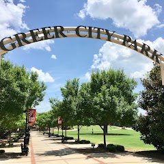
Greer City Park

City of Greer
Event Halls at Greer City Hall
Cowpens Police Department
Transit and Meeting Points
Useful pickup, handoff, or rendezvous points close to Inman.
Spartanburg
Greenville
Clemson
Gastonia
Flight Path Map
This map shows the direct air route between Landrum and Ashley. Straight-line distance: 21.44 mi (34.51 km).

#1 Landrum
Town in South Carolina, United States of America
| Population | 2,725 |
| Coordinates | 35.1751100, -82.1892800 |
| Altitude | 319 |
| Country | United States |
#2 Ashley
Ashley is a place in South Carolina, United States.
| Population | 0 |
| Coordinates | 34.9056800, -82.0012100 |
| Altitude | 229 |
| Country | United States |
End: Ashley (-82.00121, 34.90568)
Estimated Travel Time
Distance: 40 km by road
| Speed | Time |
|---|---|
| 30 mph (48.3 km/h) | 00h 49m |
| 40 mph (64.37 km/h) | 00h 37m |
| 50 mph (80.47 km/h) | 00h 29m |
| 60 mph (96.56 km/h) | 00h 24m |
| 70 mph (112.65 km/h) | 00h 21m |
| 80 mph (129 km/h) | 00h 18m |
Fuel, Round Trip and CO2
Estimated fuel cost and emissions for this route.
| Fuel | $/gal | One way | Round trip |
|---|---|---|---|
| Regular gas | $3.96 | $3.49 | $6.97 |
| Mid-grade | $4.43 | $3.90 | $7.80 |
| Premium | $4.78 | $4.20 | $8.41 |
| Diesel | $5.62 | $4.95 | $9.90 |
Assumes 8.3 L/100 km (about 28.3 MPG). CO2 is an estimate and varies by vehicle, fuel blend, traffic, and terrain.
Prices in South Carolina · Jul 14, 2026
Distance to Other Cities
Planning a road trip? See the full trip guide on Trip.ovh — stops, fuel costs, weather, and departure timing.