How far is Lakes by the Bay, FL from Harlem, FL?
The driving distance from Lakes by the Bay, FL to Harlem, FL is about 103.8 miles (167 km), with a travel time of about 01h 52m by car.
- The straight-line flight distance is about 89.4 miles (143.8 km).
- For a round trip, plan for roughly 03h 45m of driving time before adding stops, traffic, or weather delays.
- A comfortable departure window is usually 8:00 AM to 10:00 AM EDT.
Reverse, save, or send this route
This route works well as a day trip with time at the destination. Copy the route link, send it to another device, or print a clean version before you head out.
This route works well as a day trip with time at the destination.
Flight Distance
Driving Distance
Gas Cost Calculator
Leave and Arrive Planner
Pick a departure time to see your estimated arrival and same-day return window.
Drive time stays fixed at 01h 52m.
A morning start gives you useful time at the destination and keeps the return out of the late evening.
You are leaving earlier than the recommended window, which gives you extra margin for breaks and traffic.
Halfway Point
A useful midpoint for breaks, coffee, or meeting in the middle.
A city in Broward County, Florida.
Route Weather Snapshot
Check the forecast at both ends before you head out.
Mostly Cloudy
Sunny then Chance Showers And Thunderstorms
Driving Route Map
The map below follows the saved road route between Lakes by the Bay and Harlem.
Turn-by-Turn Driving Directions
Step-by-step road directions between Lakes by the Bay and Harlem.
-
1
Start on Southwest 210th Street
81 m · 17 sec · Southwest 210th Street
-
2
Turn slight left onto Southwest 210th Street
57 m · 12 sec · Southwest 210th Street
-
3
Turn right onto Southwest 85th Avenue
1 km · 2 min · Southwest 85th Avenue
-
4
At the end of the road, turn left
111 m · 9 sec
-
5
Enter the roundabout and take exit 2 toward Old Cutler Road
21 m · 1 sec · Old Cutler Road
-
6
Exit the roundabout onto Old Cutler Road
1309 ft · 29 sec · Old Cutler Road
-
7
Turn right onto Franjo Road
1.2 mi · 3 min · Franjo Road
-
8
Enter the roundabout and take exit 1 toward Southwest 97th Avenue
13 m · 1 sec · Southwest 97th Avenue
-
9
Exit the roundabout onto Southwest 97th Avenue
1208 ft · 39 sec · Southwest 97th Avenue
-
10
Turn left onto Southwest 186th Street
2355 ft · 1 min · Southwest 186th Street
-
11
Continue on Quail Roost Drive
1 mi · 2 min · Quail Roost Drive
-
12
Turn right
1300 ft · 33 sec
-
13
Continue on Florida's Turnpike Toll North, Orlando
1599 ft · 41 sec
-
14
Merge slight left onto Homestead Extension of Florida's Turnpike
3 mi · 4 min · Homestead Extension of Florida's Turnpike
-
15
Keep slight left to continue on Homestead Extension of Florida's Turnpike
2.5 mi · 3 min · Homestead Extension of Florida's Turnpike
-
16
Keep slight right to continue on Homestead Extension of Florida's Turnpike
15.5 mi · 18 min · Homestead Extension of Florida's Turnpike
-
17
Take the exit slight right toward US 27: Okeechobee Road
1140 ft · 28 sec
-
18
Keep slight right to continue on US 27: Okeechobee Road
633 ft · 16 sec
-
19
Merge slight left onto Okeechobee Road
19.2 mi · 24 min · Okeechobee Road
-
20
Continue straight
55.9 mi · 1 hr 9 min
-
21
Turn left onto Olympia Street
1 mi · 3 min · Olympia Street
-
22
At the end of the road, turn right onto Georgia Avenue
985 ft · 27 sec · Georgia Avenue
-
23
Keep slight left to continue on 7th Street
782 ft · 24 sec · 7th Street
-
24
Turn right onto Harlem Academy Avenue
2231 ft · 1 min · Harlem Academy Avenue
-
25
Turn right onto 10th Street
27 m · 3 sec · 10th Street
-
26
Arrive at your destination
0 m · 1 sec · 10th Street
Car Route Details
A richer read on the saved driving route between Lakes by the Bay and Harlem.
Interchange-aware route
The drive includes several ramps, exits, or merges, so checking the next few maneuvers before busy interchanges is useful.
Okeechobee Road
Continue straight
55.9 mi · 01h 09m
Route Summary
A quick read on whether this route feels easy, ambitious, or worth planning around.
A comfortable day-trip route
This route works well as a day trip. You can leave in the morning, spend meaningful time at the destination, and still return the same day.
Mostly Cloudy leaving Lakes by the Bay and Sunny then Chance Showers And Thunderstorms near Harlem.
Trip Questions
Direct answers travelers usually want before committing to the drive.
How long does it take to drive from Lakes by the Bay to Harlem?
The road trip is about 103.8 miles (167 km) and usually takes 01h 52m in normal driving conditions.
Is this a same-day trip or an overnight route?
This route works well as a day trip. You can leave in the morning, spend meaningful time at the destination, and still return the same day.
What is the halfway point on this route?
Weston is a useful midpoint, sitting about 51.4 miles from Lakes by the Bay and 52.3 miles from Harlem.
How much longer is the road route than the straight-line distance?
The direct path is about 89.4 miles (143.8 km), while the road route adds roughly 14.4 extra miles because roads do not follow the straight air line.
When is the best time to leave for this route?
A good departure window is usually 8:00 AM to 10:00 AM EDT. If you want a more comfortable same-day return, try to leave by 2:44 PM EDT.
How much will gas cost for this route?
Using about 28.3 MPG, regular gas is estimated at $15.18 one way or $30.36 round trip. Estimated CO2 is about 32.5 kg one way.
What should you check before leaving?
Before you leave, expect Mostly Cloudy around Lakes by the Bay and Sunny then Chance Showers And Thunderstorms near Harlem.
Stop Ideas Near Weston
Useful break, food, and waypoint ideas within about 15 miles of the route midpoint.
Coral Springs City Hall Garage
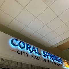
City Hall in the Mall
Transit and Meeting Points
Useful pickup, handoff, or rendezvous points close to Weston.
Fort Lauderdale
Hollywood
Miami Intermodal Center
Deerfield Beach
Flight Path Map
This map shows the direct air route between Lakes by the Bay and Harlem. Straight-line distance: 89.37 mi (143.83 km).

#1 Lakes by the Bay
Census-designated place in Miami-Dade County, Florida
| Population | 11,422 |
| Coordinates | 25.5723300, -80.3253300 |
| Altitude | 1 |
| Country | United States |

#2 Harlem
A census-designated place in Palm Beach County, Florida.
| Population | 2,705 |
| Coordinates | 26.7375700, -80.9509000 |
| Altitude | 6 |
| Country | United States |
End: 10th Street (-80.950993, 26.737569)
Estimated Travel Time
Distance: 167 km by road
| Speed | Time |
|---|---|
| 30 mph (48.3 km/h) | 03h 27m |
| 40 mph (64.37 km/h) | 02h 35m |
| 50 mph (80.47 km/h) | 02h 04m |
| 60 mph (96.56 km/h) | 01h 43m |
| 70 mph (112.65 km/h) | 01h 28m |
| 80 mph (129 km/h) | 01h 17m |
Fuel, Round Trip and CO2
Estimated fuel cost and emissions for this route.
| Fuel | $/gal | One way | Round trip |
|---|---|---|---|
| Regular gas | $4.15 | $15.18 | $30.36 |
| Mid-grade | $4.60 | $16.82 | $33.64 |
| Premium | $4.90 | $17.92 | $35.84 |
| Diesel | $4.35 | $15.92 | $31.84 |
Assumes 8.3 L/100 km (about 28.3 MPG). CO2 is an estimate and varies by vehicle, fuel blend, traffic, and terrain.
Prices in Florida · Jun 11, 2026
Distance to Other Cities
Planning a road trip? See the full trip guide on Trip.ovh — stops, fuel costs, weather, and departure timing.