How far is Kendall, FL from Miami, FL?
Fastest route
Kendall, Florida is approximately 10.11 miles (16.28 km) away from Miami, Florida by flight and 17.33 miles (27.9 km) by car. The estimated travel time by car is around 28 minutes.
Tips & Suggestions
- 🛫 Take a Flight: Consider flying between Kendall and Miami for the quickest option, covering a distance of 10.11 miles (16.28 km) in around 2 minutes.
- 🚗 Drive by Car: If you prefer driving, the route spans about 17.33 miles (27.9 km), and the journey takes around 28 minutes at an average speed of 60 mph (96.56 km/h).
- 🛣️ Explore Speed Options: Review the travel time table for different speeds ranging from 30 mph to 80 mph to find the most suitable driving speed.
- ⛽ Gas Consumption: If driving, a car with a fuel efficiency of 8.3 l/100 km will require approximately 2.32 liters (0.61 gallon) of gas, costing around $2.51 (diesel $2.97) for the trip.
- 🚘 Check Gas Cost Calculator: Utilize the Gas Cost Calculator feature to estimate the total cost of gas for your specific vehicle and gas prices on the date of travel.
- 🗺️ Understanding Distance Calculation: The distance between Kendall and Miami is calculated using the Haversine formula based on latitude and longitude coordinates of the respective locations.
- 🕰️ No Time Difference: Note that there is no time difference between Kendall and Miami; the current time remains the same in both places.
Reverse, save, or send this route
This is an easy same-day return drive. Copy the route link, send it to another device, or print a clean version before you head out.
This is an easy same-day return drive.
Flight Distance
Driving Distance
Gas Cost Calculator
Leave and Arrive Planner
Pick a departure time to see your estimated arrival and same-day return window.
Drive time stays fixed at 00h 28m.
This is a short drive, so your comfort window is wide. Traffic and current weather matter more than the clock.
You are leaving earlier than the recommended window, which gives you extra margin for breaks and traffic.
Halfway Point
A useful midpoint for breaks, coffee, or meeting in the middle.
A city in Miami-Dade County, Florida.
Route Weather Snapshot
Check the forecast at both ends before you head out.
Chance Showers And Thunderstorms
Chance Showers And Thunderstorms
Driving Route Map
The map below follows the saved road route between Kendall and Miami.
Turn-by-Turn Driving Directions
Step-by-step road directions between Kendall and Miami.
-
1
Start on South Dixie Highway
4 m · 2 sec · South Dixie Highway
-
2
Turn right
35 m · 11 sec
-
3
At the end of the road, turn right onto Southwest 98th Street
33 m · 5 sec · Southwest 98th Street
-
4
Turn left onto South Dixie Highway
8.2 mi · 15 min · South Dixie Highway
-
5
Keep slight left to continue on I 95 North
1.9 mi · 3 min
-
6
Take the exit slight right toward US 1: Downtown, Biscayne Boulevard
2125 ft · 1 min
-
7
Keep slight right to continue on Southeast 1st Avenue
643 ft · 24 sec
-
8
Turn straight onto Southeast 1st Avenue
1234 ft · 38 sec · Southeast 1st Avenue
-
9
Turn left onto Northeast 1st Street
549 ft · 18 sec · Northeast 1st Street
-
10
Turn left onto North Miami Avenue
95 m · 9 sec · North Miami Avenue
-
11
Arrive at your destination
0 m · 1 sec · North Miami Avenue
Car Route Details
A richer read on the saved driving route between Kendall and Miami.
Turn-heavy local drive
The route has frequent decision points for its length, so lane choice and turn timing will matter more than cruising speed.
South Dixie Highway
Turn left onto South Dixie Highway
8.24 mi · 00h 15m
Route Summary
A quick read on whether this route feels easy, ambitious, or worth planning around.
A short regional drive
This route is short enough to handle as a quick errand, commute, or easy same-day return without much planning overhead.
Chance Showers And Thunderstorms leaving Kendall and Chance Showers And Thunderstorms near Miami.
Trip Questions
Direct answers travelers usually want before committing to the drive.
How long does it take to drive from Kendall to Miami?
The road trip is about 17.3 miles (27.9 km) and usually takes 00h 28m in normal driving conditions.
Is this a same-day trip or an overnight route?
This route is short enough to handle as a quick errand, commute, or easy same-day return without much planning overhead.
What is the halfway point on this route?
Coral Gables is a useful midpoint, sitting about 5.6 miles from Kendall and 11.7 miles from Miami.
How much longer is the road route than the straight-line distance?
The direct path is about 10.1 miles (16.3 km), while the road route adds roughly 7.2 extra miles because roads do not follow the straight air line.
When is the best time to leave for this route?
A good departure window is usually 7:00 AM to 7:00 PM EDT. If you want a more comfortable same-day return, try to leave by 7:34 PM EDT.
How much will gas cost for this route?
Using about 28.3 MPG, regular gas is estimated at $2.53 one way or $5.06 round trip. Estimated CO2 is about 5.4 kg one way.
What should you check before leaving?
Before you leave, expect Chance Showers And Thunderstorms around Kendall and Chance Showers And Thunderstorms near Miami.
Stop Ideas Near Coral Gables
Useful break, food, and waypoint ideas within about 15 miles of the route midpoint.
Miami Beach Parking Garage
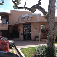
West Miami City Hall

Hialeah Gardens Community Hall

Basketball Court
Transit and Meeting Points
Useful pickup, handoff, or rendezvous points close to Coral Gables.
Miami Intermodal Center
Hollywood
Fort Lauderdale
Deerfield Beach
Flight Path Map
This map shows the direct air route between Kendall and Miami. Straight-line distance: 10.12 mi (16.28 km).
#1 Kendall
A census-designated place in Miami-Dade County, Florida.
| Population | 75,371 |
| Coordinates | 25.6792700, -80.3172700 |
| Altitude | 4 |
| Country | United States |

#2 Miami
The most populous city in Florida, Miami is a major center for tourism, finance, and culture.
| Population | 471,525 |
| Coordinates | 25.7742700, -80.1936600 |
| Altitude | 2 |
| Country | United States |
End: North Miami Avenue (-80.1936, 25.774271)
Estimated Travel Time
Distance: 28 km by road
| Speed | Time |
|---|---|
| 30 mph (48.3 km/h) | 00h 34m |
| 40 mph (64.37 km/h) | 00h 26m |
| 50 mph (80.47 km/h) | 00h 20m |
| 60 mph (96.56 km/h) | 00h 17m |
| 70 mph (112.65 km/h) | 00h 14m |
| 80 mph (129 km/h) | 00h 12m |
Fuel, Round Trip and CO2
Estimated fuel cost and emissions for this route.
| Fuel | $/gal | One way | Round trip |
|---|---|---|---|
| Regular gas | $4.15 | $2.53 | $5.06 |
| Mid-grade | $4.60 | $2.80 | $5.61 |
| Premium | $4.90 | $2.99 | $5.97 |
| Diesel | $4.35 | $2.65 | $5.31 |
Assumes 8.3 L/100 km (about 28.3 MPG). CO2 is an estimate and varies by vehicle, fuel blend, traffic, and terrain.
Prices in Florida · Jun 10, 2026
Distance to Other Cities
Planning a road trip? See the full trip guide on Trip.ovh — stops, fuel costs, weather, and departure timing.