How far is Huntington, WV from Mullens, WV?
The driving distance from Huntington, WV to Mullens, WV is about 132.9 miles (213.9 km), with a travel time of about 02h 40m by car.
- The straight-line flight distance is about 81.8 miles (131.7 km).
- For a round trip, plan for roughly 05h 21m of driving time before adding stops, traffic, or weather delays.
- A comfortable departure window is usually 8:00 AM to 10:00 AM EDT.
Reverse, save, or send this route
This route works well as a day trip with time at the destination. Copy the route link, send it to another device, or print a clean version before you head out.
This route works well as a day trip with time at the destination.
Flight Distance
Driving Distance
Gas Cost Calculator
Leave and Arrive Planner
Pick a departure time to see your estimated arrival and same-day return window.
Drive time stays fixed at 02h 40m.
A morning start gives you useful time at the destination and keeps the return out of the late evening.
You are leaving earlier than the recommended window, which gives you extra margin for breaks and traffic.
Halfway Point
A useful midpoint for breaks, coffee, or meeting in the middle.
Town in Kanawha County, West Virginia, United States
Route Weather Snapshot
Check the forecast at both ends before you head out.
Chance Showers And Thunderstorms
Chance Showers And Thunderstorms
Driving Route Map
The map below follows the saved road route between Huntington and Mullens.
Turn-by-Turn Driving Directions
Step-by-step road directions between Huntington and Mullens.
-
1
Start on 8th Street
1671 ft · 1 min · 8th Street
-
2
Turn left onto 8th Avenue
1.2 km · 2 min · 8th Avenue
-
3
Turn right onto Hal Greer Boulevard
3185 ft · 1 min · Hal Greer Boulevard
-
4
Keep slight right to continue on Hal Greer Boulevard
1487 ft · 40 sec · Hal Greer Boulevard
-
5
Continue on Troy Brown Way
1.7 mi · 3 min · Troy Brown Way
-
6
Take the ramp slight left
1629 ft · 43 sec
-
7
Merge slight left
106.1 mi · 2 hr 2 min
-
8
Take the exit slight right toward WV 16, WV 97: Mabscott
1971 ft · 48 sec
-
9
Continue on Coalfields Expressway
849 ft · 10 sec · Coalfields Expressway
-
10
Keep slight right to continue on WV 16, WV 97: Mabscott
3.3 mi · 4 min
-
11
Take the exit straight
788 ft · 22 sec
-
12
Keep slight right
1733 ft · 48 sec
-
13
Keep slight left
123 m · 13 sec
-
14
Turn right onto Lester Highway
3.6 mi · 5 min · Lester Highway
-
15
Continue on Central Street
13.7 mi · 18 min · Central Street
-
16
Turn straight onto Coalfields Expressway
1.2 mi · 2 min · Coalfields Expressway
-
17
Turn right onto 2nd Street
55 m · 3 sec · 2nd Street
-
18
Arrive at your destination
0 m · 1 sec · 2nd Street
Car Route Details
A richer read on the saved driving route between Huntington and Mullens.
Straightforward drive
The saved road route has a manageable number of maneuvers and should be easy to follow with normal attention to signs.
Troy Brown Way
Merge slight left
106 mi · 02h 02m
Route Summary
A quick read on whether this route feels easy, ambitious, or worth planning around.
A comfortable day-trip route
This route works well as a day trip. You can leave in the morning, spend meaningful time at the destination, and still return the same day.
Chance Showers And Thunderstorms leaving Huntington and Chance Showers And Thunderstorms near Mullens.
Trip Questions
Direct answers travelers usually want before committing to the drive.
How long does it take to drive from Huntington to Mullens?
The road trip is about 132.9 miles (213.9 km) and usually takes 02h 40m in normal driving conditions.
Is this a same-day trip or an overnight route?
This route works well as a day trip. You can leave in the morning, spend meaningful time at the destination, and still return the same day.
What is the halfway point on this route?
Chesapeake is a useful midpoint, sitting about 66.4 miles from Huntington and 66.5 miles from Mullens.
How much longer is the road route than the straight-line distance?
The direct path is about 81.8 miles (131.7 km), while the road route adds roughly 51.1 extra miles because roads do not follow the straight air line.
When is the best time to leave for this route?
A good departure window is usually 8:00 AM to 10:00 AM EDT. If you want a more comfortable same-day return, try to leave by 1:08 PM EDT.
How much will gas cost for this route?
Using about 28.3 MPG, regular gas is estimated at $18.58 one way or $37.15 round trip. Estimated CO2 is about 41.7 kg one way.
What should you check before leaving?
Before you leave, expect Chance Showers And Thunderstorms around Huntington and Chance Showers And Thunderstorms near Mullens.
Stop Ideas Near Chesapeake
Useful break, food, and waypoint ideas within about 15 miles of the route midpoint.

Parks and Recreation

Kanawha County Magistrate Court
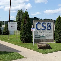
Charleston Sanitary Board

Belle City Offices
Transit and Meeting Points
Useful pickup, handoff, or rendezvous points close to Chesapeake.
Charleston
Montgomery
Thurmond
Prince
Flight Path Map
This map shows the direct air route between Huntington and Mullens. Straight-line distance: 81.84 mi (131.71 km).

#1 Huntington
The second-most populous city in West Virginia.
| Population | 44,934 |
| Coordinates | 38.4192500, -82.4451500 |
| Altitude | 173 |
| Country | United States |

#2 Mullens
City in Wyoming County, West Virginia, United States of America
| Population | 1,288 |
| Coordinates | 37.5831700, -81.3803800 |
| Altitude | 432 |
| Country | United States |
End: Mullens (-81.38038, 37.58317)
Estimated Travel Time
Distance: 214 km by road
| Speed | Time |
|---|---|
| 30 mph (48.3 km/h) | 04h 25m |
| 40 mph (64.37 km/h) | 03h 19m |
| 50 mph (80.47 km/h) | 02h 39m |
| 60 mph (96.56 km/h) | 02h 12m |
| 70 mph (112.65 km/h) | 01h 53m |
| 80 mph (129 km/h) | 01h 39m |
Fuel, Round Trip and CO2
Estimated fuel cost and emissions for this route.
| Fuel | $/gal | One way | Round trip |
|---|---|---|---|
| Regular gas | $3.96 | $18.58 | $37.15 |
| Mid-grade | $4.43 | $20.77 | $41.54 |
| Premium | $4.78 | $22.41 | $44.82 |
| Diesel | $5.62 | $26.38 | $52.75 |
Assumes 8.3 L/100 km (about 28.3 MPG). CO2 is an estimate and varies by vehicle, fuel blend, traffic, and terrain.
Prices in West Virginia · Jun 28, 2026
Distance to Other Cities
Planning a road trip? See the full trip guide on Trip.ovh — stops, fuel costs, weather, and departure timing.