How far is Hood River, OR from Keizer, OR?
The driving distance from Hood River, OR to Keizer, OR is about 104.9 miles (168.8 km), with a travel time of about 01h 49m by car.
- The straight-line flight distance is about 88.2 miles (142 km).
- For a round trip, plan for roughly 03h 39m of driving time before adding stops, traffic, or weather delays.
- A comfortable departure window is usually 8:00 AM to 10:00 AM PDT.
Reverse, save, or send this route
This route works well as a day trip with time at the destination. Copy the route link, send it to another device, or print a clean version before you head out.
This route works well as a day trip with time at the destination.
Flight Distance
Driving Distance
Gas Cost Calculator
Leave and Arrive Planner
Pick a departure time to see your estimated arrival and same-day return window.
Drive time stays fixed at 01h 49m.
A morning start gives you useful time at the destination and keeps the return out of the late evening.
This departure sits inside the recommended comfort window for the route.
Halfway Point
A useful midpoint for breaks, coffee, or meeting in the middle.
City in Oregon, USA
Route Weather Snapshot
Check the forecast at both ends before you head out.
Mostly Clear
Mostly Sunny
Driving Route Map
The map below follows the saved road route between Hood River and Keizer.
Turn-by-Turn Driving Directions
Step-by-step road directions between Hood River and Keizer.
-
1
Start on Park Street
136 m · 19 sec · Park Street
-
2
Continue on 9th Street
676 ft · 25 sec · 9th Street
-
3
Turn right onto State Street
2005 ft · 52 sec · State Street
-
4
Turn left onto 2nd Street
1267 ft · 34 sec · 2nd Street
-
5
Take the ramp left toward I 84 West: Portland
1178 ft · 15 sec
-
6
Merge slight left onto Columbia River Highway
54.2 mi · 1 hr 3 min · Columbia River Highway
-
7
Continue on Banfield Freeway
6.8 mi · 9 min · Banfield Freeway
-
8
Keep slight left to continue on I 5 South: Salem, OMSI, City Center
1906 ft · 32 sec
-
9
Keep slight left to continue on I 5 South: Beaverton, Salem
80 m · 5 sec
-
10
Merge slight left
40.8 mi · 50 min
-
11
Take the exit slight right toward Chemawa Road Northeast: Keizer
2128 ft · 43 sec
-
12
Turn right onto Chemawa Road Northeast
669 ft · 13 sec · Chemawa Road Northeast
-
13
Keep slight right to continue on Chemawa Road Northeast
864 ft · 31 sec · Chemawa Road Northeast
-
14
Continue on Chemawa Road Northeast
1.3 km · 1 min · Chemawa Road Northeast
-
15
Enter the roundabout and take exit 2 toward Chemawa Road Northeast
30 m · 2 sec · Chemawa Road Northeast
-
16
Exit the roundabout onto Chemawa Road Northeast
1.1 km · 2 min · Chemawa Road Northeast
-
17
Turn left onto River Road North
2553 ft · 1 min · River Road North
-
18
Turn left
38 m · 9 sec
-
19
Keep slight left
63 m · 15 sec
-
20
Arrive at your destination
0 m · 1 sec
Car Route Details
A richer read on the saved driving route between Hood River and Keizer.
Highway-focused drive
Most of the mileage stays on named highways, so the important moments are ramps, exits, merges, and the final local approach.
Columbia River Highway
Merge slight left onto Columbia River Highway
54.2 mi · 01h 03m
Route Summary
A quick read on whether this route feels easy, ambitious, or worth planning around.
A comfortable day-trip route
This route works well as a day trip. You can leave in the morning, spend meaningful time at the destination, and still return the same day.
Mostly Clear leaving Hood River and Mostly Sunny near Keizer.
Trip Questions
Direct answers travelers usually want before committing to the drive.
How long does it take to drive from Hood River to Keizer?
The road trip is about 104.9 miles (168.8 km) and usually takes 01h 49m in normal driving conditions.
Is this a same-day trip or an overnight route?
This route works well as a day trip. You can leave in the morning, spend meaningful time at the destination, and still return the same day.
What is the halfway point on this route?
Maywood Park is a useful midpoint, sitting about 52.9 miles from Hood River and 52 miles from Keizer.
How much longer is the road route than the straight-line distance?
The direct path is about 88.2 miles (142 km), while the road route adds roughly 16.7 extra miles because roads do not follow the straight air line.
When is the best time to leave for this route?
A good departure window is usually 8:00 AM to 10:00 AM PDT. If you want a more comfortable same-day return, try to leave by 2:50 PM PDT.
How much will gas cost for this route?
Using about 28.3 MPG, regular gas is estimated at $18.32 one way or $36.64 round trip. Estimated CO2 is about 32.9 kg one way.
What should you check before leaving?
Before you leave, expect Mostly Clear around Hood River and Mostly Sunny near Keizer.
Stop Ideas Near Maywood Park
Useful break, food, and waypoint ideas within about 15 miles of the route midpoint.

Powell's City of Books

City of Portland: Archives and Records Management
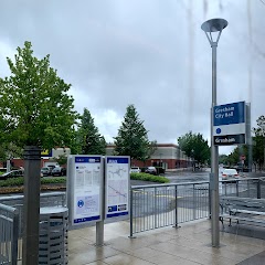
Gresham City Hall

Hollybrook Park
Transit and Meeting Points
Useful pickup, handoff, or rendezvous points close to Maywood Park.
Portland, OR
Union Station
Vancouver station
Oregon City station
Flight Path Map
This map shows the direct air route between Hood River and Keizer. Straight-line distance: 88.21 mi (141.96 km).

#1 Hood River
City in Oregon, USA
| Population | 7,793 |
| Coordinates | 45.7054000, -121.5214600 |
| Altitude | 126 |
| Country | United States |

#2 Keizer
City in Oregon, USA
| Population | 39,593 |
| Coordinates | 44.9901200, -123.0262100 |
| Altitude | 42 |
| Country | United States |
End: Dietz Avenue Northeast (-123.026207, 44.990264)
Estimated Travel Time
Distance: 169 km by road
| Speed | Time |
|---|---|
| 30 mph (48.3 km/h) | 03h 29m |
| 40 mph (64.37 km/h) | 02h 37m |
| 50 mph (80.47 km/h) | 02h 05m |
| 60 mph (96.56 km/h) | 01h 44m |
| 70 mph (112.65 km/h) | 01h 29m |
| 80 mph (129 km/h) | 01h 18m |
Fuel, Round Trip and CO2
Estimated fuel cost and emissions for this route.
| Fuel | $/gal | One way | Round trip |
|---|---|---|---|
| Regular gas | $4.95 | $18.32 | $36.64 |
| Mid-grade | $5.34 | $19.75 | $39.50 |
| Premium | $5.57 | $20.59 | $41.19 |
| Diesel | $6.37 | $23.55 | $47.11 |
Assumes 8.3 L/100 km (about 28.3 MPG). CO2 is an estimate and varies by vehicle, fuel blend, traffic, and terrain.
Prices in Oregon · Jul 10, 2026
Distance to Other Cities
Planning a road trip? See the full trip guide on Trip.ovh — stops, fuel costs, weather, and departure timing.