How far is Hitchcock, TX from Houston, TX?
The driving distance from Hitchcock, TX to Houston, TX is about 38.2 miles (61.4 km), with a travel time of about 00h 48m by car.
- The straight-line flight distance is about 35.5 miles (57.1 km).
- For a round trip, plan for roughly 01h 37m of driving time before adding stops, traffic, or weather delays.
- A comfortable departure window is usually 8:00 AM to 10:00 AM CDT.
Reverse, save, or send this route
This route works well as a day trip with time at the destination. Copy the route link, send it to another device, or print a clean version before you head out.
This route works well as a day trip with time at the destination.
Flight Distance
Driving Distance
Gas Cost Calculator
Leave and Arrive Planner
Pick a departure time to see your estimated arrival and same-day return window.
Drive time stays fixed at 00h 48m.
A morning start gives you useful time at the destination and keeps the return out of the late evening.
You are leaving earlier than the recommended window, which gives you extra margin for breaks and traffic.
Halfway Point
A useful midpoint for breaks, coffee, or meeting in the middle.
A city in Galveston County, Texas.
Route Weather Snapshot
Check the forecast at both ends before you head out.
Slight Chance Rain Showers then Mostly Sunny
Partly Cloudy
Driving Route Map
The map below follows the saved road route between Hitchcock and Houston.
Turn-by-Turn Driving Directions
Step-by-step road directions between Hitchcock and Houston.
-
1
Start on the route
1.5 km · 2 min
-
2
Turn right
3.5 mi · 6 min
-
3
Turn right onto FM 1764
710 ft · 22 sec · FM 1764
-
4
Turn left onto Gulf Freeway Frontage Road
2.2 mi · 4 min · Gulf Freeway Frontage Road
-
5
Take the ramp slight left
812 ft · 20 sec
-
6
Merge slight left onto Gulf Freeway
30.1 mi · 35 min · Gulf Freeway
-
7
Take the exit slight right toward Houston Avenue, Memorial Drive
1566 ft · 38 sec
-
8
Keep slight right to continue on Memorial Drive
135 m · 15 sec
-
9
Turn right onto Memorial Drive Frontage Road
878 ft · 24 sec · Memorial Drive Frontage Road
-
10
Continue on Rusk Street
1470 ft · 52 sec · Rusk Street
-
11
Turn left onto Louisiana Street
1525 ft · 52 sec · Louisiana Street
-
12
Arrive at your destination
0 m · 1 sec · Louisiana Street
Car Route Details
A richer read on the saved driving route between Hitchcock and Houston.
Highway-focused drive
Most of the mileage stays on named highways, so the important moments are ramps, exits, merges, and the final local approach.
Gulf Freeway
Merge slight left onto Gulf Freeway
30.1 mi · 00h 35m
Route Summary
A quick read on whether this route feels easy, ambitious, or worth planning around.
A comfortable day-trip route
This route works well as a day trip. You can leave in the morning, spend meaningful time at the destination, and still return the same day.
Slight Chance Rain Showers then Mostly Sunny leaving Hitchcock and Partly Cloudy near Houston.
Trip Questions
Direct answers travelers usually want before committing to the drive.
How long does it take to drive from Hitchcock to Houston?
The road trip is about 38.2 miles (61.4 km) and usually takes 00h 48m in normal driving conditions.
Is this a same-day trip or an overnight route?
This route works well as a day trip. You can leave in the morning, spend meaningful time at the destination, and still return the same day.
What is the halfway point on this route?
Friendswood is a useful midpoint, sitting about 19.1 miles from Hitchcock and 19.1 miles from Houston.
How much longer is the road route than the straight-line distance?
The direct path is about 35.5 miles (57.1 km), while the road route adds roughly 2.7 extra miles because roads do not follow the straight air line.
When is the best time to leave for this route?
A good departure window is usually 8:00 AM to 10:00 AM CDT. If you want a more comfortable same-day return, try to leave by 4:52 PM CDT.
How much will gas cost for this route?
Using about 28.3 MPG, regular gas is estimated at $5.06 one way or $10.13 round trip. Estimated CO2 is about 11.9 kg one way.
What should you check before leaving?
Before you leave, expect Slight Chance Rain Showers then Mostly Sunny around Hitchcock and Partly Cloudy near Houston.
Stop Ideas Near Friendswood
Useful break, food, and waypoint ideas within about 15 miles of the route midpoint.
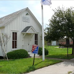
La Porte First City Hall & Jail
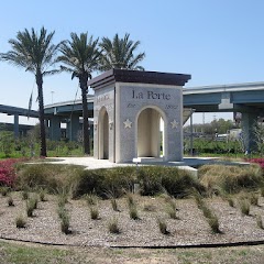
La Porte City Hall

Alvin City Attorney
Transit and Meeting Points
Useful pickup, handoff, or rendezvous points close to Friendswood.
Houston, TX
Houston
Galveston (Texas Eagle Bus), Texas
Prairie View, TX
Flight Path Map
This map shows the direct air route between Hitchcock and Houston. Straight-line distance: 35.46 mi (57.07 km).

#1 Hitchcock
City in Galveston County, Texas, United States
| Population | 7,884 |
| Coordinates | 29.3482900, -95.0160400 |
| Altitude | 5 |
| Country | United States |

#2 Houston
The fourth most populous city in the United States and the center of the Houston metropolitan area.
| Population | 2,316,120 |
| Coordinates | 29.7632800, -95.3632700 |
| Altitude | 12 |
| Country | United States |
End: Louisiana Street (-95.363596, 29.76347)
Estimated Travel Time
Distance: 61 km by road
| Speed | Time |
|---|---|
| 30 mph (48.3 km/h) | 01h 16m |
| 40 mph (64.37 km/h) | 00h 57m |
| 50 mph (80.47 km/h) | 00h 45m |
| 60 mph (96.56 km/h) | 00h 38m |
| 70 mph (112.65 km/h) | 00h 32m |
| 80 mph (129 km/h) | 00h 28m |
Fuel, Round Trip and CO2
Estimated fuel cost and emissions for this route.
| Fuel | $/gal | One way | Round trip |
|---|---|---|---|
| Regular gas | $3.78 | $5.06 | $10.13 |
| Mid-grade | $4.25 | $5.70 | $11.40 |
| Premium | $4.59 | $6.15 | $12.30 |
| Diesel | $3.99 | $5.35 | $10.70 |
Assumes 8.3 L/100 km (about 28.3 MPG). CO2 is an estimate and varies by vehicle, fuel blend, traffic, and terrain.
Prices in Texas · Jun 10, 2026
Distance to Other Cities
Planning a road trip? See the full trip guide on Trip.ovh — stops, fuel costs, weather, and departure timing.