How far is Hazlehurst, GA from Augusta, GA?
The driving distance from Hazlehurst, GA to Augusta, GA is about 228.7 miles (368.1 km), with a travel time of about 03h 58m by car.
- The straight-line flight distance is about 176.9 miles (284.7 km).
- For a round trip, plan for roughly 07h 57m of driving time before adding stops, traffic, or weather delays.
- A comfortable departure window is usually 6:00 AM to 8:00 AM EDT.
Reverse, save, or send this route
This drive is better planned with a longer stop or an overnight stay. Copy the route link, send it to another device, or print a clean version before you head out.
This drive is better planned with a longer stop or an overnight stay.
Flight Distance
Driving Distance
Gas Cost Calculator
Leave and Arrive Planner
Pick a departure time to see your estimated arrival and same-day return window.
Drive time stays fixed at 03h 58m.
An early departure helps you fit a real stop into the day without turning the return into a late-night drive.
This departure sits inside the recommended comfort window for the route.
Halfway Point
A useful midpoint for breaks, coffee, or meeting in the middle.
City in Chatham County, Georgia, USA
Route Weather Snapshot
Check the forecast at both ends before you head out.
Mostly Sunny then Slight Chance Showers And Thunderstorms
Areas Of Fog then Chance Showers And Thunderstorms
Driving Route Map
The map below follows the saved road route between Hazlehurst and Augusta.
Turn-by-Turn Driving Directions
Step-by-step road directions between Hazlehurst and Augusta.
-
1
Start on Old Hazelhurst Road
1.5 km · 4 min · Old Hazelhurst Road
-
2
Turn left onto Bailey Mill Road
3.3 mi · 13 min · Bailey Mill Road
-
3
At the end of the road, turn right onto Burnt Fort Road
7.4 mi · 11 min · Burnt Fort Road
-
4
Continue on Burnt Fort Road
4.6 mi · 7 min · Burnt Fort Road
-
5
Turn left onto Ocean Highway
5.3 mi · 7 min · Ocean Highway
-
6
Continue on US Highway 17
2 mi · 3 min · US Highway 17
-
7
Continue on Ocean Highway
6.7 mi · 9 min · Ocean Highway
-
8
Turn right onto South Georgia Parkway
1.1 km · 1 min · South Georgia Parkway
-
9
Take the exit left toward I 95 North: Savannah
2927 ft · 1 min
-
10
Merge slight left
68.3 mi · 1 hr 14 min
-
11
Keep slight left
9.4 mi · 10 min
-
12
Take the exit slight right toward GA 21: Port Wentworth
1628 ft · 40 sec
-
13
Keep slight left to continue on GA 21 North, GA 30 West
120 m · 12 sec
-
14
Merge slight right onto Augusta Road
3.3 mi · 4 min · Augusta Road
-
15
Continue straight
2.2 mi · 3 min
-
16
Continue straight
41.9 mi · 48 min
-
17
Turn right onto South Main Street
1.5 mi · 2 min · South Main Street
-
18
Continue on North Main Street
1 mi · 2 min · North Main Street
-
19
Turn slight left
91 m · 7 sec
-
20
Turn right
4.5 mi · 5 min
-
21
Take the exit slight left
5.4 mi · 8 min
-
22
Turn right onto Millhaven Road
1.9 mi · 3 min · Millhaven Road
-
23
Continue on Milhaven Road
1.2 mi · 2 min · Milhaven Road
-
24
Turn straight onto Girard Millhaven Road
3.4 mi · 5 min · Girard Millhaven Road
-
25
Continue on Millhaven Road
5.6 mi · 8 min · Millhaven Road
-
26
Continue on Main Street
19.5 mi · 27 min · Main Street
-
27
At the end of the road, turn right
15.5 mi · 22 min
-
28
Turn slight right
120 m · 17 sec
-
29
Continue on Old Savannah Road
1.2 km · 1 min · Old Savannah Road
-
30
Turn right onto Gordon Highway
133 m · 10 sec · Gordon Highway
-
31
Turn left onto Old Savannah Road
1.3 mi · 3 min · Old Savannah Road
-
32
Turn slight left onto 12th Street
1.3 km · 2 min · 12th Street
-
33
Turn right onto Laney Walker Boulevard
605 ft · 20 sec · Laney Walker Boulevard
-
34
Turn left onto 11th Street
2069 ft · 43 sec · 11th Street
-
35
Turn left onto Walton Way
86 m · 12 sec · Walton Way
-
36
Arrive at your destination
0 m · 1 sec · Walton Way
Car Route Details
A richer read on the saved driving route between Hazlehurst and Augusta.
Interchange-aware route
The drive includes several ramps, exits, or merges, so checking the next few maneuvers before busy interchanges is useful.
I 95 North
Merge slight left
68.3 mi · 01h 14m
Route Summary
A quick read on whether this route feels easy, ambitious, or worth planning around.
A longer out-and-back drive
This is still possible in one day, but it becomes a long driving day. Leaving early and planning your stop window matters more here.
Mostly Sunny then Slight Chance Showers And Thunderstorms leaving Hazlehurst and Areas Of Fog then Chance Showers And Thunderstorms near Augusta.
Trip Questions
Direct answers travelers usually want before committing to the drive.
How long does it take to drive from Hazlehurst to Augusta?
The road trip is about 228.7 miles (368.1 km) and usually takes 03h 58m in normal driving conditions.
Is this a same-day trip or an overnight route?
This is still possible in one day, but it becomes a long driving day. Leaving early and planning your stop window matters more here.
What is the halfway point on this route?
Port Wentworth is a useful midpoint, sitting about 110.3 miles from Hazlehurst and 118.4 miles from Augusta.
How much longer is the road route than the straight-line distance?
The direct path is about 176.9 miles (284.7 km), while the road route adds roughly 51.8 extra miles because roads do not follow the straight air line.
When is the best time to leave for this route?
A good departure window is usually 6:00 AM to 8:00 AM EDT. If you want a more comfortable same-day return, try to leave by 9:02 AM EDT.
How much will gas cost for this route?
Using about 28.3 MPG, regular gas is estimated at $31.97 one way or $63.93 round trip. Estimated CO2 is about 71.7 kg one way.
What should you check before leaving?
Before you leave, expect Mostly Sunny then Slight Chance Showers And Thunderstorms around Hazlehurst and Areas Of Fog then Chance Showers And Thunderstorms near Augusta.
Stop Ideas Near Port Wentworth
Useful break, food, and waypoint ideas within about 15 miles of the route midpoint.

Savannah City Hall
City of Savannah - Utility Services
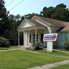
Port Wentworth Police Department
Transit and Meeting Points
Useful pickup, handoff, or rendezvous points close to Port Wentworth.
Savannah
Yemassee
Jesup
Flight Path Map
This map shows the direct air route between Hazlehurst and Augusta. Straight-line distance: 176.88 mi (284.66 km).

#1 Hazlehurst
City in Jeff Davis County, Georgia, United States
| Population | 4,080 |
| Coordinates | 30.9135700, -81.8384400 |
| Altitude | 4 |
| Country | United States |

#2 Augusta
The third most populous city in Georgia.
| Population | 197,166 |
| Coordinates | 33.4709700, -81.9748400 |
| Altitude | 43 |
| Country | United States |
End: Walton Way (-81.975097, 33.470468)
Estimated Travel Time
Distance: 368 km by road
| Speed | Time |
|---|---|
| 30 mph (48.3 km/h) | 07h 37m |
| 40 mph (64.37 km/h) | 05h 43m |
| 50 mph (80.47 km/h) | 04h 34m |
| 60 mph (96.56 km/h) | 03h 48m |
| 70 mph (112.65 km/h) | 03h 16m |
| 80 mph (129 km/h) | 02h 51m |
Fuel, Round Trip and CO2
Estimated fuel cost and emissions for this route.
| Fuel | $/gal | One way | Round trip |
|---|---|---|---|
| Regular gas | $3.96 | $31.97 | $63.93 |
| Mid-grade | $4.43 | $35.74 | $71.48 |
| Premium | $4.78 | $38.56 | $77.12 |
| Diesel | $5.62 | $45.39 | $90.77 |
Assumes 8.3 L/100 km (about 28.3 MPG). CO2 is an estimate and varies by vehicle, fuel blend, traffic, and terrain.
Prices in Georgia · Jul 15, 2026
Distance to Other Cities
Planning a road trip? See the full trip guide on Trip.ovh — stops, fuel costs, weather, and departure timing.