How far is Hayesville, OR from Salem, OR?
Fastest route
The distance between Hayesville, Oregon 97305, and Salem, Oregon is approximately 4.8 miles (7.7 kilometers). The fastest route is via Silverton Rd NE, and it takes about 11 minutes.
Directions 🗺️
- Head south on 45th Ave NE toward Iberis St NE.
- Turn right onto Silverton Rd NE.
- Continue straight to stay on Silverton Rd NE.
- Pass by Domino's Pizza (on the right in 0.5 mi).
- Silverton Rd NE turns slightly left and becomes Fairgrounds Rd NE.
- Take Broadway St and High St NE to Center St NE.
- Turn left onto Broadway St.
- Turn left onto Center St NE.
Tips & Suggestions 🚗
- 🛣️ Use Silverton Rd NE for the fastest route to Salem.
- ⏱️ Check for real-time traffic conditions before leaving.
- 📱 Utilize navigation apps for real-time updates during the journey.
- ⛽ Ensure your vehicle has enough fuel for the trip.
- 🚦 Obey traffic rules and signals along the way.
FAQs
Q: How long does it take to travel from Hayesville to Salem, Oregon? A: The travel time from Hayesville, Oregon 97305 to Salem, Oregon is approximately 11 minutes.
Q: What is the distance between Hayesville and Salem, Oregon? A: The distance between Hayesville and Salem is about 4.8 miles (7.7 kilometers).
Q: Which route should I take to reach Salem from Hayesville the fastest? A: The fastest route is via Silverton Rd NE.
Q: Can I rely on navigation apps for real-time updates during the journey? A: Yes, using navigation apps can provide you with real-time updates and traffic conditions.
Q: Are there any specific landmarks or turns to look out for during the trip? A: Look out for the turn onto Hood St NE in Salem, and then follow the directions to Broadway St and High St NE, leading to Center St NE.
Reverse, save, or send this route
This is an easy same-day return drive. Copy the route link, send it to another device, or print a clean version before you head out.
This is an easy same-day return drive.
Flight Distance
Driving Distance
Gas Cost Calculator
Leave and Arrive Planner
Pick a departure time to see your estimated arrival and same-day return window.
Drive time stays fixed at 00h 12m.
This is a short drive, so your comfort window is wide. Traffic and current weather matter more than the clock.
This departure sits inside the recommended comfort window for the route.
Halfway Point
A useful midpoint for breaks, coffee, or meeting in the middle.
Route Weather Snapshot
Check the forecast at both ends before you head out.
Partly Sunny
Partly Sunny
Driving Route Map
The map below follows the saved road route between Hayesville and Salem.
Turn-by-Turn Driving Directions
Step-by-step road directions between Hayesville and Salem.
-
1
Start on Jade Street Northeast
28 m · 6 sec · Jade Street Northeast
-
2
Turn right onto Lancaster Drive Northeast
1516 ft · 36 sec · Lancaster Drive Northeast
-
3
Turn left onto Hayesville Drive Northeast
1221 ft · 37 sec · Hayesville Drive Northeast
-
4
Turn left onto Portland Road Northeast
2.5 mi · 5 min · Portland Road Northeast
-
5
Continue on Fairgrounds Road Northeast
2179 ft · 1 min · Fairgrounds Road Northeast
-
6
Continue on Fairgrounds Road Northeast
2476 ft · 1 min · Fairgrounds Road Northeast
-
7
Turn left onto 5th Street Northeast
665 ft · 31 sec · 5th Street Northeast
-
8
Turn right onto Market Street Northeast
106 m · 19 sec · Market Street Northeast
-
9
Turn left onto Broadway Street Northeast
993 ft · 30 sec · Broadway Street Northeast
-
10
Continue on High Street Northeast
2135 ft · 1 min · High Street Northeast
-
11
Arrive at your destination
0 m · 1 sec · High Street Northeast
Car Route Details
A richer read on the saved driving route between Hayesville and Salem.
Turn-heavy local drive
The route has frequent decision points for its length, so lane choice and turn timing will matter more than cruising speed.
Portland Road Northeast
Turn left onto Portland Road Northeast
2.48 mi · 00h 05m
Route Summary
A quick read on whether this route feels easy, ambitious, or worth planning around.
A short regional drive
This route is short enough to handle as a quick errand, commute, or easy same-day return without much planning overhead.
Partly Sunny leaving Hayesville and Partly Sunny near Salem.
Trip Questions
Direct answers travelers usually want before committing to the drive.
How long does it take to drive from Hayesville to Salem?
The road trip is about 4.7 miles (7.6 km) and usually takes 00h 12m in normal driving conditions.
Is this a same-day trip or an overnight route?
This route is short enough to handle as a quick errand, commute, or easy same-day return without much planning overhead.
What is the halfway point on this route?
Keizer is a useful midpoint, sitting about 2.4 miles from Hayesville and 2.4 miles from Salem.
How much longer is the road route than the straight-line distance?
The direct path is about 3.9 miles (6.3 km), while the road route adds roughly 0.8 extra miles because roads do not follow the straight air line.
When is the best time to leave for this route?
A good departure window is usually 7:00 AM to 7:00 PM PDT. If you want a more comfortable same-day return, try to leave by 8:04 PM PDT.
How much will gas cost for this route?
Using about 28.3 MPG, regular gas is estimated at $0.84 one way or $1.68 round trip. Estimated CO2 is about 1.5 kg one way.
What should you check before leaving?
Before you leave, expect Partly Sunny around Hayesville and Partly Sunny near Salem.
Stop Ideas Near Keizer
Useful break, food, and waypoint ideas within about 15 miles of the route midpoint.
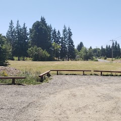
Salem city park
Woodburn City Hall
Council Chambers City of Keizer
Transit and Meeting Points
Useful pickup, handoff, or rendezvous points close to Keizer.
Salem station
Woodburn, OR
Albany station
Corvallis, Oregon
Flight Path Map
This map shows the direct air route between Hayesville and Salem. Straight-line distance: 3.92 mi (6.31 km).

#1 Hayesville
City in Keokuk County, Iowa, United States of America
| Population | 19,936 |
| Coordinates | 44.9859500, -122.9828700 |
| Altitude | 56 |
| Country | United States |

#2 Salem
The capital of Oregon.
| Population | 175,891 |
| Coordinates | 44.9429000, -123.0351000 |
| Altitude | 49 |
| Country | United States |
End: Center Street Northeast (-123.035154, 44.942793)
Estimated Travel Time
Distance: 8 km by road
| Speed | Time |
|---|---|
| 30 mph (48.3 km/h) | 00h 09m |
| 40 mph (64.37 km/h) | 00h 07m |
| 50 mph (80.47 km/h) | 00h 05m |
| 60 mph (96.56 km/h) | 00h 04m |
| 70 mph (112.65 km/h) | 00h 04m |
| 80 mph (129 km/h) | 00h 03m |
Fuel, Round Trip and CO2
Estimated fuel cost and emissions for this route.
| Fuel | $/gal | One way | Round trip |
|---|---|---|---|
| Regular gas | $4.95 | $0.84 | $1.68 |
| Mid-grade | $5.34 | $0.91 | $1.81 |
| Premium | $5.57 | $0.95 | $1.89 |
| Diesel | $6.37 | $1.08 | $2.16 |
Assumes 8.3 L/100 km (about 28.3 MPG). CO2 is an estimate and varies by vehicle, fuel blend, traffic, and terrain.
Prices in Oregon · Aug 01, 2026
Distance to Other Cities
Planning a road trip? See the full trip guide on Trip.ovh — stops, fuel costs, weather, and departure timing.