How far is Frisco, CO from Greeley, CO?
The driving distance from Frisco, CO to Greeley, CO is about 123.6 miles (198.9 km), with a travel time of about 02h 14m by car.
- The straight-line flight distance is about 94 miles (151.3 km).
- For a round trip, plan for roughly 04h 28m of driving time before adding stops, traffic, or weather delays.
- A comfortable departure window is usually 8:00 AM to 10:00 AM MDT.
Reverse, save, or send this route
This route works well as a day trip with time at the destination. Copy the route link, send it to another device, or print a clean version before you head out.
This route works well as a day trip with time at the destination.
Flight Distance
Driving Distance
Gas Cost Calculator
Leave and Arrive Planner
Pick a departure time to see your estimated arrival and same-day return window.
Drive time stays fixed at 02h 14m.
A morning start gives you useful time at the destination and keeps the return out of the late evening.
You are leaving earlier than the recommended window, which gives you extra margin for breaks and traffic.
Halfway Point
A useful midpoint for breaks, coffee, or meeting in the middle.
Census designated place
Route Weather Snapshot
Check the forecast at both ends before you head out.
Mostly Sunny then Chance Showers And Thunderstorms
Sunny
Driving Route Map
The map below follows the saved road route between Frisco and Greeley.
Turn-by-Turn Driving Directions
Step-by-step road directions between Frisco and Greeley.
-
1
Start on South 4th Avenue
541 ft · 28 sec · South 4th Avenue
-
2
Turn right onto East Main Street
1476 ft · 1 min · East Main Street
-
3
Turn left onto Summit Boulevard
1.1 mi · 3 min · Summit Boulevard
-
4
Take the ramp straight
8.5 mi · 12 min
-
5
Continue straight
57.9 mi · 1 hr 9 min
-
6
Keep slight left to continue on Heartland Expressway
12.6 mi · 15 min · Heartland Expressway
-
7
Keep slight right to continue on Heartland Expressway
21.8 mi · 22 min · Heartland Expressway
-
8
Take the exit slight right toward Kersey Road
1014 ft · 22 sec
-
9
Turn left onto County Road 49
22 mi · 26 min · County Road 49
-
10
Turn left onto East 18th Street
3.7 mi · 6 min · East 18th Street
-
11
At the end of the road, turn right onto 8th Avenue
1.4 km · 2 min · 8th Avenue
-
12
Turn left onto 10th Street
1022 ft · 29 sec · 10th Street
-
13
Turn right onto 10th Avenue
153 m · 17 sec · 10th Avenue
-
14
Turn left onto 9th Street
1.2 km · 1 min · 9th Street
-
15
Turn left onto 19th Avenue
80 m · 12 sec · 19th Avenue
-
16
Arrive at your destination
0 m · 1 sec · 19th Avenue
Car Route Details
A richer read on the saved driving route between Frisco and Greeley.
Straightforward drive
The saved road route has a manageable number of maneuvers and should be easy to follow with normal attention to signs.
Summit Boulevard
Continue straight
57.9 mi · 01h 09m
Route Summary
A quick read on whether this route feels easy, ambitious, or worth planning around.
A comfortable day-trip route
This route works well as a day trip. You can leave in the morning, spend meaningful time at the destination, and still return the same day.
Mostly Sunny then Chance Showers And Thunderstorms leaving Frisco and Sunny near Greeley.
Trip Questions
Direct answers travelers usually want before committing to the drive.
How long does it take to drive from Frisco to Greeley?
The road trip is about 123.6 miles (198.9 km) and usually takes 02h 14m in normal driving conditions.
Is this a same-day trip or an overnight route?
This route works well as a day trip. You can leave in the morning, spend meaningful time at the destination, and still return the same day.
What is the halfway point on this route?
Applewood is a useful midpoint, sitting about 65 miles from Frisco and 58.6 miles from Greeley.
How much longer is the road route than the straight-line distance?
The direct path is about 94 miles (151.3 km), while the road route adds roughly 29.6 extra miles because roads do not follow the straight air line.
When is the best time to leave for this route?
A good departure window is usually 8:00 AM to 10:00 AM MDT. If you want a more comfortable same-day return, try to leave by 2:02 PM MDT.
How much will gas cost for this route?
Using about 28.3 MPG, regular gas is estimated at $16.12 one way or $32.25 round trip. Estimated CO2 is about 38.7 kg one way.
What should you check before leaving?
Before you leave, expect Mostly Sunny then Chance Showers And Thunderstorms around Frisco and Sunny near Greeley.
Stop Ideas Near Applewood
Useful break, food, and waypoint ideas within about 15 miles of the route midpoint.

Municipal Court Park

Denver City Council
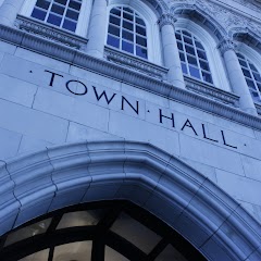
Town Hall Arts Center

City of Littleton
Transit and Meeting Points
Useful pickup, handoff, or rendezvous points close to Applewood.
Union Station
Denver (Bus Station), Colorado
Boulder, Colorado
Pine Junction, CO
Flight Path Map
This map shows the direct air route between Frisco and Greeley. Straight-line distance: 94.02 mi (151.31 km).

#1 Frisco
Town in Summit County, Colorado, United States of America
| Population | 2,874 |
| Coordinates | 39.5744300, -106.0975200 |
| Altitude | 2766 |
| Country | United States |

#2 Greeley
The third most populous city in Weld County, Colorado.
| Population | 108,958 |
| Coordinates | 40.4233100, -104.7091300 |
| Altitude | 1425 |
| Country | United States |
End: 19th Avenue (-104.709131, 40.42331)
Estimated Travel Time
Distance: 199 km by road
| Speed | Time |
|---|---|
| 30 mph (48.3 km/h) | 04h 07m |
| 40 mph (64.37 km/h) | 03h 05m |
| 50 mph (80.47 km/h) | 02h 28m |
| 60 mph (96.56 km/h) | 02h 03m |
| 70 mph (112.65 km/h) | 01h 45m |
| 80 mph (129 km/h) | 01h 32m |
Fuel, Round Trip and CO2
Estimated fuel cost and emissions for this route.
| Fuel | $/gal | One way | Round trip |
|---|---|---|---|
| Regular gas | $3.70 | $16.12 | $32.25 |
| Mid-grade | $4.08 | $17.81 | $35.61 |
| Premium | $4.39 | $19.14 | $38.29 |
| Diesel | $4.74 | $20.65 | $41.31 |
Assumes 8.3 L/100 km (about 28.3 MPG). CO2 is an estimate and varies by vehicle, fuel blend, traffic, and terrain.
Prices in Colorado · Jul 17, 2026
Distance to Other Cities
Planning a road trip? See the full trip guide on Trip.ovh — stops, fuel costs, weather, and departure timing.