How far is Flat Rock, NC from Concord, NC?
The driving distance from Flat Rock, NC to Concord, NC is about 120.4 miles (193.8 km), with a travel time of about 02h 07m by car.
- The straight-line flight distance is about 105.3 miles (169.4 km).
- For a round trip, plan for roughly 04h 14m of driving time before adding stops, traffic, or weather delays.
- A comfortable departure window is usually 8:00 AM to 10:00 AM EDT.
Reverse, save, or send this route
This route works well as a day trip with time at the destination. Copy the route link, send it to another device, or print a clean version before you head out.
This route works well as a day trip with time at the destination.
Flight Distance
Driving Distance
Gas Cost Calculator
Leave and Arrive Planner
Pick a departure time to see your estimated arrival and same-day return window.
Drive time stays fixed at 02h 07m.
A morning start gives you useful time at the destination and keeps the return out of the late evening.
You are leaving earlier than the recommended window, which gives you extra margin for breaks and traffic.
Halfway Point
A useful midpoint for breaks, coffee, or meeting in the middle.
Township in Cleveland County, North Carolina
Route Weather Snapshot
Check the forecast at both ends before you head out.
Mostly Clear
Driving Route Map
The map below follows the saved road route between Flat Rock and Concord.
Turn-by-Turn Driving Directions
Step-by-step road directions between Flat Rock and Concord.
-
1
Start on West Blue Ridge Road
10 m · 6 sec · West Blue Ridge Road
-
2
Turn right onto Greenville Highway
1.5 km · 2 min · Greenville Highway
-
3
Turn right onto North Highland Lake Road
1.1 mi · 3 min · North Highland Lake Road
-
4
Continue on Upward Road
1.3 mi · 2 min · Upward Road
-
5
Take the ramp right
1114 ft · 27 sec
-
6
Merge slight left onto Andrew Jackson Highway
3107 ft · 41 sec · Andrew Jackson Highway
-
7
Keep slight left to continue on Andrew Jackson Highway
12 mi · 14 min · Andrew Jackson Highway
-
8
Take the exit slight right toward US 74 East, NC 108: Columbus, Rutherfordton
1433 ft · 19 sec · Sgt W Dean Arledge Memorial Highway
-
9
Keep slight left to continue on Sergeant W Dean Arledge Memorial Highway
810 ft · 11 sec · Sergeant W Dean Arledge Memorial Highway
-
10
Continue on Sgt W Dean Arledge Memorial Highway
17.9 mi · 20 min · Sgt W Dean Arledge Memorial Highway
-
11
Continue on James A. Callahan Highway
15.2 mi · 17 min · James A. Callahan Highway
-
12
Take the exit slight right toward West Dixon Boulevard
12.4 mi · 18 min · West Dixon Boulevard
-
13
Continue on Andrew Jackson Highway
1.8 mi · 3 min · Andrew Jackson Highway
-
14
Continue on Senator J. Ollie Harris Highway
6.8 mi · 8 min · Senator J. Ollie Harris Highway
-
15
Take the exit straight toward I 85, US 29 South: Charlotte, Spartanburg
572 ft · 8 sec
-
16
Keep slight left to continue on I 85 North: Gastonia, Charlotte
1.3 km · 56 sec
-
17
Merge slight left onto Senator Marshall Arthur Rauch Highway
17.6 mi · 21 min · Senator Marshall Arthur Rauch Highway
-
18
Continue on Cameron Morrison Bridge
18.4 mi · 22 min · Cameron Morrison Bridge
-
19
Take the exit slight right toward Mallard Creek Church Road East
1645 ft · 42 sec
-
20
Turn right onto West Mallard Creek Church Road
1.5 km · 2 min · West Mallard Creek Church Road
-
21
Turn left onto North Tryon Street
2.2 mi · 3 min · North Tryon Street
-
22
Continue on Concord Parkway South
6.7 mi · 10 min · Concord Parkway South
-
23
Turn right onto Cabarrus Avenue West
1 mi · 2 min · Cabarrus Avenue West
-
24
Enter the roundabout and take exit 2 toward Cabarrus Avenue West
48 m · 3 sec · Cabarrus Avenue West
-
25
Exit the roundabout onto Cabarrus Avenue West
1.4 km · 2 min · Cabarrus Avenue West
-
26
Turn right onto Spring Street Southwest
125 m · 11 sec · Spring Street Southwest
-
27
Arrive at your destination
0 m · 1 sec · Spring Street Southwest
Car Route Details
A richer read on the saved driving route between Flat Rock and Concord.
Highway-focused drive
Most of the mileage stays on named highways, so the important moments are ramps, exits, merges, and the final local approach.
Cameron Morrison Bridge
Continue on Cameron Morrison Bridge
18.4 mi · 00h 22m
Route Summary
A quick read on whether this route feels easy, ambitious, or worth planning around.
A comfortable day-trip route
This route works well as a day trip. You can leave in the morning, spend meaningful time at the destination, and still return the same day.
Clear leaving Flat Rock and Mostly Clear near Concord.
Trip Questions
Direct answers travelers usually want before committing to the drive.
How long does it take to drive from Flat Rock to Concord?
The road trip is about 120.4 miles (193.8 km) and usually takes 02h 07m in normal driving conditions.
Is this a same-day trip or an overnight route?
This route works well as a day trip. You can leave in the morning, spend meaningful time at the destination, and still return the same day.
What is the halfway point on this route?
Light Oak is a useful midpoint, sitting about 59.8 miles from Flat Rock and 60.6 miles from Concord.
How much longer is the road route than the straight-line distance?
The direct path is about 105.3 miles (169.4 km), while the road route adds roughly 15.1 extra miles because roads do not follow the straight air line.
When is the best time to leave for this route?
A good departure window is usually 8:00 AM to 10:00 AM EDT. If you want a more comfortable same-day return, try to leave by 2:16 PM EDT.
How much will gas cost for this route?
Using about 28.3 MPG, regular gas is estimated at $16.83 one way or $33.67 round trip. Estimated CO2 is about 37.8 kg one way.
What should you check before leaving?
Before you leave, expect Clear around Flat Rock and Mostly Clear near Concord.
Stop Ideas Near Light Oak
Useful break, food, and waypoint ideas within about 15 miles of the route midpoint.

Downtown Shelby Fountain Park
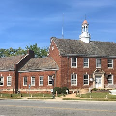
Shelby City Hall
Transit and Meeting Points
Useful pickup, handoff, or rendezvous points close to Light Oak.
Gastonia
Spartanburg
Charlotte
Kannapolis
Flight Path Map
This map shows the direct air route between Flat Rock and Concord. Straight-line distance: 105.26 mi (169.4 km).

#1 Flat Rock
Village in Henderson County, North Carolina
| Population | 3,408 |
| Coordinates | 35.2712300, -82.4415100 |
| Altitude | 672 |
| Country | United States |

#2 Concord
The most populous city in Cabarrus County, North Carolina.
| Population | 98,500 |
| Coordinates | 35.4088800, -80.5815800 |
| Altitude | 228 |
| Country | United States |
End: Spring Street Southwest (-80.581621, 35.408832)
Estimated Travel Time
Distance: 194 km by road
| Speed | Time |
|---|---|
| 30 mph (48.3 km/h) | 04h 00m |
| 40 mph (64.37 km/h) | 03h 00m |
| 50 mph (80.47 km/h) | 02h 24m |
| 60 mph (96.56 km/h) | 02h 00m |
| 70 mph (112.65 km/h) | 01h 43m |
| 80 mph (129 km/h) | 01h 30m |
Fuel, Round Trip and CO2
Estimated fuel cost and emissions for this route.
| Fuel | $/gal | One way | Round trip |
|---|---|---|---|
| Regular gas | $3.96 | $16.83 | $33.67 |
| Mid-grade | $4.43 | $18.82 | $37.65 |
| Premium | $4.78 | $20.31 | $40.61 |
| Diesel | $5.62 | $23.90 | $47.80 |
Assumes 8.3 L/100 km (about 28.3 MPG). CO2 is an estimate and varies by vehicle, fuel blend, traffic, and terrain.
Prices in North Carolina · Jul 29, 2026
Distance to Other Cities
Planning a road trip? See the full trip guide on Trip.ovh — stops, fuel costs, weather, and departure timing.