How far is Emerald Lake Hills, CA from Sacramento, CA?
The driving distance from Emerald Lake Hills, CA to Sacramento, CA is about 117.3 miles (188.7 km), with a travel time of about 02h 11m by car.
- The straight-line flight distance is about 87.9 miles (141.5 km).
- For a round trip, plan for roughly 04h 23m of driving time before adding stops, traffic, or weather delays.
- A comfortable departure window is usually 8:00 AM to 10:00 AM PDT.
Reverse, save, or send this route
This route works well as a day trip with time at the destination. Copy the route link, send it to another device, or print a clean version before you head out.
This route works well as a day trip with time at the destination.
Flight Distance
Driving Distance
Gas Cost Calculator
Leave and Arrive Planner
Pick a departure time to see your estimated arrival and same-day return window.
Drive time stays fixed at 02h 11m.
A morning start gives you useful time at the destination and keeps the return out of the late evening.
You are leaving earlier than the recommended window, which gives you extra margin for breaks and traffic.
Halfway Point
A useful midpoint for breaks, coffee, or meeting in the middle.
The second most populous city in Solano County, California.
Route Weather Snapshot
Check the forecast at both ends before you head out.
Partly Sunny
Sunny
Driving Route Map
The map below follows the saved road route between Emerald Lake Hills and Sacramento.
Turn-by-Turn Driving Directions
Step-by-step road directions between Emerald Lake Hills and Sacramento.
-
1
Start on Midland Way
51 m · 7 sec · Midland Way
-
2
Turn right onto Vernal Way
151 m · 24 sec · Vernal Way
-
3
Turn sharp left onto Sylvan Way
828 ft · 38 sec · Sylvan Way
-
4
Continue on Sylvan Way
1.2 km · 2 min · Sylvan Way
-
5
Continue on Sylvan Way
100 m · 18 sec · Sylvan Way
-
6
Turn left onto Lakeview Way
2646 ft · 2 min · Lakeview Way
-
7
At the end of the road, turn left onto Cordilleras Road
39 m · 10 sec · Cordilleras Road
-
8
Turn left onto Edgewood Road
1.2 mi · 2 min · Edgewood Road
-
9
Take the ramp slight right toward I 280 North: San Francisco
1606 ft · 39 sec
-
10
Merge slight left onto Junipero Serra Freeway
13.7 mi · 16 min · Junipero Serra Freeway
-
11
Take the exit slight right toward I 380 East: San Francisco International Airport
1975 ft · 26 sec
-
12
Continue on Quentin L. Kopp Freeway
1.1 mi · 1 min · Quentin L. Kopp Freeway
-
13
Take the exit slight right toward US 101 North: San Francisco
1.3 km · 2 min
-
14
Merge slight left onto Bayshore Freeway
4.9 mi · 6 min · Bayshore Freeway
-
15
Continue on James Lick Freeway
4.2 mi · 6 min · James Lick Freeway
-
16
Take the exit slight right toward I 80 East: Bay Bridge, Oakland
8.2 mi · 12 min
-
17
Take the exit slight left toward I 80 East
2949 ft · 45 sec
-
18
Merge slight right onto Nimitz Freeway
124 m · 6 sec · Nimitz Freeway
-
19
Continue on Eastshore Freeway
3.3 mi · 4 min · Eastshore Freeway
-
20
Keep slight left to continue on Eastshore Freeway
7.4 mi · 9 min · Eastshore Freeway
-
21
Continue on Eastshore Freeway
3.2 mi · 4 min · Eastshore Freeway
-
22
Continue on Linus F. Claeys Freeway
3.5 mi · 4 min · Linus F. Claeys Freeway
-
23
Continue on Eastshore Freeway
1718 ft · 27 sec · Eastshore Freeway
-
24
Continue on Carquinez Bridge
1.6 km · 1 min · Carquinez Bridge
-
25
Continue on Dwight D. Eisenhower Highway
14.5 mi · 17 min · Dwight D. Eisenhower Highway
-
26
Keep slight left to continue on Dwight D. Eisenhower Highway
27.3 mi · 31 min · Dwight D. Eisenhower Highway
-
27
Keep slight left to continue on Dwight D. Eisenhower Highway
8.4 mi · 10 min · Dwight D. Eisenhower Highway
-
28
Continue on Yolo Causeway
3.7 mi · 4 min · Yolo Causeway
-
29
Take the exit slight left
3.3 mi · 4 min
-
30
Take the exit slight right toward I 5 North, I 5 South: Redding, Los Angeles
1053 ft · 14 sec
-
31
Keep slight left to continue on I 5 North: Redding
1052 ft · 30 sec
-
32
Keep slight left to continue on I 5 North: Redding
1112 ft · 15 sec
-
33
Merge slight left onto Westside Freeway
1 km · 44 sec · Westside Freeway
-
34
Take the exit slight right toward J Street, Downtown
1300 ft · 34 sec
-
35
Turn right onto J Street
822 ft · 25 sec · J Street
-
36
Turn left onto 5th Street
814 ft · 19 sec · 5th Street
-
37
Turn right onto H Street
1602 ft · 40 sec · H Street
-
38
Turn right onto 9th Street
149 m · 15 sec · 9th Street
-
39
Arrive at your destination
0 m · 1 sec · 9th Street
Car Route Details
A richer read on the saved driving route between Emerald Lake Hills and Sacramento.
Highway-focused drive
Most of the mileage stays on named highways, so the important moments are ramps, exits, merges, and the final local approach.
Dwight D. Eisenhower Highway
Keep slight left to continue on Dwight D. Eisenhower Highway
27.3 mi · 00h 31m
Route Summary
A quick read on whether this route feels easy, ambitious, or worth planning around.
A comfortable day-trip route
This route works well as a day trip. You can leave in the morning, spend meaningful time at the destination, and still return the same day.
Partly Sunny leaving Emerald Lake Hills and Sunny near Sacramento.
Trip Questions
Direct answers travelers usually want before committing to the drive.
How long does it take to drive from Emerald Lake Hills to Sacramento?
The road trip is about 117.3 miles (188.7 km) and usually takes 02h 11m in normal driving conditions.
Is this a same-day trip or an overnight route?
This route works well as a day trip. You can leave in the morning, spend meaningful time at the destination, and still return the same day.
What is the halfway point on this route?
Vallejo is a useful midpoint, sitting about 57.5 miles from Emerald Lake Hills and 59.7 miles from Sacramento.
How much longer is the road route than the straight-line distance?
The direct path is about 87.9 miles (141.5 km), while the road route adds roughly 29.4 extra miles because roads do not follow the straight air line.
When is the best time to leave for this route?
A good departure window is usually 8:00 AM to 10:00 AM PDT. If you want a more comfortable same-day return, try to leave by 2:06 PM PDT.
How much will gas cost for this route?
Using about 28.3 MPG, regular gas is estimated at $23.88 one way or $47.77 round trip. Estimated CO2 is about 36.8 kg one way.
What should you check before leaving?
Before you leave, expect Partly Sunny around Emerald Lake Hills and Sunny near Sacramento.
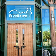
Stop Ideas Near Vallejo
Useful break, food, and waypoint ideas within about 15 miles of the route midpoint.
BikeLink : Richmond City Hall

El Cerrito City Hall
Old Maple Hall
BikeLink eLockers: El Cerrito City Hall
Transit and Meeting Points
Useful pickup, handoff, or rendezvous points close to Vallejo.
Vallejo, California
Marine World (Seasonal), Vallejo, California
Martinez station
Richmond station
Flight Path Map
This map shows the direct air route between Emerald Lake Hills and Sacramento. Straight-line distance: 87.91 mi (141.48 km).

#1 Emerald Lake Hills
Census-designated place and neighborhood in unincorporated San Mateo County, in the state of California
| Population | 4,278 |
| Coordinates | 37.4646600, -122.2680200 |
| Altitude | 159 |
| Country | United States |

#2 Sacramento
The sixth most populous city in California and the center of the Sacramento metropolitan area.
| Population | 512,838 |
| Coordinates | 38.5815700, -121.4944000 |
| Altitude | 9 |
| Country | United States |
End: 9th Street (-121.49442, 38.581575)
Estimated Travel Time
Distance: 189 km by road
| Speed | Time |
|---|---|
| 30 mph (48.3 km/h) | 03h 54m |
| 40 mph (64.37 km/h) | 02h 55m |
| 50 mph (80.47 km/h) | 02h 20m |
| 60 mph (96.56 km/h) | 01h 57m |
| 70 mph (112.65 km/h) | 01h 40m |
| 80 mph (129 km/h) | 01h 27m |
Fuel, Round Trip and CO2
Estimated fuel cost and emissions for this route.
| Fuel | $/gal | One way | Round trip |
|---|---|---|---|
| Regular gas | $5.77 | $23.88 | $47.77 |
| Mid-grade | $6.07 | $25.11 | $50.23 |
| Premium | $6.24 | $25.85 | $51.69 |
| Diesel | $7.57 | $31.33 | $62.65 |
Assumes 8.3 L/100 km (about 28.3 MPG). CO2 is an estimate and varies by vehicle, fuel blend, traffic, and terrain.
Prices in California · Jul 18, 2026
Distance to Other Cities
Planning a road trip? See the full trip guide on Trip.ovh — stops, fuel costs, weather, and departure timing.