How far is Coronado, CA from La Mesa, CA?
Fastest route
The distance from Coronado, California to La Mesa, California is approximately 16.5 miles (26.6 kilometers), and the estimated travel time is 20 minutes via CA-15 and I-8 E.
Directions
- Head southeast on Encino Ln toward E Ave.
- Turn left onto Orange Ave.
- Turn right onto CA-75 N/4th St and continue to follow CA-75 N.
- Keep right at the fork to continue on Exit 13A, follow signs for I-5 S, and merge onto I-5 S.
- Take CA-15 and I-8 E to Nebo Dr in La Mesa. Take exit 13A from I-8 E.
- Take exit 13A for CA-15 toward Riverside.
- Keep left, follow signs for I-8 E/El Centro, and merge onto I-8 E.
- Take exit 13A for Spring St toward Downtown, then keep right at the fork to continue toward Nebo Dr.
- Continue on Nebo Dr to your destination, and proceed straight onto Nebo Dr.
Tips & Suggestions
- 🚗 Plan your trip during off-peak hours to avoid heavy traffic and reduce travel time.
- 📍 Use navigation apps like Google Maps or Waze to get real-time traffic updates and the fastest route.
- ⛽ Before starting your journey, ensure your vehicle has enough fuel to cover the distance.
- 🚧 Be mindful of construction zones or road closures that may affect your route.
- 🍴 Consider having snacks or drinks in the car, especially for longer journeys.
- 🚙 Check your vehicle's tire pressure and fluid levels before embarking on the trip.
- 🧭 Familiarize yourself with the route and have a backup map or GPS in case of any unexpected detours.
Reverse, save, or send this route
This is an easy same-day return drive. Copy the route link, send it to another device, or print a clean version before you head out.
This is an easy same-day return drive.
Flight Distance
Driving Distance
Gas Cost Calculator
Leave and Arrive Planner
Pick a departure time to see your estimated arrival and same-day return window.
Drive time stays fixed at 00h 22m.
This is a short drive, so your comfort window is wide. Traffic and current weather matter more than the clock.
You are leaving earlier than the recommended window, which gives you extra margin for breaks and traffic.
Halfway Point
A useful midpoint for breaks, coffee, or meeting in the middle.
The most populous city in San Diego County, California.
Route Weather Snapshot
Check the forecast at both ends before you head out.
Mostly Sunny
Mostly Sunny
Driving Route Map
The map below follows the saved road route between Coronado and La Mesa.
Turn-by-Turn Driving Directions
Step-by-step road directions between Coronado and La Mesa.
-
1
Start on Encino Lane
36 m · 15 sec · Encino Lane
-
2
Turn left onto E Avenue
119 m · 21 sec · E Avenue
-
3
Turn right onto 10th Street
764 ft · 23 sec · 10th Street
-
4
Turn left onto Orange Avenue
1.1 km · 2 min · Orange Avenue
-
5
Turn right onto 4th Street
1.2 km · 1 min · 4th Street
-
6
Continue on San Diego–Coronado Bridge
1.5 mi · 2 min · San Diego–Coronado Bridge
-
7
Take the exit slight left toward I 5 North: Downtown
2806 ft · 1 min
-
8
Merge slight left onto John J. Montgomery Freeway
928 ft · 11 sec · John J. Montgomery Freeway
-
9
Take the exit slight right toward CA 94 East: J Street, Martin Luther king Junior Freeway
992 ft · 24 sec
-
10
Continue on 19th Street
983 ft · 26 sec · 19th Street
-
11
Take the ramp straight toward CA 94 East: Martin Luther King Junior Freeway
669 ft · 18 sec
-
12
Merge slight left onto Martin Luther King Junior Freeway
6.7 mi · 7 min · Martin Luther King Junior Freeway
-
13
Take the exit slight right toward Massachusetts Avenue
911 ft · 28 sec
-
14
Turn right onto Massachusetts Avenue
1.3 km · 2 min · Massachusetts Avenue
-
15
Turn right onto University Avenue
1.3 mi · 2 min · University Avenue
-
16
Turn right onto Allison Avenue
1193 ft · 44 sec · Allison Avenue
-
17
Turn left onto Spring Street
534 ft · 13 sec · Spring Street
-
18
Turn left onto University Avenue
149 m · 13 sec · University Avenue
-
19
Turn right
11 m · 3 sec
-
20
Arrive at your destination
0 m · 1 sec
Car Route Details
A richer read on the saved driving route between Coronado and La Mesa.
Turn-heavy local drive
The route has frequent decision points for its length, so lane choice and turn timing will matter more than cruising speed.
Martin Luther King Junior Freeway
Merge slight left onto Martin Luther King Junior Freeway
6.74 mi · 00h 07m
Route Summary
A quick read on whether this route feels easy, ambitious, or worth planning around.
A short regional drive
This route is short enough to handle as a quick errand, commute, or easy same-day return without much planning overhead.
Mostly Sunny leaving Coronado and Mostly Sunny near La Mesa.
Trip Questions
Direct answers travelers usually want before committing to the drive.
How long does it take to drive from Coronado to La Mesa?
The road trip is about 16.7 miles (26.8 km) and usually takes 00h 22m in normal driving conditions.
Is this a same-day trip or an overnight route?
This route is short enough to handle as a quick errand, commute, or easy same-day return without much planning overhead.
What is the halfway point on this route?
National City is a useful midpoint, sitting about 6.9 miles from Coronado and 9.7 miles from La Mesa.
How much longer is the road route than the straight-line distance?
The direct path is about 10.9 miles (17.5 km), while the road route adds roughly 5.8 extra miles because roads do not follow the straight air line.
When is the best time to leave for this route?
A good departure window is usually 7:00 AM to 7:00 PM PDT. If you want a more comfortable same-day return, try to leave by 7:46 PM PDT.
How much will gas cost for this route?
Using about 28.3 MPG, regular gas is estimated at $3.40 one way or $6.81 round trip. Estimated CO2 is about 5.2 kg one way.
What should you check before leaving?
Before you leave, expect Mostly Sunny around Coronado and Mostly Sunny near La Mesa.
Stop Ideas Near National City
Useful break, food, and waypoint ideas within about 15 miles of the route midpoint.

El Primero Boutique Hotel

Crown City Inn

Coronado Beach Resort
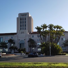
San Diego County Administration Center
Transit and Meeting Points
Useful pickup, handoff, or rendezvous points close to National City.
Santa Fe Depot
Old Town Transit Center
Sorrento Valley station
Solana Beach
Flight Path Map
This map shows the direct air route between Coronado and La Mesa. Straight-line distance: 10.89 mi (17.52 km).

#1 Coronado
City in San Diego County, California, United States
| Population | 22,647 |
| Coordinates | 32.6858900, -117.1830900 |
| Altitude | 5 |
| Country | United States |

#2 La Mesa
The most populous city in San Diego County, California.
| Population | 59,724 |
| Coordinates | 32.7678300, -117.0230800 |
| Altitude | 161 |
| Country | United States |
End: (-117.023112, 32.767843)
Estimated Travel Time
Distance: 27 km by road
| Speed | Time |
|---|---|
| 30 mph (48.3 km/h) | 00h 33m |
| 40 mph (64.37 km/h) | 00h 24m |
| 50 mph (80.47 km/h) | 00h 19m |
| 60 mph (96.56 km/h) | 00h 16m |
| 70 mph (112.65 km/h) | 00h 14m |
| 80 mph (129 km/h) | 00h 12m |
Fuel, Round Trip and CO2
Estimated fuel cost and emissions for this route.
| Fuel | $/gal | One way | Round trip |
|---|---|---|---|
| Regular gas | $5.77 | $3.40 | $6.81 |
| Mid-grade | $6.07 | $3.58 | $7.16 |
| Premium | $6.24 | $3.68 | $7.37 |
| Diesel | $7.57 | $4.46 | $8.93 |
Assumes 8.3 L/100 km (about 28.3 MPG). CO2 is an estimate and varies by vehicle, fuel blend, traffic, and terrain.
Prices in California · Jul 27, 2026
Distance to Other Cities
Planning a road trip? See the full trip guide on Trip.ovh — stops, fuel costs, weather, and departure timing.