How far is Columbia, MD from Germantown, MD?
The driving distance from Columbia, MD to Germantown, MD is about 36 miles (58 km), with a travel time of about 00h 51m by car.
- The straight-line flight distance is about 23.6 miles (38 km).
- For a round trip, plan for roughly 01h 42m of driving time before adding stops, traffic, or weather delays.
- A comfortable departure window is usually 8:00 AM to 10:00 AM EDT.
Reverse, save, or send this route
This route works well as a day trip with time at the destination. Copy the route link, send it to another device, or print a clean version before you head out.
This route works well as a day trip with time at the destination.
Flight Distance
Driving Distance
Gas Cost Calculator
Leave and Arrive Planner
Pick a departure time to see your estimated arrival and same-day return window.
Drive time stays fixed at 00h 51m.
A morning start gives you useful time at the destination and keeps the return out of the late evening.
You are leaving earlier than the recommended window, which gives you extra margin for breaks and traffic.
Halfway Point
A useful midpoint for breaks, coffee, or meeting in the middle.
Unincorporated area in Montgomery County, Maryland, United States
Route Weather Snapshot
Check the forecast at both ends before you head out.
Patchy Fog
Driving Route Map
The map below follows the saved road route between Columbia and Germantown.
Turn-by-Turn Driving Directions
Step-by-step road directions between Columbia and Germantown.
-
1
Start on MD 108 West: Clarksville, Dorsey's Search, Harper's Choice
123 m · 10 sec
-
2
Turn straight onto Clarksville Pike
1031 ft · 19 sec · Clarksville Pike
-
3
Continue on Clarksville Pike
565 ft · 26 sec · Clarksville Pike
-
4
Take the ramp slight right toward US 29 South: Columbia, Town Center
2112 ft · 51 sec
-
5
Merge slight left onto Columbia Pike
12.3 mi · 17 min · Columbia Pike
-
6
Take the exit slight right toward MD 200 Toll
562 ft · 14 sec
-
7
Keep slight right to continue on MD 200 Toll West
3069 ft · 1 min
-
8
Merge slight left onto Intercounty Connector
6.7 mi · 8 min · Intercounty Connector
-
9
Continue on Intercounty Connector
6.2 mi · 8 min · Intercounty Connector
-
10
Continue straight
1.7 mi · 2 min
-
11
Take the exit slight right toward I 270 North: Frederick
2317 ft · 57 sec
-
12
Merge slight left
4.5 mi · 6 min
-
13
Take the exit slight right toward Middlebrook Road West
1561 ft · 38 sec
-
14
Turn straight onto Middlebrook Road
1.4 km · 1 min · Middlebrook Road
-
15
Turn left onto Great Seneca Highway
1.3 km · 2 min · Great Seneca Highway
-
16
Turn right onto Dawson Farm Road
1757 ft · 52 sec · Dawson Farm Road
-
17
Turn right onto Liberty Mill Road
1592 ft · 1 min · Liberty Mill Road
-
18
Turn sharp right
21 m · 7 sec
-
19
Turn right
3 m · 1 sec
-
20
Arrive at your destination
0 m · 1 sec
Car Route Details
A richer read on the saved driving route between Columbia and Germantown.
Turn-heavy local drive
The route has frequent decision points for its length, so lane choice and turn timing will matter more than cruising speed.
Columbia Pike
Merge slight left onto Columbia Pike
12.3 mi · 00h 17m
Route Summary
A quick read on whether this route feels easy, ambitious, or worth planning around.
A comfortable day-trip route
This route works well as a day trip. You can leave in the morning, spend meaningful time at the destination, and still return the same day.
Patchy Fog leaving Columbia and Patchy Fog near Germantown.
Trip Questions
Direct answers travelers usually want before committing to the drive.
How long does it take to drive from Columbia to Germantown?
The road trip is about 36 miles (58 km) and usually takes 00h 51m in normal driving conditions.
Is this a same-day trip or an overnight route?
This route works well as a day trip. You can leave in the morning, spend meaningful time at the destination, and still return the same day.
What is the halfway point on this route?
Colesville is a useful midpoint, sitting about 18 miles from Columbia and 18 miles from Germantown.
How much longer is the road route than the straight-line distance?
The direct path is about 23.6 miles (38 km), while the road route adds roughly 12.4 extra miles because roads do not follow the straight air line.
When is the best time to leave for this route?
A good departure window is usually 8:00 AM to 10:00 AM EDT. If you want a more comfortable same-day return, try to leave by 4:48 PM EDT.
How much will gas cost for this route?
Using about 28.3 MPG, regular gas is estimated at $5.19 one way or $10.38 round trip. Estimated CO2 is about 11.3 kg one way.
What should you check before leaving?
Before you leave, expect Patchy Fog around Columbia and Patchy Fog near Germantown.
Stop Ideas Near Colesville
Useful break, food, and waypoint ideas within about 15 miles of the route midpoint.

United States Capitol
D C Government
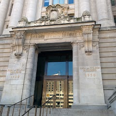
The John Wilson Building

Town Hall Liquor And Bar
Transit and Meeting Points
Useful pickup, handoff, or rendezvous points close to Colesville.
Rockville station
New Carrollton station
Washington Union Station
BWI Rail Station
Flight Path Map
This map shows the direct air route between Columbia and Germantown. Straight-line distance: 23.6 mi (37.98 km).
#1 Columbia
Columbia is a place in Maryland, United States.
| Population | 0 |
| Coordinates | 39.2403800, -76.8394200 |
| Altitude | 124 |
| Country | United States |

#2 Germantown
Census-designated place in Montgomery County, Maryland, United States
| Population | 86,395 |
| Coordinates | 39.1731600, -77.2716500 |
| Altitude | 134 |
| Country | United States |
End: Germantown (-77.27165, 39.17316)
Estimated Travel Time
Distance: 58 km by road
| Speed | Time |
|---|---|
| 30 mph (48.3 km/h) | 01h 12m |
| 40 mph (64.37 km/h) | 00h 54m |
| 50 mph (80.47 km/h) | 00h 43m |
| 60 mph (96.56 km/h) | 00h 36m |
| 70 mph (112.65 km/h) | 00h 30m |
| 80 mph (129 km/h) | 00h 26m |
Fuel, Round Trip and CO2
Estimated fuel cost and emissions for this route.
| Fuel | $/gal | One way | Round trip |
|---|---|---|---|
| Regular gas | $4.09 | $5.19 | $10.38 |
| Mid-grade | $4.60 | $5.84 | $11.68 |
| Premium | $4.95 | $6.29 | $12.58 |
| Diesel | $5.98 | $7.59 | $15.19 |
Assumes 8.3 L/100 km (about 28.3 MPG). CO2 is an estimate and varies by vehicle, fuel blend, traffic, and terrain.
Prices in Maryland · Jun 29, 2026
Distance to Other Cities
Planning a road trip? See the full trip guide on Trip.ovh — stops, fuel costs, weather, and departure timing.