How far is Colt, LA from Sun, LA?
The driving distance from Colt, LA to Sun, LA is about 37.5 miles (60.3 km), with a travel time of about 00h 51m by car.
- The straight-line flight distance is about 24.2 miles (39 km).
- For a round trip, plan for roughly 01h 42m of driving time before adding stops, traffic, or weather delays.
- A comfortable departure window is usually 8:00 AM to 10:00 AM CDT.
Reverse, save, or send this route
This route works well as a day trip with time at the destination. Copy the route link, send it to another device, or print a clean version before you head out.
This route works well as a day trip with time at the destination.
Flight Distance
Driving Distance
Gas Cost Calculator
Leave and Arrive Planner
Pick a departure time to see your estimated arrival and same-day return window.
Drive time stays fixed at 00h 51m.
A morning start gives you useful time at the destination and keeps the return out of the late evening.
You are leaving earlier than the recommended window, which gives you extra margin for breaks and traffic.
Halfway Point
A useful midpoint for breaks, coffee, or meeting in the middle.
Town of the United States
Route Weather Snapshot
Check the forecast at both ends before you head out.
Driving Route Map
The map below follows the saved road route between Colt and Sun.
Turn-by-Turn Driving Directions
Step-by-step road directions between Colt and Sun.
-
1
Start on Gause Boulevard West
2390 ft · 44 sec · Gause Boulevard West
-
2
Turn left onto Northshore Boulevard
1.1 km · 1 min · Northshore Boulevard
-
3
Continue on Airport Road
1520 ft · 29 sec · Airport Road
-
4
Take the ramp left
1862 ft · 45 sec
-
5
Merge slight left onto West Florida Republic Parkway
5.6 mi · 6 min · West Florida Republic Parkway
-
6
Take the exit slight right toward LA 434: Lacombe, Saint Tammany
2126 ft · 55 sec
-
7
Turn right onto Highway 434
5.6 mi · 10 min · Highway 434
-
8
At the end of the road, turn right onto Hickory Highway
1.2 km · 1 min · Hickory Highway
-
9
Continue on State Route 36
1.3 mi · 2 min · State Route 36
-
10
Turn left
8.1 mi · 12 min
-
11
Continue on Highway 3241
5.5 mi · 7 min · Highway 3241
-
12
Continue on Highway 41
3259 ft · 55 sec · Highway 41
-
13
Continue on Highway 21
2.2 mi · 3 min · Highway 21
-
14
Continue on Highway 21
97 m · 9 sec · Highway 21
-
15
Arrive at your destination
0 m · 1 sec · Highway 21
Car Route Details
A richer read on the saved driving route between Colt and Sun.
Highway-focused drive
Most of the mileage stays on named highways, so the important moments are ramps, exits, merges, and the final local approach.
Longest stretch
Turn left
8.14 mi · 00h 12m
Route Summary
A quick read on whether this route feels easy, ambitious, or worth planning around.
A comfortable day-trip route
This route works well as a day trip. You can leave in the morning, spend meaningful time at the destination, and still return the same day.
Partly Cloudy leaving Colt and Partly Cloudy near Sun.
Trip Questions
Direct answers travelers usually want before committing to the drive.
How long does it take to drive from Colt to Sun?
The road trip is about 37.5 miles (60.3 km) and usually takes 00h 51m in normal driving conditions.
Is this a same-day trip or an overnight route?
This route works well as a day trip. You can leave in the morning, spend meaningful time at the destination, and still return the same day.
What is the halfway point on this route?
Pearl River is a useful midpoint, sitting about 16 miles from Colt and 21.4 miles from Sun.
How much longer is the road route than the straight-line distance?
The direct path is about 24.2 miles (39 km), while the road route adds roughly 13.3 extra miles because roads do not follow the straight air line.
When is the best time to leave for this route?
A good departure window is usually 8:00 AM to 10:00 AM CDT. If you want a more comfortable same-day return, try to leave by 4:48 PM CDT.
How much will gas cost for this route?
Using about 28.3 MPG, regular gas is estimated at $5.00 one way or $10.00 round trip. Estimated CO2 is about 11.7 kg one way.
What should you check before leaving?
Before you leave, expect Partly Cloudy around Colt and Partly Cloudy near Sun.
Stop Ideas Near Pearl River
Useful break, food, and waypoint ideas within about 15 miles of the route midpoint.

City of Picayune
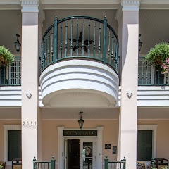
Slidell City Hall
Mandevile City Hall
Transit and Meeting Points
Useful pickup, handoff, or rendezvous points close to Pearl River.
Slidell
Picayune
New Orleans Union Passenger Terminal
Gulfport, MS
Flight Path Map
This map shows the direct air route between Colt and Sun. Straight-line distance: 24.25 mi (39.02 km).
#1 Colt
Colt is a place in Louisiana, United States.
| Population | 0 |
| Coordinates | 30.3018600, -89.8334000 |
| Altitude | 4 |
| Country | United States |
#2 Sun
Village in the northeastern corner of St.
| Population | 498 |
| Coordinates | 30.6490800, -89.8925700 |
| Altitude | 21 |
| Country | United States |
End: Highway 21 (-89.892648, 30.649105)
Estimated Travel Time
Distance: 60 km by road
| Speed | Time |
|---|---|
| 30 mph (48.3 km/h) | 01h 14m |
| 40 mph (64.37 km/h) | 00h 56m |
| 50 mph (80.47 km/h) | 00h 44m |
| 60 mph (96.56 km/h) | 00h 37m |
| 70 mph (112.65 km/h) | 00h 32m |
| 80 mph (129 km/h) | 00h 28m |
Fuel, Round Trip and CO2
Estimated fuel cost and emissions for this route.
| Fuel | $/gal | One way | Round trip |
|---|---|---|---|
| Regular gas | $3.79 | $5.00 | $10.00 |
| Mid-grade | $4.26 | $5.62 | $11.24 |
| Premium | $4.63 | $6.11 | $12.21 |
| Diesel | $5.42 | $7.15 | $14.30 |
Assumes 8.3 L/100 km (about 28.3 MPG). CO2 is an estimate and varies by vehicle, fuel blend, traffic, and terrain.
Prices in Louisiana · Jul 17, 2026
Distance to Other Cities
Planning a road trip? See the full trip guide on Trip.ovh — stops, fuel costs, weather, and departure timing.