How far is Cobb, CA from San Jose, CA?
The driving distance from Cobb, CA to San Jose, CA is about 141.5 miles (227.8 km), with a travel time of about 02h 45m by car.
- The straight-line flight distance is about 111.9 miles (180.1 km).
- For a round trip, plan for roughly 05h 30m of driving time before adding stops, traffic, or weather delays.
- A comfortable departure window is usually 8:00 AM to 10:00 AM PDT.
Reverse, save, or send this route
This route works well as a day trip with time at the destination. Copy the route link, send it to another device, or print a clean version before you head out.
This route works well as a day trip with time at the destination.
Flight Distance
Driving Distance
Gas Cost Calculator
Leave and Arrive Planner
Pick a departure time to see your estimated arrival and same-day return window.
Drive time stays fixed at 02h 45m.
A morning start gives you useful time at the destination and keeps the return out of the late evening.
You are leaving earlier than the recommended window, which gives you extra margin for breaks and traffic.
Halfway Point
A useful midpoint for breaks, coffee, or meeting in the middle.
The second most populous city in Solano County, California.
Route Weather Snapshot
Check the forecast at both ends before you head out.
Mostly Clear
Driving Route Map
The map below follows the saved road route between Cobb and San Jose.
Turn-by-Turn Driving Directions
Step-by-step road directions between Cobb and San Jose.
-
1
Start on High Road
866 ft · 39 sec · High Road
-
2
Turn right
8.3 mi · 12 min
-
3
Turn right onto Calistoga Street
16.5 mi · 24 min · Calistoga Street
-
4
Continue on Lincoln Avenue
1 mi · 2 min · Lincoln Avenue
-
5
Turn left onto Saint Helena Highway
6.8 mi · 8 min · Saint Helena Highway
-
6
Continue on Main Street
2.4 mi · 3 min · Main Street
-
7
Continue on Saint Helena Highway South
21.7 mi · 26 min · Saint Helena Highway South
-
8
Continue on Napa–Vallejo Highway
1.3 mi · 1 min · Napa–Vallejo Highway
-
9
Continue on Broadway Street
4 mi · 5 min · Broadway Street
-
10
Continue on Sonoma Boulevard
1.8 mi · 2 min · Sonoma Boulevard
-
11
Continue on Sonoma Boulevard
1.1 mi · 2 min · Sonoma Boulevard
-
12
Turn left onto Redwood Street
1786 ft · 45 sec · Redwood Street
-
13
Turn right onto Broadway Street
1.1 mi · 2 min · Broadway Street
-
14
Turn slight left onto Alameda Street
1.1 km · 2 min · Alameda Street
-
15
Turn left onto Curtola Parkway
7.1 mi · 9 min · Curtola Parkway
-
16
Keep slight left to continue on I 680 South: Martinez, San Jose
1.1 km · 47 sec
-
17
Continue on Benicia-Martinez Bridge
8 mi · 9 min · Benicia-Martinez Bridge
-
18
Keep slight right to continue on Senator Daniel E Boatwright Highway
4.8 mi · 6 min · Senator Daniel E Boatwright Highway
-
19
Continue on Donald D Doyle Highway
1.4 mi · 2 min · Donald D Doyle Highway
-
20
Keep slight right to continue on Donald D Doyle Highway
31 mi · 36 min · Donald D Doyle Highway
-
21
Take the exit slight right toward CA 262
866 ft · 21 sec
-
22
Keep slight right to continue on CA 262: Northwestern Polytechnic University, Warm Springs District
1597 ft · 39 sec
-
23
Merge slight left onto Mission Boulevard
1.5 mi · 2 min · Mission Boulevard
-
24
Merge slight left onto Nimitz Freeway
8.3 mi · 10 min · Nimitz Freeway
-
25
Take the exit slight right toward Downtown, North First Street
991 ft · 26 sec
-
26
Turn left onto North 1st Street
1.5 mi · 4 min · North 1st Street
-
27
Turn right onto West Julian Street
151 m · 18 sec · West Julian Street
-
28
Turn left onto North Market Street
60 m · 7 sec · North Market Street
-
29
Arrive at your destination
0 m · 1 sec · North Market Street
Car Route Details
A richer read on the saved driving route between Cobb and San Jose.
Highway-focused drive
Most of the mileage stays on named highways, so the important moments are ramps, exits, merges, and the final local approach.
Donald D Doyle Highway
Keep slight right to continue on Donald D Doyle Highway
31 mi · 00h 36m
Route Summary
A quick read on whether this route feels easy, ambitious, or worth planning around.
A comfortable day-trip route
This route works well as a day trip. You can leave in the morning, spend meaningful time at the destination, and still return the same day.
Mostly Clear leaving Cobb and Clear near San Jose.
Trip Questions
Direct answers travelers usually want before committing to the drive.
How long does it take to drive from Cobb to San Jose?
The road trip is about 141.5 miles (227.8 km) and usually takes 02h 45m in normal driving conditions.
Is this a same-day trip or an overnight route?
This route works well as a day trip. You can leave in the morning, spend meaningful time at the destination, and still return the same day.
What is the halfway point on this route?
Vallejo is a useful midpoint, sitting about 66.2 miles from Cobb and 75.4 miles from San Jose.
How much longer is the road route than the straight-line distance?
The direct path is about 111.9 miles (180.1 km), while the road route adds roughly 29.6 extra miles because roads do not follow the straight air line.
When is the best time to leave for this route?
A good departure window is usually 8:00 AM to 10:00 AM PDT. If you want a more comfortable same-day return, try to leave by 1:00 PM PDT.
How much will gas cost for this route?
Using about 28.3 MPG, regular gas is estimated at $28.79 one way or $57.57 round trip. Estimated CO2 is about 44.3 kg one way.
What should you check before leaving?
Before you leave, expect Mostly Clear around Cobb and Clear near San Jose.
Stop Ideas Near Vallejo
Useful break, food, and waypoint ideas within about 15 miles of the route midpoint.
BikeLink : Richmond City Hall

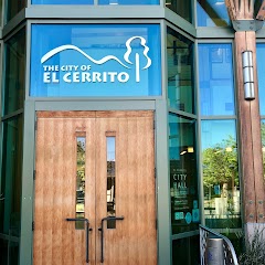
El Cerrito City Hall
Old Maple Hall
BikeLink eLockers: El Cerrito City Hall
Transit and Meeting Points
Useful pickup, handoff, or rendezvous points close to Vallejo.
Vallejo, California
Marine World (Seasonal), Vallejo, California
Martinez station
Richmond station
Flight Path Map
This map shows the direct air route between Cobb and San Jose. Straight-line distance: 111.91 mi (180.1 km).
#1 Cobb
Census designated place
| Population | 1,778 |
| Coordinates | 38.8221300, -122.7230500 |
| Altitude | 802 |
| Country | United States |

#2 San Jose
The tenth most populous city in the United States and the center of the San Jose metropolitan area.
| Population | 1,013,616 |
| Coordinates | 37.3393900, -121.8949600 |
| Altitude | 26 |
| Country | United States |
End: North Market Street (-121.894962, 37.339389)
Estimated Travel Time
Distance: 228 km by road
| Speed | Time |
|---|---|
| 30 mph (48.3 km/h) | 04h 42m |
| 40 mph (64.37 km/h) | 03h 32m |
| 50 mph (80.47 km/h) | 02h 49m |
| 60 mph (96.56 km/h) | 02h 21m |
| 70 mph (112.65 km/h) | 02h 01m |
| 80 mph (129 km/h) | 01h 45m |
Fuel, Round Trip and CO2
Estimated fuel cost and emissions for this route.
| Fuel | $/gal | One way | Round trip |
|---|---|---|---|
| Regular gas | $5.77 | $28.79 | $57.57 |
| Mid-grade | $6.07 | $30.27 | $60.54 |
| Premium | $6.24 | $31.15 | $62.31 |
| Diesel | $7.57 | $37.76 | $75.52 |
Assumes 8.3 L/100 km (about 28.3 MPG). CO2 is an estimate and varies by vehicle, fuel blend, traffic, and terrain.
Prices in California · Jun 10, 2026
Distance to Other Cities
Planning a road trip? See the full trip guide on Trip.ovh — stops, fuel costs, weather, and departure timing.