How far is Clinton, MD from New Ipswich, NH?
The driving distance from Clinton, MD to New Ipswich, NH is about 445.9 miles (717.6 km), with a travel time of about 09h 30m by car.
- The straight-line flight distance is about 381.2 miles (613.5 km).
- For a round trip, plan for roughly 19h 01m of driving time before adding stops, traffic, or weather delays.
- A comfortable departure window is usually 6:00 AM to 7:30 AM EDT.
Reverse, save, or send this route
This drive is better planned with a longer stop or an overnight stay. Copy the route link, send it to another device, or print a clean version before you head out.
This drive is better planned with a longer stop or an overnight stay.
Flight Distance
Driving Distance
Gas Cost Calculator
Leave and Arrive Planner
Pick a departure time to see your estimated arrival and same-day return window.
Drive time stays fixed at 09h 30m.
Starting early still helps, but most travelers will want a longer stop or an overnight stay on a route this long.
You are leaving earlier than the recommended window, which gives you extra margin for breaks and traffic.
Halfway Point
A useful midpoint for breaks, coffee, or meeting in the middle.
Town in Hudson County, New Jersey, United States
Route Weather Snapshot
Check the forecast at both ends before you head out.
Patchy Fog then Partly Sunny
Rain
Driving Route Map
The map below follows the saved road route between Clinton and New Ipswich.
Turn-by-Turn Driving Directions
Step-by-step road directions between Clinton and New Ipswich.
-
1
Start on the route
13 m · 6 sec
-
2
Turn right onto Woodyard Road
1.2 km · 1 min · Woodyard Road
-
3
Take the ramp slight left toward MD 5 North: Washington
2050 ft · 56 sec
-
4
Merge slight left onto Branch Avenue
3.3 mi · 4 min · Branch Avenue
-
5
Take the exit slight right toward I 95 North, I 495 North: Baltimore, College Park
2193 ft · 53 sec
-
6
Merge slight left onto Capital Beltway
14.2 mi · 19 min · Capital Beltway
-
7
Take the exit slight right toward MD 295 North: BWI Marshall Airport, Baltimore North, Baltimore-Washington Parkway
1285 ft · 31 sec
-
8
Keep slight left to continue on MD 295 North: Baltimore, Baltimore/Washington International Thurgood Marshall Airport
1100 ft · 27 sec
-
9
Merge slight left onto Baltimore-Washington Parkway
21.3 mi · 29 min · Baltimore-Washington Parkway
-
10
Take the exit slight right toward I 895 North: Baltimore Harbor Tunnel Thruway
1327 ft · 32 sec
-
11
Merge slight left onto Harbor Tunnel Thruway
1.1 mi · 2 min · Harbor Tunnel Thruway
-
12
Continue on Harbor Tunnel Throughway
1.6 km · 1 min · Harbor Tunnel Throughway
-
13
Continue on Harbor Tunnel Thruway
2.2 mi · 3 min · Harbor Tunnel Thruway
-
14
Continue on Baltimore Harbor Tunnel
1.4 mi · 2 min · Baltimore Harbor Tunnel
-
15
Continue on Harbor Tunnel Thruway
3.7 mi · 5 min · Harbor Tunnel Thruway
-
16
Keep slight left to continue on Express Toll Lanes
8.5 mi · 10 min · Express Toll Lanes
-
17
Keep slight right
91 m · 4 sec
-
18
Merge slight right onto John F. Kennedy Memorial Highway
40.5 mi · 47 min · John F. Kennedy Memorial Highway
-
19
Continue on Delaware Turnpike
3005 ft · 40 sec · Delaware Turnpike
-
20
Keep slight left to continue on Delaware Turnpike
10 mi · 12 min · Delaware Turnpike
-
21
Keep slight right to continue on Delaware Turnpike
1 mi · 2 min · Delaware Turnpike
-
22
Take the exit slight left toward US 13 North: Wilmington
1.2 km · 1 min
-
23
Keep slight right to continue on I 295 North: Delware Memorial Bridge, New York, New Jersey
1033 ft · 16 sec
-
24
Merge slight right onto Delaware Turnpike
2.2 mi · 3 min · Delaware Turnpike
-
25
Continue on Delaware Memorial Bridge
2.4 mi · 4 min · Delaware Memorial Bridge
-
26
Keep slight left to continue on New Jersey Turnpike
2.5 mi · 3 min · New Jersey Turnpike
-
27
Take the exit slight left
1039 ft · 14 sec
-
28
Continue straight
899 ft · 12 sec
-
29
Merge slight right onto New Jersey Turnpike
46.7 mi · 54 min · New Jersey Turnpike
-
30
Keep slight right to continue on New Jersey Turnpike
56.4 mi · 1 hr 7 min · New Jersey Turnpike
-
31
Keep slight left to continue on New Jersey Turnpike Western Spur
11.3 mi · 15 min · New Jersey Turnpike Western Spur
-
32
Take the exit slight right toward US 46: The Ridgefields, Palisades Park
823 ft · 28 sec
-
33
Keep slight right to continue on US 46 East: Ridgefield, Palisades Park
1233 ft · 42 sec
-
34
Merge slight left
1.5 km · 2 min
-
35
Continue straight
1.8 mi · 3 min
-
36
Take the exit slight left toward George Washington Bridge Upper Level
95 m · 5 sec
-
37
Merge slight left
1649 ft · 20 sec
-
38
Keep slight left
1.3 km · 1 min
-
39
Continue on George Washington Bridge (upper level)
3174 ft · 1 min · George Washington Bridge (upper level)
-
40
Continue on Trans-Manhattan Expressway
1.2 km · 1 min · Trans-Manhattan Expressway
-
41
Continue on Cross Bronx Expressway
4.7 mi · 6 min · Cross Bronx Expressway
-
42
Keep slight left
2.9 mi · 4 min
-
43
Take the exit slight right toward Hutchinson Parkway North
131 m · 15 sec
-
44
Keep slight left to continue on Hutchinson River Parkway North
912 ft · 31 sec
-
45
Merge slight left onto Hutchinson River Parkway
1.5 mi · 2 min · Hutchinson River Parkway
-
46
Take the exit slight right toward I 95 North: New Haven
1570 ft · 44 sec
-
47
Merge slight left onto New England Thruway
40.8 mi · 55 min · New England Thruway
-
48
Take the exit slight right toward CT 25, CT 8: Trumbull, Waterbury
1 km · 1 min
-
49
Continue straight
3.2 mi · 3 min
-
50
Keep slight right to continue on CT 8 North: Waterbury, New Haven
1.8 mi · 2 min
-
51
Take the exit slight right toward CT 15 North: Merritt Parkway, New Haven
1.2 km · 2 min
-
52
Merge slight left onto Merritt Parkway
3 mi · 4 min · Merritt Parkway
-
53
Continue on Wilbur Cross Parkway
30.4 mi · 38 min · Wilbur Cross Parkway
-
54
Continue on Berlin Turnpike
15.7 mi · 20 min · Berlin Turnpike
-
55
Merge slight right
1.4 mi · 2 min
-
56
Keep slight left to continue on I 84 East: Boston
39.7 mi · 46 min
-
57
Merge slight left onto Massachusetts Turnpike
11.2 mi · 13 min · Massachusetts Turnpike
-
58
Take the exit slight right toward I 395, MA 12, I 290: Auburn, Worcester
2031 ft · 1 min
-
59
Keep slight left to continue on I 395, MA 12 North, I 290
794 ft · 19 sec
-
60
Keep slight left to continue on I 395, I 290
1244 ft · 30 sec
-
61
Keep slight left to continue on I 290
1723 ft · 42 sec
-
62
Continue straight
7.5 mi · 10 min
-
63
Take the exit slight right toward I 190 North, MA 70: Sterling, Leominster, Burncoat Street, Lincoln Street
788 ft · 14 sec
-
64
Keep slight left to continue on I 190 North: Sterling, Leominster
1897 ft · 33 sec
-
65
Continue straight
18.1 mi · 21 min
-
66
Continue on Fitchburg
1.6 km · 1 min
-
67
Merge slight right onto Concord Turnpike
2.8 mi · 4 min · Concord Turnpike
-
68
Turn right onto Abbott Avenue
1.1 km · 2 min · Abbott Avenue
-
69
At the end of the road, turn left onto Water Street
986 ft · 23 sec · Water Street
-
70
Turn right onto Bemis Road
2605 ft · 54 sec · Bemis Road
-
71
Keep slight right to continue on John Fitch Highway
2.9 mi · 6 min · John Fitch Highway
-
72
Enter the roundabout and take exit 1 toward Ashby State Road
10 m · 1 sec · Ashby State Road
-
73
Exit the roundabout onto Ashby State Road
2.6 mi · 4 min · Ashby State Road
-
74
Continue on Fitchburg State Road
1.9 mi · 3 min · Fitchburg State Road
-
75
Continue on Main Street
2.6 mi · 6 min · Main Street
-
76
Turn slight right onto West Road
2.5 mi · 4 min · West Road
-
77
Continue on Ashburnham Road
1.4 mi · 3 min · Ashburnham Road
-
78
Continue on Ashby Road
1.3 mi · 2 min · Ashby Road
-
79
Turn right onto Main Street
1.1 km · 1 min · Main Street
-
80
Arrive at your destination
0 m · 1 sec · Main Street
Car Route Details
A richer read on the saved driving route between Clinton and New Ipswich.
Long-distance drive
This route is long enough that fuel, rest stops, weather, and timing matter more than any single maneuver.
New Jersey Turnpike
Keep slight right to continue on New Jersey Turnpike
56.4 mi · 01h 07m
Route Summary
A quick read on whether this route feels easy, ambitious, or worth planning around.
Better with a longer stop
This route is long enough that most travelers will be better off planning an overnight stay or a more deliberate stop window.
Patchy Fog then Partly Sunny leaving Clinton and Rain near New Ipswich.
Trip Questions
Direct answers travelers usually want before committing to the drive.
How long does it take to drive from Clinton to New Ipswich?
The road trip is about 445.9 miles (717.6 km) and usually takes 09h 30m in normal driving conditions.
Is this a same-day trip or an overnight route?
This route is long enough that most travelers will be better off planning an overnight stay or a more deliberate stop window.
What is the halfway point on this route?
Harrison is a useful midpoint, sitting about 222.8 miles from Clinton and 223.1 miles from New Ipswich.
How much longer is the road route than the straight-line distance?
The direct path is about 381.2 miles (613.5 km), while the road route adds roughly 64.7 extra miles because roads do not follow the straight air line.
When is the best time to leave for this route?
A good departure window is usually 6:00 AM to 7:30 AM EDT. Starting early still helps, but most travelers will want a longer stop or an overnight stay on a route this long.
How much will gas cost for this route?
Using about 28.3 MPG, regular gas is estimated at $66.00 one way or $132.01 round trip. Estimated CO2 is about 139.8 kg one way.
What should you check before leaving?
Before you leave, expect Patchy Fog then Partly Sunny around Clinton and Rain near New Ipswich.
Stop Ideas Near Harrison
Useful break, food, and waypoint ideas within about 15 miles of the route midpoint.
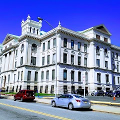
City Hall Parking Lot

#Artlook New York City Hall Wedding Photographer
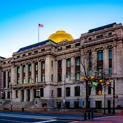
City Hall Personnel Office

Diamond City Hall Photography
Transit and Meeting Points
Useful pickup, handoff, or rendezvous points close to Harrison.
Pennsylvania Station
Newark Liberty International Airport
Pennsylvania Station
Metropark station
Flight Path Map
This map shows the direct air route between Clinton and New Ipswich. Straight-line distance: 381.2 mi (613.49 km).
#1 Clinton
Clinton is a place in Maryland, United States.
| Population | 0 |
| Coordinates | 38.7651100, -76.8983100 |
| Altitude | 76 |
| Country | United States |

#2 New Ipswich
Town in New Hampshire
| Population | 5,429 |
| Coordinates | 42.7481400, -71.8542400 |
| Altitude | 323 |
| Country | United States |
End: New Ipswich (-71.85424, 42.74814)
Estimated Travel Time
Distance: 718 km by road
| Speed | Time |
|---|---|
| 30 mph (48.3 km/h) | 14h 51m |
| 40 mph (64.37 km/h) | 11h 08m |
| 50 mph (80.47 km/h) | 08h 55m |
| 60 mph (96.56 km/h) | 07h 25m |
| 70 mph (112.65 km/h) | 06h 22m |
| 80 mph (129 km/h) | 05h 33m |
Fuel, Round Trip and CO2
Estimated fuel cost and emissions for this route.
| Fuel | $/gal | One way | Round trip |
|---|---|---|---|
| Regular gas | $4.20 | $66.00 | $132.01 |
| Mid-grade | $4.81 | $75.68 | $151.35 |
| Premium | $5.12 | $80.46 | $160.92 |
| Diesel | $6.35 | $99.82 | $199.65 |
Assumes 8.3 L/100 km (about 28.3 MPG). CO2 is an estimate and varies by vehicle, fuel blend, traffic, and terrain.
Prices in Maryland · Oct 16, 2026