How far is Clearwater, FL from Palm Bay, FL?
The driving distance from Clearwater, FL to Palm Bay, FL is about 170.8 miles (274.8 km), with a travel time of about 02h 40m by car.
- The straight-line flight distance is about 135 miles (217.2 km).
- For a round trip, plan for roughly 05h 21m of driving time before adding stops, traffic, or weather delays.
- A comfortable departure window is usually 8:00 AM to 10:00 AM EDT.
Reverse, save, or send this route
This route works well as a day trip with time at the destination. Copy the route link, send it to another device, or print a clean version before you head out.
This route works well as a day trip with time at the destination.
Flight Distance
Driving Distance
Gas Cost Calculator
Leave and Arrive Planner
Pick a departure time to see your estimated arrival and same-day return window.
Drive time stays fixed at 02h 40m.
A morning start gives you useful time at the destination and keeps the return out of the late evening.
You are leaving earlier than the recommended window, which gives you extra margin for breaks and traffic.
Halfway Point
A useful midpoint for breaks, coffee, or meeting in the middle.
Census-designated place in Polk County, Florida
Route Weather Snapshot
Check the forecast at both ends before you head out.
Mostly Sunny then Scattered Showers And Thunderstorms
Slight Chance Showers And Thunderstorms
Driving Route Map
The map below follows the saved road route between Clearwater and Palm Bay.
Turn-by-Turn Driving Directions
Step-by-step road directions between Clearwater and Palm Bay.
-
1
Start on North Fort Harrison Avenue
840 ft · 27 sec · North Fort Harrison Avenue
-
2
Turn right onto Drew Street
4.2 mi · 8 min · Drew Street
-
3
Take the ramp slight right
60 m · 5 sec
-
4
Merge slight left onto Southbound Frontage Road
2092 ft · 49 sec · Southbound Frontage Road
-
5
Continue straight
115 m · 8 sec
-
6
Take the exit left
71 m · 6 sec
-
7
Merge slight right onto Gulf to Bay Boulevard
1.9 mi · 4 min · Gulf to Bay Boulevard
-
8
Continue on Courtney Campbell Causeway
8.2 mi · 11 min · Courtney Campbell Causeway
-
9
Continue straight
1.3 km · 1 min
-
10
Keep slight right to continue on FL 60 East, FL 616: Tampa International Airport, Spruce Street
1.1 km · 59 sec
-
11
Keep slight left to continue on Memorial Highway
1.4 mi · 2 min · Memorial Highway
-
12
Take the exit slight right toward I 275 North: Tampa
1333 ft · 46 sec
-
13
Merge slight left onto I 275: Tampa
5.2 mi · 7 min
-
14
Take the exit slight right toward I 4 East: Orlando
2472 ft · 42 sec
-
15
Continue straight
60.9 mi · 1 hr 7 min
-
16
Keep slight right to continue on FL 417 North: Airport, Disney World, Celebration
1380 ft · 17 sec
-
17
Continue on Southern Connector Extension
4.2 mi · 5 min · Southern Connector Extension
-
18
Take the exit slight right toward Osceola Parkway, Gaylord Convention Center
1973 ft · 48 sec
-
19
Turn right onto Osceola Parkway
7.1 mi · 11 min · Osceola Parkway
-
20
Continue on East Osceola Parkway
1.5 mi · 2 min · East Osceola Parkway
-
21
Take the ramp right toward Miami, Florida's Turnpike Toll South
2276 ft · 56 sec
-
22
Merge slight left onto Florida's Turnpike
3.5 mi · 4 min · Florida's Turnpike
-
23
Take the exit slight right toward US 192, US 441: Kissimmee, Saint Cloud
2873 ft · 1 min
-
24
Keep slight left to continue on US 192 East, US 441 South: Saint. Cloud, Orlando Health Saint Cloud Hospital
54 m · 6 sec
-
25
Turn left onto Bronson Highway
3.4 mi · 5 min · Bronson Highway
-
26
Continue on East Irlo Bronson Memorial Highway
679 ft · 15 sec · East Irlo Bronson Memorial Highway
-
27
Continue on 13th Street
2.6 mi · 5 min · 13th Street
-
28
Continue on East Irlo Bronson Memorial Highway
1.4 mi · 2 min · East Irlo Bronson Memorial Highway
-
29
Continue on Bronson Highway
33.8 mi · 41 min · Bronson Highway
-
30
Continue straight
2.9 mi · 4 min
-
31
Take the exit slight right toward I 95 South: Miami
2951 ft · 1 min
-
32
Merge slight left
3.4 mi · 4 min
-
33
Take the exit slight right toward CR 516: Palm Bay
2022 ft · 52 sec
-
34
Continue on CR 516: Palm Bay, Palm Bay Road
30 m · 5 sec
-
35
Turn straight onto Palm Bay Road Northeast
4.3 mi · 8 min · Palm Bay Road Northeast
-
36
Arrive at your destination
0 m · 1 sec · Palm Bay Road Northeast
Car Route Details
A richer read on the saved driving route between Clearwater and Palm Bay.
Highway-focused drive
Most of the mileage stays on named highways, so the important moments are ramps, exits, merges, and the final local approach.
I 4 East
Continue straight
60.9 mi · 01h 07m
Route Summary
A quick read on whether this route feels easy, ambitious, or worth planning around.
A comfortable day-trip route
This route works well as a day trip. You can leave in the morning, spend meaningful time at the destination, and still return the same day.
Mostly Sunny then Scattered Showers And Thunderstorms leaving Clearwater and Slight Chance Showers And Thunderstorms near Palm Bay.
Trip Questions
Direct answers travelers usually want before committing to the drive.
How long does it take to drive from Clearwater to Palm Bay?
The road trip is about 170.8 miles (274.8 km) and usually takes 02h 40m in normal driving conditions.
Is this a same-day trip or an overnight route?
This route works well as a day trip. You can leave in the morning, spend meaningful time at the destination, and still return the same day.
What is the halfway point on this route?
Loughman is a useful midpoint, sitting about 77.7 miles from Clearwater and 93 miles from Palm Bay.
How much longer is the road route than the straight-line distance?
The direct path is about 135 miles (217.2 km), while the road route adds roughly 35.8 extra miles because roads do not follow the straight air line.
When is the best time to leave for this route?
A good departure window is usually 8:00 AM to 10:00 AM EDT. If you want a more comfortable same-day return, try to leave by 1:08 PM EDT.
How much will gas cost for this route?
Using about 28.3 MPG, regular gas is estimated at $25.01 one way or $50.02 round trip. Estimated CO2 is about 53.6 kg one way.
What should you check before leaving?
Before you leave, expect Mostly Sunny then Scattered Showers And Thunderstorms around Clearwater and Slight Chance Showers And Thunderstorms near Palm Bay.
Stop Ideas Near Loughman
Useful break, food, and waypoint ideas within about 15 miles of the route midpoint.

City Hall
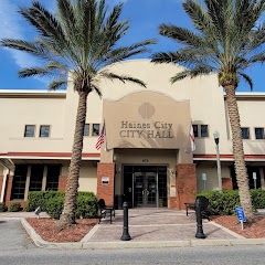
Haines City Municipal Government
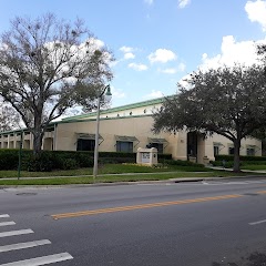
Celebration Town Hall
Transit and Meeting Points
Useful pickup, handoff, or rendezvous points close to Loughman.
Kissimmee
Winter Haven
Orlando Health/Amtrak
Lakeland
Flight Path Map
This map shows the direct air route between Clearwater and Palm Bay. Straight-line distance: 134.99 mi (217.25 km).

#1 Clearwater
The second most populous city in Pinellas County, Florida.
| Population | 116,552 |
| Coordinates | 27.9658500, -82.8001000 |
| Altitude | 9 |
| Country | United States |

#2 Palm Bay
The most populous city in Brevard County, Florida.
| Population | 116,932 |
| Coordinates | 28.0344600, -80.5886600 |
| Altitude | 5 |
| Country | United States |
End: Palm Bay Road Northeast (-80.58866, 28.03445)
Estimated Travel Time
Distance: 275 km by road
| Speed | Time |
|---|---|
| 30 mph (48.3 km/h) | 05h 41m |
| 40 mph (64.37 km/h) | 04h 16m |
| 50 mph (80.47 km/h) | 03h 24m |
| 60 mph (96.56 km/h) | 02h 50m |
| 70 mph (112.65 km/h) | 02h 26m |
| 80 mph (129 km/h) | 02h 07m |
Fuel, Round Trip and CO2
Estimated fuel cost and emissions for this route.
| Fuel | $/gal | One way | Round trip |
|---|---|---|---|
| Regular gas | $4.15 | $25.01 | $50.02 |
| Mid-grade | $4.60 | $27.71 | $55.43 |
| Premium | $4.90 | $29.52 | $59.05 |
| Diesel | $4.35 | $26.23 | $52.46 |
Assumes 8.3 L/100 km (about 28.3 MPG). CO2 is an estimate and varies by vehicle, fuel blend, traffic, and terrain.
Prices in Florida · Jul 24, 2026
Distance to Other Cities
Planning a road trip? See the full trip guide on Trip.ovh — stops, fuel costs, weather, and departure timing.