How far is Cincinnati, OH from Montpelier, OH?
The driving distance from Cincinnati, OH to Montpelier, OH is about 191.9 miles (308.8 km), with a travel time of about 04h 17m by car.
- The straight-line flight distance is about 169.9 miles (273.4 km).
- For a round trip, plan for roughly 08h 35m of driving time before adding stops, traffic, or weather delays.
- A comfortable departure window is usually 6:00 AM to 8:00 AM EDT.
Reverse, save, or send this route
This drive is better planned with a longer stop or an overnight stay. Copy the route link, send it to another device, or print a clean version before you head out.
This drive is better planned with a longer stop or an overnight stay.
Flight Distance
Driving Distance
Gas Cost Calculator
Leave and Arrive Planner
Pick a departure time to see your estimated arrival and same-day return window.
Drive time stays fixed at 04h 17m.
An early departure helps you fit a real stop into the day without turning the return into a late-night drive.
You are leaving earlier than the recommended window, which gives you extra margin for breaks and traffic.
Halfway Point
A useful midpoint for breaks, coffee, or meeting in the middle.
Village in Darke County, Ohio
Route Weather Snapshot
Check the forecast at both ends before you head out.
Driving Route Map
The map below follows the saved road route between Cincinnati and Montpelier.
Turn-by-Turn Driving Directions
Step-by-step road directions between Cincinnati and Montpelier.
-
1
Start on Ohio Avenue
30 m · 6 sec · Ohio Avenue
-
2
Turn right onto West McMillan Avenue
876 ft · 27 sec · West McMillan Avenue
-
3
Turn left onto Vine Street
86 m · 10 sec · Vine Street
-
4
Continue on Jefferson Avenue
2889 ft · 1 min · Jefferson Avenue
-
5
Continue on Vine Street
2 mi · 5 min · Vine Street
-
6
Turn left onto West Mitchell Avenue
1490 ft · 40 sec · West Mitchell Avenue
-
7
Take the ramp right toward I 75 North: Dayton
1927 ft · 49 sec
-
8
Merge slight left onto Mill Creek Expressway
46.5 mi · 55 min · Mill Creek Expressway
-
9
Take the exit slight right toward Second Street, Salem Avenue, 1st Street
1468 ft · 45 sec
-
10
Turn left onto West 2nd Street
668 ft · 13 sec · West 2nd Street
-
11
Continue on West 1st Street
116 m · 7 sec · West 1st Street
-
12
Continue on Salem Avenue
11.4 mi · 17 min · Salem Avenue
-
13
Take the exit slight right toward SR 49 North: Phillipsburg, Greenville
1806 ft · 44 sec
-
14
Keep slight right to continue on SR 49 North: Phillipsburg, Greenville
19.9 mi · 23 min
-
15
Take the exit right
1374 ft · 38 sec
-
16
Merge slight left
41.2 mi · 51 min
-
17
Continue straight
16.2 mi · 25 min
-
18
Continue straight
1.2 mi · 2 min
-
19
Enter the roundabout and take exit 3 toward the route
65 m · 4 sec
-
20
Exit the roundabout
16.6 mi · 23 min
-
21
Turn right onto North Williams Street
6.5 mi · 10 min · North Williams Street
-
22
Continue straight
14.3 mi · 21 min
-
23
At the end of the road, turn left
1.4 km · 1 min
-
24
Continue straight
10.1 mi · 14 min
-
25
Turn left
2.5 mi · 5 min
-
26
Turn left onto South Harrison Street
681 ft · 32 sec · South Harrison Street
-
27
Turn right onto East Jefferson Street
66 m · 9 sec · East Jefferson Street
-
28
Arrive at your destination
0 m · 1 sec · East Jefferson Street
Car Route Details
A richer read on the saved driving route between Cincinnati and Montpelier.
Highway-focused drive
Most of the mileage stays on named highways, so the important moments are ramps, exits, merges, and the final local approach.
Mill Creek Expressway
Merge slight left onto Mill Creek Expressway
46.5 mi · 00h 55m
Route Summary
A quick read on whether this route feels easy, ambitious, or worth planning around.
A longer out-and-back drive
This is still possible in one day, but it becomes a long driving day. Leaving early and planning your stop window matters more here.
Mostly Clear leaving Cincinnati and Smoke near Montpelier.
Trip Questions
Direct answers travelers usually want before committing to the drive.
How long does it take to drive from Cincinnati to Montpelier?
The road trip is about 191.9 miles (308.8 km) and usually takes 04h 17m in normal driving conditions.
Is this a same-day trip or an overnight route?
This is still possible in one day, but it becomes a long driving day. Leaving early and planning your stop window matters more here.
What is the halfway point on this route?
North Star is a useful midpoint, sitting about 96 miles from Cincinnati and 95.9 miles from Montpelier.
How much longer is the road route than the straight-line distance?
The direct path is about 169.9 miles (273.4 km), while the road route adds roughly 22 extra miles because roads do not follow the straight air line.
When is the best time to leave for this route?
A good departure window is usually 6:00 AM to 8:00 AM EDT. If you want a more comfortable same-day return, try to leave by 8:24 AM EDT.
How much will gas cost for this route?
Using about 28.3 MPG, regular gas is estimated at $25.08 one way or $50.17 round trip. Estimated CO2 is about 60.2 kg one way.
What should you check before leaving?
Before you leave, expect Mostly Clear around Cincinnati and Smoke near Montpelier.
Stop Ideas Near North Star
Useful break, food, and waypoint ideas within about 15 miles of the route midpoint.

Darke County Visitors Bureau

Advance America
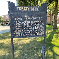
Greenville City Hall
Fireside Resort
Transit and Meeting Points
Useful pickup, handoff, or rendezvous points close to North Star.
Connersville station
Flight Path Map
This map shows the direct air route between Cincinnati and Montpelier. Straight-line distance: 169.86 mi (273.36 km).

#1 Cincinnati
The third most populous city in Ohio and the center of the Cincinnati metropolitan area.
| Population | 304,548 |
| Coordinates | 39.1271100, -84.5143900 |
| Altitude | 191 |
| Country | United States |

#2 Montpelier
City in Williams County, Ohio, United States of America
| Population | 3,907 |
| Coordinates | 41.5845000, -84.6055100 |
| Altitude | 261 |
| Country | United States |
End: Montpelier (-84.60551, 41.5845)
Estimated Travel Time
Distance: 309 km by road
| Speed | Time |
|---|---|
| 30 mph (48.3 km/h) | 06h 23m |
| 40 mph (64.37 km/h) | 04h 47m |
| 50 mph (80.47 km/h) | 03h 50m |
| 60 mph (96.56 km/h) | 03h 11m |
| 70 mph (112.65 km/h) | 02h 44m |
| 80 mph (129 km/h) | 02h 23m |
Fuel, Round Trip and CO2
Estimated fuel cost and emissions for this route.
| Fuel | $/gal | One way | Round trip |
|---|---|---|---|
| Regular gas | $3.71 | $25.08 | $50.17 |
| Mid-grade | $4.24 | $28.72 | $57.44 |
| Premium | $4.79 | $32.43 | $64.86 |
| Diesel | $4.30 | $29.14 | $58.28 |
Assumes 8.3 L/100 km (about 28.3 MPG). CO2 is an estimate and varies by vehicle, fuel blend, traffic, and terrain.
Prices in Ohio · Jul 16, 2026
Distance to Other Cities
Planning a road trip? See the full trip guide on Trip.ovh — stops, fuel costs, weather, and departure timing.