How far is Carrabelle, FL from Cape Coral, FL?
The driving distance from Carrabelle, FL to Cape Coral, FL is about 410.7 miles (660.9 km), with a travel time of about 06h 59m by car.
- The straight-line flight distance is about 281 miles (452.3 km).
- For a round trip, plan for roughly 13h 59m of driving time before adding stops, traffic, or weather delays.
- A comfortable departure window is usually 6:00 AM to 7:30 AM EDT.
Reverse, save, or send this route
This drive is better planned with a longer stop or an overnight stay. Copy the route link, send it to another device, or print a clean version before you head out.
This drive is better planned with a longer stop or an overnight stay.
Flight Distance
Driving Distance
Gas Cost Calculator
Leave and Arrive Planner
Pick a departure time to see your estimated arrival and same-day return window.
Drive time stays fixed at 06h 59m.
Starting early still helps, but most travelers will want a longer stop or an overnight stay on a route this long.
You are leaving earlier than the recommended window, which gives you extra margin for breaks and traffic.
Halfway Point
A useful midpoint for breaks, coffee, or meeting in the middle.
Census designated place
Route Weather Snapshot
Check the forecast at both ends before you head out.
Mostly Cloudy
Isolated Showers And Thunderstorms then Mostly Cloudy
Driving Route Map
The map below follows the saved road route between Carrabelle and Cape Coral.
Turn-by-Turn Driving Directions
Step-by-step road directions between Carrabelle and Cape Coral.
-
1
Start on Tallahassee Street
788 ft · 18 sec · Tallahassee Street
-
2
Turn left
20.6 mi · 30 min
-
3
Continue on Sopchoppy Highway
6.6 mi · 10 min · Sopchoppy Highway
-
4
Turn left onto Coastal Highway
54.4 mi · 1 hr 11 min · Coastal Highway
-
5
Turn right onto Byron Butler Parkway
58.3 mi · 1 hr 14 min · Byron Butler Parkway
-
6
Keep slight right
55.2 mi · 1 hr 11 min
-
7
Turn left onto Northeast 5th Street
1.4 km · 2 min · Northeast 5th Street
-
8
Continue on Gulf to Lake Highway
4.7 mi · 7 min · Gulf to Lake Highway
-
9
Take the ramp right toward FL 589 Toll: Suncoast Parkway
2186 ft · 50 sec
-
10
Merge slight left onto Suncoast Parkway
48.5 mi · 52 min · Suncoast Parkway
-
11
Take the exit slight right toward FL 54: New Port Richey, Zephyrhills
2463 ft · 1 min
-
12
Turn straight onto State Road 54
9.5 mi · 14 min · State Road 54
-
13
Continue on State Road 56
2366 ft · 39 sec · State Road 56
-
14
Continue straight
542 ft · 8 sec
-
15
Turn slight right onto I 75 South: Tampa, Saint Petersburg
839 ft · 13 sec
-
16
Take the ramp straight toward I 75 South: Tampa, Saint Petersburg
2119 ft · 45 sec
-
17
Merge slight left
75.3 mi · 1 hr 21 min
-
18
Keep slight left
42.2 mi · 45 min
-
19
Take the exit slight right toward CR 762: North Fort Myers, Cape Coral
1532 ft · 37 sec
-
20
Keep slight right to continue on CR 762 West, to US 41
859 ft · 21 sec
-
21
Turn straight onto Tuckers Grade
1.4 km · 2 min · Tuckers Grade
-
22
Turn left onto Tamiami Trail
10.4 mi · 13 min · Tamiami Trail
-
23
Turn right onto Del Prado Boulevard North
6.5 mi · 11 min · Del Prado Boulevard North
-
24
Continue on Del Prado Boulevard South
6.2 mi · 13 min · Del Prado Boulevard South
-
25
Turn right onto Cape Coral Parkway East
1669 ft · 41 sec · Cape Coral Parkway East
-
26
Turn right
61 m · 15 sec
-
27
Arrive at your destination
0 m · 1 sec
Car Route Details
A richer read on the saved driving route between Carrabelle and Cape Coral.
Long-distance drive
This route is long enough that fuel, rest stops, weather, and timing matter more than any single maneuver.
I 75 South
Merge slight left
75.3 mi · 01h 21m
Route Summary
A quick read on whether this route feels easy, ambitious, or worth planning around.
Better with a longer stop
This route is long enough that most travelers will be better off planning an overnight stay or a more deliberate stop window.
Mostly Cloudy leaving Carrabelle and Isolated Showers And Thunderstorms then Mostly Cloudy near Cape Coral.
Trip Questions
Direct answers travelers usually want before committing to the drive.
How long does it take to drive from Carrabelle to Cape Coral?
The road trip is about 410.7 miles (660.9 km) and usually takes 06h 59m in normal driving conditions.
Is this a same-day trip or an overnight route?
This route is long enough that most travelers will be better off planning an overnight stay or a more deliberate stop window.
What is the halfway point on this route?
Lecanto is a useful midpoint, sitting about 201.8 miles from Carrabelle and 208.8 miles from Cape Coral.
How much longer is the road route than the straight-line distance?
The direct path is about 281 miles (452.3 km), while the road route adds roughly 129.7 extra miles because roads do not follow the straight air line.
When is the best time to leave for this route?
A good departure window is usually 6:00 AM to 7:30 AM EDT. Starting early still helps, but most travelers will want a longer stop or an overnight stay on a route this long.
How much will gas cost for this route?
Using about 28.3 MPG, regular gas is estimated at $60.10 one way or $120.21 round trip. Estimated CO2 is about 128.8 kg one way.
What should you check before leaving?
Before you leave, expect Mostly Cloudy around Carrabelle and Isolated Showers And Thunderstorms then Mostly Cloudy near Cape Coral.
Stop Ideas Near Lecanto
Useful break, food, and waypoint ideas within about 15 miles of the route midpoint.

Inverness Government Center
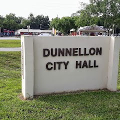
Dunnellon City Hall
Transit and Meeting Points
Useful pickup, handoff, or rendezvous points close to Lecanto.
Wildwood, Florida
Ocala, Florida
The Villages-Lady Lake, FL
Dade City, Florida
Flight Path Map
This map shows the direct air route between Carrabelle and Cape Coral. Straight-line distance: 281.06 mi (452.32 km).

#1 Carrabelle
City in Florida, United States
| Population | 2,832 |
| Coordinates | 29.8532600, -84.6643500 |
| Altitude | 8 |
| Country | United States |

#2 Cape Coral
The second most populous city in Lee County, Florida.
| Population | 200,972 |
| Coordinates | 26.5628500, -81.9495300 |
| Altitude | 1 |
| Country | United States |
End: (-81.94953, 26.562855)
Estimated Travel Time
Distance: 661 km by road
| Speed | Time |
|---|---|
| 30 mph (48.3 km/h) | 13h 40m |
| 40 mph (64.37 km/h) | 10h 15m |
| 50 mph (80.47 km/h) | 08h 12m |
| 60 mph (96.56 km/h) | 06h 50m |
| 70 mph (112.65 km/h) | 05h 51m |
| 80 mph (129 km/h) | 05h 07m |
Fuel, Round Trip and CO2
Estimated fuel cost and emissions for this route.
| Fuel | $/gal | One way | Round trip |
|---|---|---|---|
| Regular gas | $4.15 | $60.10 | $120.21 |
| Mid-grade | $4.60 | $66.60 | $133.19 |
| Premium | $4.90 | $70.94 | $141.89 |
| Diesel | $4.35 | $63.03 | $126.06 |
Assumes 8.3 L/100 km (about 28.3 MPG). CO2 is an estimate and varies by vehicle, fuel blend, traffic, and terrain.
Prices in Florida · Jul 15, 2026
Distance to Other Cities
Planning a road trip? See the full trip guide on Trip.ovh — stops, fuel costs, weather, and departure timing.