How far is Carmel, IN from DeMotte, IN?
The driving distance from Carmel, IN to DeMotte, IN is about 124.1 miles (199.8 km), with a travel time of about 02h 21m by car.
- The straight-line flight distance is about 101.4 miles (163.2 km).
- For a round trip, plan for roughly 04h 43m of driving time before adding stops, traffic, or weather delays.
- A comfortable departure window is usually 8:00 AM to 10:00 AM EDT.
Reverse, save, or send this route
This route works well as a day trip with time at the destination. Copy the route link, send it to another device, or print a clean version before you head out.
This route works well as a day trip with time at the destination.
Flight Distance
Driving Distance
Gas Cost Calculator
Leave and Arrive Planner
Pick a departure time to see your estimated arrival and same-day return window.
Drive time stays fixed at 02h 21m.
A morning start gives you useful time at the destination and keeps the return out of the late evening.
This departure sits inside the recommended comfort window for the route.
Halfway Point
A useful midpoint for breaks, coffee, or meeting in the middle.
The most populous city in Tippecanoe County, Indiana.
Route Weather Snapshot
Check the forecast at both ends before you head out.
Scattered Rain Showers
Partly Sunny
Driving Route Map
The map below follows the saved road route between Carmel and DeMotte.
Turn-by-Turn Driving Directions
Step-by-step road directions between Carmel and DeMotte.
-
1
Start on East Main Street
1338 ft · 39 sec · East Main Street
-
2
Enter the roundabout and take exit 1 toward the route
11 m · 2 sec
-
3
Exit the roundabout
1097 ft · 19 sec
-
4
Merge slight left onto Keystone Parkway
3.3 mi · 5 min · Keystone Parkway
-
5
Enter the roundabout and take exit 2 toward I 465: South Keystone Avenue
42 m · 8 sec
-
6
Exit the roundabout onto I 465: South Keystone Avenue
1346 ft · 33 sec
-
7
Keep slight right to continue on I 465 West
116 m · 9 sec
-
8
Continue straight
2269 ft · 55 sec
-
9
Merge slight left
7.4 mi · 9 min
-
10
Keep slight left to continue on I 865 West: Chicago
5 mi · 6 min
-
11
Merge slight left
12.3 mi · 13 min
-
12
Take the exit slight right toward US 52 West
1281 ft · 16 sec
-
13
Keep slight left
786 ft · 10 sec
-
14
Merge slight left
87.4 mi · 1 hr 34 min
-
15
Take the exit slight right toward SR 10: Roselawn, Demotte
1361 ft · 33 sec
-
16
Turn right onto West State Road 10
3.4 mi · 5 min · West State Road 10
-
17
Continue on North State Road 10
2.6 mi · 4 min · North State Road 10
-
18
Continue on South Halleck Street
2497 ft · 50 sec · South Halleck Street
-
19
Continue on North Halleck Street
2116 ft · 1 min · North Halleck Street
-
20
Arrive at your destination
0 m · 1 sec · North Halleck Street
Car Route Details
A richer read on the saved driving route between Carmel and DeMotte.
Highway-focused drive
Most of the mileage stays on named highways, so the important moments are ramps, exits, merges, and the final local approach.
US 52 West
Merge slight left
87.4 mi · 01h 34m
Route Summary
A quick read on whether this route feels easy, ambitious, or worth planning around.
A comfortable day-trip route
This route works well as a day trip. You can leave in the morning, spend meaningful time at the destination, and still return the same day.
Scattered Rain Showers leaving Carmel and Partly Sunny near DeMotte.
Trip Questions
Direct answers travelers usually want before committing to the drive.
How long does it take to drive from Carmel to DeMotte?
The road trip is about 124.1 miles (199.8 km) and usually takes 02h 21m in normal driving conditions.
Is this a same-day trip or an overnight route?
This route works well as a day trip. You can leave in the morning, spend meaningful time at the destination, and still return the same day.
What is the halfway point on this route?
Lafayette is a useful midpoint, sitting about 62.1 miles from Carmel and 62.1 miles from DeMotte.
How much longer is the road route than the straight-line distance?
The direct path is about 101.4 miles (163.2 km), while the road route adds roughly 22.7 extra miles because roads do not follow the straight air line.
When is the best time to leave for this route?
A good departure window is usually 8:00 AM to 10:00 AM EDT. If you want a more comfortable same-day return, try to leave by 1:46 PM EDT.
How much will gas cost for this route?
Using about 28.3 MPG, regular gas is estimated at $16.52 one way or $33.03 round trip. Estimated CO2 is about 38.9 kg one way.
Do you cross a time zone on this route?
Yes. There is about a 1 hour time difference between Carmel and DeMotte, so arrival and return times should be read in local time.
What should you check before leaving?
Before you leave, expect Scattered Rain Showers around Carmel and Partly Sunny near DeMotte.
Stop Ideas Near Lafayette
Useful break, food, and waypoint ideas within about 15 miles of the route midpoint.

Town of Mulberry - Town Hall & Municipal Utilities
Lafayette City Hall
Morton Community Center
Transit and Meeting Points
Useful pickup, handoff, or rendezvous points close to Lafayette.
Lafayette station
Crawfordsville (Bus), Indiana
Crawfordsville
Rensselaer
Flight Path Map
This map shows the direct air route between Carmel and DeMotte. Straight-line distance: 101.4 mi (163.18 km).

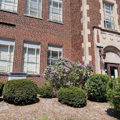
#1 Carmel
The most populous city in Hamilton County, Indiana.
| Population | 101,643 |
| Coordinates | 39.9783700, -86.1180400 |
| Altitude | 260 |
| Country | United States |

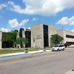
#2 DeMotte
City in Jasper County, Indiana, United States of America
| Population | 3,814 |
| Coordinates | 41.1950400, -87.1986400 |
| Altitude | 204 |
| Country | United States |
End: DeMotte (-87.19864, 41.19504)
Estimated Travel Time
Distance: 200 km by road
| Speed | Time |
|---|---|
| 30 mph (48.3 km/h) | 04h 08m |
| 40 mph (64.37 km/h) | 03h 06m |
| 50 mph (80.47 km/h) | 02h 28m |
| 60 mph (96.56 km/h) | 02h 04m |
| 70 mph (112.65 km/h) | 01h 46m |
| 80 mph (129 km/h) | 01h 32m |
Fuel, Round Trip and CO2
Estimated fuel cost and emissions for this route.
| Fuel | $/gal | One way | Round trip |
|---|---|---|---|
| Regular gas | $3.77 | $16.52 | $33.03 |
| Mid-grade | $4.25 | $18.63 | $37.26 |
| Premium | $4.65 | $20.38 | $40.77 |
| Diesel | $5.30 | $23.23 | $46.46 |
Assumes 8.3 L/100 km (about 28.3 MPG). CO2 is an estimate and varies by vehicle, fuel blend, traffic, and terrain.
Prices in Indiana · Jun 27, 2026
Distance to Other Cities
Planning a road trip? See the full trip guide on Trip.ovh — stops, fuel costs, weather, and departure timing.