How far is California City, CA from San Diego, CA?
The driving distance from California City, CA to San Diego, CA is about 208.9 miles (336.2 km), with a travel time of about 03h 39m by car.
- The straight-line flight distance is about 173.1 miles (278.5 km).
- For a round trip, plan for roughly 07h 18m of driving time before adding stops, traffic, or weather delays.
- A comfortable departure window is usually 6:00 AM to 8:00 AM PDT.
Reverse, save, or send this route
This drive is better planned with a longer stop or an overnight stay. Copy the route link, send it to another device, or print a clean version before you head out.
This drive is better planned with a longer stop or an overnight stay.
Flight Distance
Driving Distance
Gas Cost Calculator
Leave and Arrive Planner
Pick a departure time to see your estimated arrival and same-day return window.
Drive time stays fixed at 03h 39m.
An early departure helps you fit a real stop into the day without turning the return into a late-night drive.
You are leaving earlier than the recommended window, which gives you extra margin for breaks and traffic.
Halfway Point
A useful midpoint for breaks, coffee, or meeting in the middle.
A city in San Bernardino County, California.
Route Weather Snapshot
Check the forecast at both ends before you head out.
Mostly Sunny
Mostly Sunny
Driving Route Map
The map below follows the saved road route between California City and San Diego.
Turn-by-Turn Driving Directions
Step-by-step road directions between California City and San Diego.
-
1
Start on California City Boulevard
2.5 mi · 4 min · California City Boulevard
-
2
Continue on California City Boulevard
8.4 mi · 13 min · California City Boulevard
-
3
At the end of the road, turn left onto Mojave-Barstow Highway
16.2 mi · 17 min · Mojave-Barstow Highway
-
4
Continue on Barstow-Bakersfield Highway
5.2 mi · 6 min · Barstow-Bakersfield Highway
-
5
Take the exit slight right toward US 395: Bishop, San Bernardino
1715 ft · 1 min
-
6
Turn left onto Blue Star Memorial Highway
41.6 mi · 52 min · Blue Star Memorial Highway
-
7
Take the exit straight toward I 15 South: San Bernardino, Los Angeles
1.1 km · 1 min
-
8
Merge slight left onto Barstow and Mojave Freeway
3.4 mi · 4 min · Barstow and Mojave Freeway
-
9
Continue on CHP Officer Larry L. Wetterling and San Bernardino County Sheriff's Lieutenant Alfred E. Stewart Memorial Highway
5.6 mi · 6 min · CHP Officer Larry L. Wetterling and San Bernardino County Sheriff's Lieutenant Alfred E. Stewart Memorial Highway
-
10
Continue on Barstow and Mojave Freeway
6.3 mi · 7 min · Barstow and Mojave Freeway
-
11
Continue on Barstow Freeway
1095 ft · 13 sec · Barstow Freeway
-
12
Keep slight left to continue on Barstow Freeway
9.3 mi · 10 min · Barstow Freeway
-
13
Continue on San Bernardino Freeway
5.6 mi · 6 min · San Bernardino Freeway
-
14
Continue on Riverside Freeway
5.3 mi · 6 min · Riverside Freeway
-
15
Take the exit slight right toward I 215 South, CA 60 East: San Diego, Indio
5.1 mi · 6 min
-
16
Keep slight right to continue on I 215, CA 60 Truck
2512 ft · 33 sec
-
17
Keep slight right
36.3 mi · 41 min
-
18
Continue on Avocado Highway
21.9 mi · 24 min · Avocado Highway
-
19
Continue on Escondido Freeway
3.4 mi · 4 min · Escondido Freeway
-
20
Keep slight right to continue on Escondido Freeway
8.7 mi · 10 min · Escondido Freeway
-
21
Continue on Tony Gwynn Memorial Freeway
4.5 mi · 5 min · Tony Gwynn Memorial Freeway
-
22
Continue on Escondido Freeway
3.1 mi · 4 min · Escondido Freeway
-
23
Continue on Semper Fi Highway
2.2 mi · 3 min · Semper Fi Highway
-
24
Take the exit slight right toward CA 163 South
1.2 km · 52 sec
-
25
Continue on Cabrillo Freeway
8.2 mi · 9 min · Cabrillo Freeway
-
26
Continue on Cabrillo Parkway
1.5 mi · 2 min · Cabrillo Parkway
-
27
Continue on Cabrillo Parkway
1.3 km · 1 min · Cabrillo Parkway
-
28
Continue on 10th Avenue
1507 ft · 42 sec · 10th Avenue
-
29
Turn right onto Broadway
2811 ft · 1 min · Broadway
-
30
Turn left onto Front Street
8 m · 1 sec · Front Street
-
31
Arrive at your destination
0 m · 1 sec · Front Street
Car Route Details
A richer read on the saved driving route between California City and San Diego.
Highway-focused drive
Most of the mileage stays on named highways, so the important moments are ramps, exits, merges, and the final local approach.
Blue Star Memorial Highway
Turn left onto Blue Star Memorial Highway
41.6 mi · 00h 52m
Route Summary
A quick read on whether this route feels easy, ambitious, or worth planning around.
A longer out-and-back drive
This is still possible in one day, but it becomes a long driving day. Leaving early and planning your stop window matters more here.
Mostly Sunny leaving California City and Mostly Sunny near San Diego.
Trip Questions
Direct answers travelers usually want before committing to the drive.
How long does it take to drive from California City to San Diego?
The road trip is about 208.9 miles (336.2 km) and usually takes 03h 39m in normal driving conditions.
Is this a same-day trip or an overnight route?
This is still possible in one day, but it becomes a long driving day. Leaving early and planning your stop window matters more here.
What is the halfway point on this route?
Colton is a useful midpoint, sitting about 104.3 miles from California City and 104.6 miles from San Diego.
How much longer is the road route than the straight-line distance?
The direct path is about 173.1 miles (278.5 km), while the road route adds roughly 35.8 extra miles because roads do not follow the straight air line.
When is the best time to leave for this route?
A good departure window is usually 6:00 AM to 8:00 AM PDT. If you want a more comfortable same-day return, try to leave by 9:42 AM PDT.
How much will gas cost for this route?
Using about 28.3 MPG, regular gas is estimated at $42.52 one way or $85.04 round trip. Estimated CO2 is about 65.5 kg one way.
What should you check before leaving?
Before you leave, expect Mostly Sunny around California City and Mostly Sunny near San Diego.
Stop Ideas Near Colton
Useful break, food, and waypoint ideas within about 15 miles of the route midpoint.

Bear Springs Hotel
City Hall
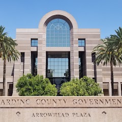
San Bernardino County Land Use
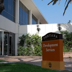
City of Fontana Civic Center
Transit and Meeting Points
Useful pickup, handoff, or rendezvous points close to Colton.
San Bernardino Santa Fe Depot
Riverside–Downtown
Moreno Valley, California
Ontario
Flight Path Map
This map shows the direct air route between California City and San Diego. Straight-line distance: 173.05 mi (278.49 km).

#1 California City
City in Kern County, California
| Population | 14,198 |
| Coordinates | 35.1258000, -117.9859000 |
| Altitude | 733 |
| Country | United States |

#2 San Diego
The eighth most populous city in the United States and the center of the San Diego metropolitan area.
| Population | 1,422,420 |
| Coordinates | 32.7157100, -117.1647200 |
| Altitude | 20 |
| Country | United States |
End: Front Street (-117.164717, 32.71571)
Estimated Travel Time
Distance: 336 km by road
| Speed | Time |
|---|---|
| 30 mph (48.3 km/h) | 06h 57m |
| 40 mph (64.37 km/h) | 05h 13m |
| 50 mph (80.47 km/h) | 04h 10m |
| 60 mph (96.56 km/h) | 03h 28m |
| 70 mph (112.65 km/h) | 02h 59m |
| 80 mph (129 km/h) | 02h 36m |
Fuel, Round Trip and CO2
Estimated fuel cost and emissions for this route.
| Fuel | $/gal | One way | Round trip |
|---|---|---|---|
| Regular gas | $5.77 | $42.52 | $85.04 |
| Mid-grade | $6.07 | $44.71 | $89.41 |
| Premium | $6.24 | $46.01 | $92.02 |
| Diesel | $7.57 | $55.77 | $111.54 |
Assumes 8.3 L/100 km (about 28.3 MPG). CO2 is an estimate and varies by vehicle, fuel blend, traffic, and terrain.
Prices in California · Jul 19, 2026
Distance to Other Cities
Planning a road trip? See the full trip guide on Trip.ovh — stops, fuel costs, weather, and departure timing.