How far is Brownsville, TX from Pleasanton, TX?
The driving distance from Brownsville, TX to Pleasanton, TX is about 241 miles (387.8 km), with a travel time of about 04h 40m by car.
- The straight-line flight distance is about 220.2 miles (354.3 km).
- For a round trip, plan for roughly 09h 20m of driving time before adding stops, traffic, or weather delays.
- A comfortable departure window is usually 6:00 AM to 8:00 AM CDT.
Reverse, save, or send this route
This drive is better planned with a longer stop or an overnight stay. Copy the route link, send it to another device, or print a clean version before you head out.
This drive is better planned with a longer stop or an overnight stay.
Flight Distance
Driving Distance
Gas Cost Calculator
Leave and Arrive Planner
Pick a departure time to see your estimated arrival and same-day return window.
Drive time stays fixed at 04h 40m.
An early departure helps you fit a real stop into the day without turning the return into a late-night drive.
You are leaving earlier than the recommended window, which gives you extra margin for breaks and traffic.
Halfway Point
A useful midpoint for breaks, coffee, or meeting in the middle.
City in Texas, United States
Route Weather Snapshot
Check the forecast at both ends before you head out.
Mostly Sunny
Mostly Sunny then Slight Chance Showers And Thunderstorms
Driving Route Map
The map below follows the saved road route between Brownsville and Pleasanton.
Turn-by-Turn Driving Directions
Step-by-step road directions between Brownsville and Pleasanton.
-
1
Start on East Washington Street
1682 ft · 41 sec · East Washington Street
-
2
Turn right onto East 7th Street
1.5 km · 2 min · East 7th Street
-
3
Turn left onto North Frontage Road
999 ft · 20 sec · North Frontage Road
-
4
Take the ramp slight left toward I 69E North, US 77 North, US 83 North
2235 ft · 55 sec
-
5
Merge slight left onto North Expressway
10.6 mi · 12 min · North Expressway
-
6
Continue on U.S. Highway 77
102 mi · 1 hr 53 min · U.S. Highway 77
-
7
Keep slight right
623 ft · 8 sec
-
8
Keep slight right
1.2 km · 2 min
-
9
Turn left onto FM 772
1009 ft · 17 sec · FM 772
-
10
Turn straight onto South 6th Street
4.4 mi · 7 min · South 6th Street
-
11
Turn left onto West King Avenue
14.5 mi · 18 min · West King Avenue
-
12
Take the ramp right
1 km · 2 min
-
13
Merge slight left
54.2 mi · 1 hr 2 min
-
14
Keep slight left to continue on Nueces Street
14.7 mi · 19 min · Nueces Street
-
15
Continue straight
1199 ft · 16 sec
-
16
Take the exit straight
31 mi · 32 min
-
17
Take the exit slight right toward US 281 North: Pleasanton
5.9 mi · 9 min
-
18
Turn straight
38 m · 4 sec
-
19
Arrive at your destination
0 m · 1 sec
Car Route Details
A richer read on the saved driving route between Brownsville and Pleasanton.
Interchange-aware route
The drive includes several ramps, exits, or merges, so checking the next few maneuvers before busy interchanges is useful.
U.S. Highway 77
Continue on U.S. Highway 77
102 mi · 01h 53m
Route Summary
A quick read on whether this route feels easy, ambitious, or worth planning around.
A longer out-and-back drive
This is still possible in one day, but it becomes a long driving day. Leaving early and planning your stop window matters more here.
Mostly Sunny leaving Brownsville and Mostly Sunny then Slight Chance Showers And Thunderstorms near Pleasanton.
Trip Questions
Direct answers travelers usually want before committing to the drive.
How long does it take to drive from Brownsville to Pleasanton?
The road trip is about 241 miles (387.8 km) and usually takes 04h 40m in normal driving conditions.
Is this a same-day trip or an overnight route?
This is still possible in one day, but it becomes a long driving day. Leaving early and planning your stop window matters more here.
What is the halfway point on this route?
Kingsville is a useful midpoint, sitting about 120.8 miles from Brownsville and 120.2 miles from Pleasanton.
How much longer is the road route than the straight-line distance?
The direct path is about 220.2 miles (354.3 km), while the road route adds roughly 20.8 extra miles because roads do not follow the straight air line.
When is the best time to leave for this route?
A good departure window is usually 6:00 AM to 8:00 AM CDT. If you want a more comfortable same-day return, try to leave by 7:40 AM CDT.
How much will gas cost for this route?
Using about 28.3 MPG, regular gas is estimated at $32.12 one way or $64.24 round trip. Estimated CO2 is about 75.5 kg one way.
What should you check before leaving?
Before you leave, expect Mostly Sunny around Brownsville and Mostly Sunny then Slight Chance Showers And Thunderstorms near Pleasanton.
Stop Ideas Near Kingsville
Useful break, food, and waypoint ideas within about 15 miles of the route midpoint.
Kingsville Water Department
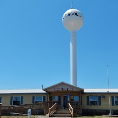
City of Driscoll
Housing Authority
Transit and Meeting Points
Useful pickup, handoff, or rendezvous points close to Kingsville.
Flight Path Map
This map shows the direct air route between Brownsville and Pleasanton. Straight-line distance: 220.18 mi (354.34 km).

#1 Brownsville
The southernmost city in Texas.
| Population | 183,428 |
| Coordinates | 25.9017500, -97.4974800 |
| Altitude | 10 |
| Country | United States |

#2 Pleasanton
Human settlement in Atascosa County, Texas, United States of America
| Population | 11,007 |
| Coordinates | 28.9671900, -98.4786300 |
| Altitude | 110 |
| Country | United States |
End: Pleasanton (-98.47863, 28.96719)
Estimated Travel Time
Distance: 388 km by road
| Speed | Time |
|---|---|
| 30 mph (48.3 km/h) | 08h 01m |
| 40 mph (64.37 km/h) | 06h 01m |
| 50 mph (80.47 km/h) | 04h 49m |
| 60 mph (96.56 km/h) | 04h 00m |
| 70 mph (112.65 km/h) | 03h 26m |
| 80 mph (129 km/h) | 03h 00m |
Fuel, Round Trip and CO2
Estimated fuel cost and emissions for this route.
| Fuel | $/gal | One way | Round trip |
|---|---|---|---|
| Regular gas | $3.78 | $32.12 | $64.24 |
| Mid-grade | $4.25 | $36.14 | $72.28 |
| Premium | $4.59 | $39.02 | $78.05 |
| Diesel | $3.99 | $33.94 | $67.88 |
Assumes 8.3 L/100 km (about 28.3 MPG). CO2 is an estimate and varies by vehicle, fuel blend, traffic, and terrain.
Prices in Texas · Jun 10, 2026
Distance to Other Cities
Planning a road trip? See the full trip guide on Trip.ovh — stops, fuel costs, weather, and departure timing.