How far is Bellevue, WA from Esperance, WA?
The driving distance from Bellevue, WA to Esperance, WA is about 19.5 miles (31.4 km), with a travel time of about 00h 29m by car.
- The straight-line flight distance is about 14.3 miles (23 km).
- For a round trip, plan for roughly 00h 59m of driving time before adding stops, traffic, or weather delays.
- A comfortable departure window is usually 7:00 AM to 7:00 PM PDT.
Reverse, save, or send this route
This is an easy same-day return drive. Copy the route link, send it to another device, or print a clean version before you head out.
This is an easy same-day return drive.
Flight Distance
Driving Distance
Gas Cost Calculator
Leave and Arrive Planner
Pick a departure time to see your estimated arrival and same-day return window.
Drive time stays fixed at 00h 29m.
This is a short drive, so your comfort window is wide. Traffic and current weather matter more than the clock.
This departure sits inside the recommended comfort window for the route.
Halfway Point
A useful midpoint for breaks, coffee, or meeting in the middle.
Route Weather Snapshot
Check the forecast at both ends before you head out.
Mostly Sunny
Mostly Cloudy
Driving Route Map
The map below follows the saved road route between Bellevue and Esperance.
Turn-by-Turn Driving Directions
Step-by-step road directions between Bellevue and Esperance.
-
1
Start on the route
14 m · 6 sec
-
2
Turn right onto Main Street
1483 ft · 52 sec · Main Street
-
3
Continue on Lake Washington Boulevard Northeast
1 km · 2 min · Lake Washington Boulevard Northeast
-
4
Turn right onto 92nd Avenue Northeast
1.1 mi · 2 min · 92nd Avenue Northeast
-
5
Turn left onto Northeast 24th Street
2476 ft · 53 sec · Northeast 24th Street
-
6
Turn right onto 84th Avenue Northeast
1462 ft · 35 sec · 84th Avenue Northeast
-
7
Enter the roundabout and take exit 3 toward WA 520 West Toll
77 m · 5 sec
-
8
Exit the roundabout onto WA 520 West Toll
1683 ft · 34 sec
-
9
Merge slight left
4 mi · 6 min
-
10
Keep slight right to continue on I 5 North: Vancouver British Columbia, Roanoke Street
98 m · 6 sec
-
11
Keep slight left to continue on I 5 North: Vancouver British Columbia
1033 ft · 22 sec
-
12
Merge slight left
9.1 mi · 11 min
-
13
Take the exit slight right toward WA 104: Edmonds, Lake Forest Park
1266 ft · 31 sec
-
14
Keep slight left to continue on WA 104 West: Edmonds
1608 ft · 28 sec
-
15
Keep slight right to continue on WA 104 West: Edmonds, Kingston Ferry
555 ft · 14 sec
-
16
Turn right onto Northeast 205th Street - Lake Ballinger Way
1.1 km · 1 min · Northeast 205th Street - Lake Ballinger Way
-
17
Continue on North 205th Street - Lake Ballinger Way
2021 ft · 45 sec · North 205th Street - Lake Ballinger Way
-
18
Keep slight right to continue on Edmonds Way
1.2 mi · 2 min · Edmonds Way
-
19
Arrive at your destination
0 m · 1 sec · Edmonds Way
Car Route Details
A richer read on the saved driving route between Bellevue and Esperance.
Turn-heavy local drive
The route has frequent decision points for its length, so lane choice and turn timing will matter more than cruising speed.
I 5 North
Merge slight left
9.06 mi · 00h 11m
Route Summary
A quick read on whether this route feels easy, ambitious, or worth planning around.
A short regional drive
This route is short enough to handle as a quick errand, commute, or easy same-day return without much planning overhead.
Mostly Sunny leaving Bellevue and Mostly Cloudy near Esperance.
Trip Questions
Direct answers travelers usually want before committing to the drive.
How long does it take to drive from Bellevue to Esperance?
The road trip is about 19.5 miles (31.4 km) and usually takes 00h 29m in normal driving conditions.
Is this a same-day trip or an overnight route?
This route is short enough to handle as a quick errand, commute, or easy same-day return without much planning overhead.
What is the halfway point on this route?
Hunts Point is a useful midpoint, sitting about 9.8 miles from Bellevue and 9.8 miles from Esperance.
How much longer is the road route than the straight-line distance?
The direct path is about 14.3 miles (23 km), while the road route adds roughly 5.2 extra miles because roads do not follow the straight air line.
When is the best time to leave for this route?
A good departure window is usually 7:00 AM to 7:00 PM PDT. If you want a more comfortable same-day return, try to leave by 7:30 PM PDT.
How much will gas cost for this route?
Using about 28.3 MPG, regular gas is estimated at $3.61 one way or $7.22 round trip. Estimated CO2 is about 6.1 kg one way.
What should you check before leaving?
Before you leave, expect Mostly Sunny around Bellevue and Mostly Cloudy near Esperance.
Stop Ideas Near Hunts Point
Useful break, food, and waypoint ideas within about 15 miles of the route midpoint.

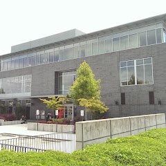
Tukwila Community Center
Burien City Hall

Shoreline City Hall
Transit and Meeting Points
Useful pickup, handoff, or rendezvous points close to Hunts Point.
King Street Station
Seattle (Ferry - Pier 69), Washington
Tukwila station
Edmonds station
Flight Path Map
This map shows the direct air route between Bellevue and Esperance. Straight-line distance: 14.29 mi (22.99 km).

#1 Bellevue
The most populous city in Washington.
| Population | 148,073 |
| Coordinates | 47.6103800, -122.2006800 |
| Altitude | 26 |
| Country | United States |
#2 Esperance
Located in southern Snohomish County at an elevation of 377 feet, this census-designated place sits immediately north of the King County line and east of the city of Edmonds.
| Population | 0 |
| Coordinates | 47.7889900, -122.3554100 |
| Altitude | 115 |
| Country | United States |
End: Esperance (-122.35541, 47.78899)
Estimated Travel Time
Distance: 31 km by road
| Speed | Time |
|---|---|
| 30 mph (48.3 km/h) | 00h 38m |
| 40 mph (64.37 km/h) | 00h 29m |
| 50 mph (80.47 km/h) | 00h 23m |
| 60 mph (96.56 km/h) | 00h 19m |
| 70 mph (112.65 km/h) | 00h 16m |
| 80 mph (129 km/h) | 00h 14m |
Fuel, Round Trip and CO2
Estimated fuel cost and emissions for this route.
| Fuel | $/gal | One way | Round trip |
|---|---|---|---|
| Regular gas | $5.23 | $3.61 | $7.22 |
| Mid-grade | $5.57 | $3.84 | $7.68 |
| Premium | $5.77 | $3.98 | $7.96 |
| Diesel | $5.47 | $3.77 | $7.54 |
Assumes 8.3 L/100 km (about 28.3 MPG). CO2 is an estimate and varies by vehicle, fuel blend, traffic, and terrain.
Prices in Washington · Jul 18, 2026
Distance to Other Cities
Planning a road trip? See the full trip guide on Trip.ovh — stops, fuel costs, weather, and departure timing.