How far is Bar Harbor, ME from Goose Falls, ME?
The driving distance from Bar Harbor, ME to Goose Falls, ME is about 52 miles (83.7 km), with a travel time of about 01h 40m by car.
- The straight-line flight distance is about 30 miles (48.3 km).
- For a round trip, plan for roughly 03h 20m of driving time before adding stops, traffic, or weather delays.
- A comfortable departure window is usually 8:00 AM to 10:00 AM EDT.
Reverse, save, or send this route
This route works well as a day trip with time at the destination. Copy the route link, send it to another device, or print a clean version before you head out.
This route works well as a day trip with time at the destination.
Flight Distance
Driving Distance
Gas Cost Calculator
Leave and Arrive Planner
Pick a departure time to see your estimated arrival and same-day return window.
Drive time stays fixed at 01h 40m.
A morning start gives you useful time at the destination and keeps the return out of the late evening.
You are leaving earlier than the recommended window, which gives you extra margin for breaks and traffic.
Halfway Point
A useful midpoint for breaks, coffee, or meeting in the middle.
Route Weather Snapshot
Check the forecast at both ends before you head out.
Areas Of Smoke then Mostly Sunny
Areas Of Smoke then Mostly Sunny
Driving Route Map
The map below follows the saved road route between Bar Harbor and Goose Falls.
Turn-by-Turn Driving Directions
Step-by-step road directions between Bar Harbor and Goose Falls.
-
1
Start on Main Street
8 m · 7 sec · Main Street
-
2
Turn left onto Mount Desert Street
2478 ft · 44 sec · Mount Desert Street
-
3
Continue on Eagle Lake Road
5.8 mi · 9 min · Eagle Lake Road
-
4
Turn right onto Sound Drive
1.4 mi · 2 min · Sound Drive
-
5
At the end of the road, turn right onto Main Street
3243 ft · 55 sec · Main Street
-
6
Continue on State Highway 102
3.5 mi · 5 min · State Highway 102
-
7
Continue on Triangle Road
696 ft · 18 sec · Triangle Road
-
8
At the end of the road, turn left onto State Highway 3
739 ft · 16 sec · State Highway 3
-
9
Continue on Bar Harbor Road
6.7 mi · 12 min · Bar Harbor Road
-
10
Continue on High Street
1.1 km · 2 min · High Street
-
11
Turn left onto Beechland Road
1 mi · 2 min · Beechland Road
-
12
At the end of the road, turn right onto Bayside Road
1 mi · 2 min · Bayside Road
-
13
Continue on Water Street
1.3 km · 1 min · Water Street
-
14
Turn left onto West Main Street
806 ft · 10 sec · West Main Street
-
15
Keep slight left to continue on West Main Street
95 m · 4 sec · West Main Street
-
16
Continue on Surry Road
6.4 mi · 11 min · Surry Road
-
17
Continue on Blue Hill Road
2.4 mi · 4 min · Blue Hill Road
-
18
Continue on Ellsworth Road
4.4 mi · 8 min · Ellsworth Road
-
19
Continue on Main Street
2480 ft · 49 sec · Main Street
-
20
Continue on Tenney Hill
2180 ft · 44 sec · Tenney Hill
-
21
Enter the roundabout and take exit 2 toward Mines Road
29 m · 6 sec · Mines Road
-
22
Exit the roundabout onto Mines Road
4.1 mi · 7 min · Mines Road
-
23
At the end of the road, turn left onto Snows Cove Road
2.9 mi · 5 min · Snows Cove Road
-
24
Turn right onto Coastal Road
3156 ft · 1 min · Coastal Road
-
25
Continue on Coastal Road
4.4 mi · 11 min · Coastal Road
-
26
Turn left onto Cape Rosier Road
1.6 mi · 6 min · Cape Rosier Road
-
27
Turn right onto Back Road
845 ft · 37 sec · Back Road
-
28
Continue on Back Road
1.6 mi · 6 min · Back Road
-
29
Continue on Goose Falls Road
595 ft · 31 sec · Goose Falls Road
-
30
Turn left onto Old Mine Road
38 m · 6 sec · Old Mine Road
-
31
Arrive at your destination
0 m · 1 sec · Old Mine Road
Car Route Details
A richer read on the saved driving route between Bar Harbor and Goose Falls.
Turn-heavy local drive
The route has frequent decision points for its length, so lane choice and turn timing will matter more than cruising speed.
Bar Harbor Road
Continue on Bar Harbor Road
6.69 mi · 00h 12m
Route Summary
A quick read on whether this route feels easy, ambitious, or worth planning around.
A comfortable day-trip route
This route works well as a day trip. You can leave in the morning, spend meaningful time at the destination, and still return the same day.
Areas Of Smoke then Mostly Sunny leaving Bar Harbor and Areas Of Smoke then Mostly Sunny near Goose Falls.
Trip Questions
Direct answers travelers usually want before committing to the drive.
How long does it take to drive from Bar Harbor to Goose Falls?
The road trip is about 52 miles (83.7 km) and usually takes 01h 40m in normal driving conditions.
Is this a same-day trip or an overnight route?
This route works well as a day trip. You can leave in the morning, spend meaningful time at the destination, and still return the same day.
What is the halfway point on this route?
Surry is a useful midpoint, sitting about 26 miles from Bar Harbor and 26 miles from Goose Falls.
How much longer is the road route than the straight-line distance?
The direct path is about 30 miles (48.3 km), while the road route adds roughly 22 extra miles because roads do not follow the straight air line.
When is the best time to leave for this route?
A good departure window is usually 8:00 AM to 10:00 AM EDT. If you want a more comfortable same-day return, try to leave by 3:10 PM EDT.
How much will gas cost for this route?
Using about 28.3 MPG, regular gas is estimated at $7.26 one way or $14.52 round trip. Estimated CO2 is about 16.4 kg one way.
What should you check before leaving?
Before you leave, expect Areas Of Smoke then Mostly Sunny around Bar Harbor and Areas Of Smoke then Mostly Sunny near Goose Falls.
Stop Ideas Near Surry
Useful break, food, and waypoint ideas within about 15 miles of the route midpoint.
City Hall Plaza parking lot
Downeast transportation — Ellsworth City Hall Bus Stop
Bar Harbor Town Office
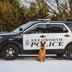
Ellsworth Police Department
Transit and Meeting Points
Useful pickup, handoff, or rendezvous points close to Surry.
Searsport, Maine
Belfast, Maine
Bangor, Maine
Lincolnville, Maine
Flight Path Map
This map shows the direct air route between Bar Harbor and Goose Falls. Straight-line distance: 30 mi (48.28 km).

#1 Bar Harbor
Town in Hancock County, Maine, United States
| Population | 5,594 |
| Coordinates | 44.3875800, -68.2039000 |
| Altitude | 18 |
| Country | United States |
#2 Goose Falls
Goose Falls is a place in Maine, United States.
| Population | 0 |
| Coordinates | 44.3534100, -68.8094700 |
| Altitude | 6 |
| Country | United States |
End: Goose Falls (-68.80947, 44.35341)
Estimated Travel Time
Distance: 84 km by road
| Speed | Time |
|---|---|
| 30 mph (48.3 km/h) | 01h 44m |
| 40 mph (64.37 km/h) | 01h 18m |
| 50 mph (80.47 km/h) | 01h 02m |
| 60 mph (96.56 km/h) | 00h 52m |
| 70 mph (112.65 km/h) | 00h 44m |
| 80 mph (129 km/h) | 00h 38m |
Fuel, Round Trip and CO2
Estimated fuel cost and emissions for this route.
| Fuel | $/gal | One way | Round trip |
|---|---|---|---|
| Regular gas | $3.95 | $7.26 | $14.52 |
| Mid-grade | $4.46 | $8.20 | $16.40 |
| Premium | $4.86 | $8.94 | $17.88 |
| Diesel | $6.00 | $11.03 | $22.07 |
Assumes 8.3 L/100 km (about 28.3 MPG). CO2 is an estimate and varies by vehicle, fuel blend, traffic, and terrain.
Prices in Maine · Jul 16, 2026
Distance to Other Cities
Planning a road trip? See the full trip guide on Trip.ovh — stops, fuel costs, weather, and departure timing.