How far is Bagley, MI from Kalamazoo, MI?
The driving distance from Bagley, MI to Kalamazoo, MI is about 481.4 miles (774.8 km), with a travel time of about 07h 18m by car.
- The straight-line flight distance is about 246 miles (395.9 km).
- For a round trip, plan for roughly 14h 36m of driving time before adding stops, traffic, or weather delays.
- A comfortable departure window is usually 6:00 AM to 7:30 AM CDT.
Reverse, save, or send this route
This drive is better planned with a longer stop or an overnight stay. Copy the route link, send it to another device, or print a clean version before you head out.
This drive is better planned with a longer stop or an overnight stay.
Flight Distance
Driving Distance
Gas Cost Calculator
Leave and Arrive Planner
Pick a departure time to see your estimated arrival and same-day return window.
Drive time stays fixed at 07h 18m.
Starting early still helps, but most travelers will want a longer stop or an overnight stay on a route this long.
You are leaving earlier than the recommended window, which gives you extra margin for breaks and traffic.
Halfway Point
A useful midpoint for breaks, coffee, or meeting in the middle.
City in Muskegon County, Michigan, United States of America
Route Weather Snapshot
Check the forecast at both ends before you head out.
Areas Of Smoke then Mostly Sunny
Smoke
Driving Route Map
The map below follows the saved road route between Bagley and Kalamazoo.
Turn-by-Turn Driving Directions
Step-by-step road directions between Bagley and Kalamazoo.
-
1
Start on US 41
31.1 mi · 44 min · US 41
-
2
Turn right onto 10th Avenue
1449 ft · 21 sec · 10th Avenue
-
3
Continue on Bridge Street
1939 ft · 47 sec · Bridge Street
-
4
Continue on Interstate Bridge
865 ft · 21 sec · Interstate Bridge
-
5
Continue on Hall Avenue
2403 ft · 1 min · Hall Avenue
-
6
Continue on Marinette Avenue
576 ft · 22 sec · Marinette Avenue
-
7
Take the exit slight right toward Hall Avenue
1.1 mi · 2 min · Hall Avenue
-
8
Enter the roundabout and take exit 3 toward County Road T
60 m · 17 sec · County Road T
-
9
Exit the roundabout onto County Road T
2172 ft · 43 sec · County Road T
-
10
Continue on Roosevelt Road
1.2 km · 1 min · Roosevelt Road
-
11
Turn right
47.9 mi · 54 min
-
12
Take the exit slight left toward I 43 South: Milwaukee
1 mi · 2 min
-
13
Continue straight
124 mi · 2 hr 18 min
-
14
Keep slight left to continue on North-South Freeway
939 ft · 16 sec · North-South Freeway
-
15
Continue on North-South Freeway
33.8 mi · 38 min · North-South Freeway
-
16
Keep slight left to continue on North Skokie Highway
18.8 mi · 22 min · North Skokie Highway
-
17
Continue on Skokie Valley Road
3.4 mi · 4 min · Skokie Valley Road
-
18
Continue on Skokie Highway
3.8 mi · 4 min · Skokie Highway
-
19
Continue on Edens Expressway
13.7 mi · 17 min · Edens Expressway
-
20
Continue on Kennedy Expressway
8.1 mi · 12 min · Kennedy Expressway
-
21
Continue on Dan Ryan Expressway
2.4 mi · 3 min · Dan Ryan Expressway
-
22
Keep slight left to continue on Dan Ryan Expressway (Express)
3.8 mi · 5 min · Dan Ryan Expressway (Express)
-
23
Take the exit slight right toward I 90 East
2183 ft · 53 sec
-
24
Merge slight right onto Dan Ryan Expressway (Local)
2612 ft · 50 sec · Dan Ryan Expressway (Local)
-
25
Keep slight left to continue on Chicago Skyway
4.5 mi · 7 min · Chicago Skyway
-
26
Turn straight onto Chicago Skyway
591 ft · 14 sec · Chicago Skyway
-
27
Merge slight left onto Chicago Skyway
3.1 mi · 5 min · Chicago Skyway
-
28
Continue on Indiana Toll Road
1.6 km · 2 min · Indiana Toll Road
-
29
Turn straight onto Indiana Toll Road
961 ft · 2 min · Indiana Toll Road
-
30
Merge slight right onto Indiana Toll Road
1.8 mi · 2 min · Indiana Toll Road
-
31
Keep slight left to continue on Indiana Toll Road
17.4 mi · 19 min · Indiana Toll Road
-
32
Take the exit slight right toward I 94, US 6, SR 51: Detroit, Lake Station
851 ft · 21 sec
-
33
Continue straight
622 ft · 15 sec
-
34
Continue straight
1977 ft · 48 sec
-
35
Keep slight left to continue on I 94 East: Detroit
3126 ft · 1 min
-
36
Merge slight left
63.3 mi · 1 hr 8 min
-
37
Keep slight left to continue on I 94: Detroit
42.2 mi · 45 min
-
38
Take the exit slight right toward Portage
2595 ft · 1 min
-
39
Turn slight left onto South Westnedge Avenue
2.3 mi · 5 min · South Westnedge Avenue
-
40
Continue on South Park Street
1.5 mi · 2 min · South Park Street
-
41
Arrive at your destination
0 m · 1 sec · North Park Street
Car Route Details
A richer read on the saved driving route between Bagley and Kalamazoo.
Long-distance drive
This route is long enough that fuel, rest stops, weather, and timing matter more than any single maneuver.
I 43 South
Continue straight
124 mi · 02h 18m
Route Summary
A quick read on whether this route feels easy, ambitious, or worth planning around.
Better with a longer stop
This route is long enough that most travelers will be better off planning an overnight stay or a more deliberate stop window.
Areas Of Smoke then Mostly Sunny leaving Bagley and Smoke near Kalamazoo.
Trip Questions
Direct answers travelers usually want before committing to the drive.
How long does it take to drive from Bagley to Kalamazoo?
The road trip is about 481.4 miles (774.8 km) and usually takes 07h 18m in normal driving conditions.
Is this a same-day trip or an overnight route?
This route is long enough that most travelers will be better off planning an overnight stay or a more deliberate stop window.
What is the halfway point on this route?
Norton Shores is a useful midpoint, sitting about 217.8 miles from Bagley and 263.6 miles from Kalamazoo.
How much longer is the road route than the straight-line distance?
The direct path is about 246 miles (395.9 km), while the road route adds roughly 235.4 extra miles because roads do not follow the straight air line.
When is the best time to leave for this route?
A good departure window is usually 6:00 AM to 7:30 AM CDT. Starting early still helps, but most travelers will want a longer stop or an overnight stay on a route this long.
How much will gas cost for this route?
Using about 28.3 MPG, regular gas is estimated at $64.07 one way or $128.14 round trip. Estimated CO2 is about 151 kg one way.
Do you cross a time zone on this route?
Yes. There is about a 1 hour time difference between Bagley and Kalamazoo, so arrival and return times should be read in local time.
What should you check before leaving?
Before you leave, expect Areas Of Smoke then Mostly Sunny around Bagley and Smoke near Kalamazoo.
Stop Ideas Near Norton Shores
Useful break, food, and waypoint ideas within about 15 miles of the route midpoint.
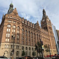
Milwaukee City Hall

West Allis City Hall

City Hall Square Apartments
Transit and Meeting Points
Useful pickup, handoff, or rendezvous points close to Norton Shores.
Holland station
Vernon J. Ehlers Station
Rockford, Michigan
Howard City, Michigan
Flight Path Map
This map shows the direct air route between Bagley and Kalamazoo. Straight-line distance: 245.98 mi (395.87 km).
#1 Bagley
Township in Otsego County, Michigan
| Population | 6,070 |
| Coordinates | 45.5513600, -87.5756800 |
| Altitude | 238 |
| Country | United States |

#2 Kalamazoo
The second most populous city in Kalamazoo County, Michigan.
| Population | 76,009 |
| Coordinates | 42.2917100, -85.5872300 |
| Altitude | 239 |
| Country | United States |
End: North Park Street (-85.587302, 42.291709)
Estimated Travel Time
Distance: 775 km by road
| Speed | Time |
|---|---|
| 30 mph (48.3 km/h) | 16h 02m |
| 40 mph (64.37 km/h) | 12h 02m |
| 50 mph (80.47 km/h) | 09h 37m |
| 60 mph (96.56 km/h) | 08h 01m |
| 70 mph (112.65 km/h) | 06h 52m |
| 80 mph (129 km/h) | 06h 00m |
Fuel, Round Trip and CO2
Estimated fuel cost and emissions for this route.
| Fuel | $/gal | One way | Round trip |
|---|---|---|---|
| Regular gas | $3.77 | $64.07 | $128.14 |
| Mid-grade | $4.25 | $72.26 | $144.52 |
| Premium | $4.65 | $79.07 | $158.14 |
| Diesel | $5.30 | $90.11 | $180.23 |
Assumes 8.3 L/100 km (about 28.3 MPG). CO2 is an estimate and varies by vehicle, fuel blend, traffic, and terrain.
Prices in Michigan · Jul 17, 2026
Distance to Other Cities
Planning a road trip? See the full trip guide on Trip.ovh — stops, fuel costs, weather, and departure timing.