How far is Auburn, AL from New Hope, AL?
The driving distance from Auburn, AL to New Hope, AL is about 179.5 miles (288.9 km), with a travel time of about 03h 58m by car.
- The straight-line flight distance is about 143.2 miles (230.4 km).
- For a round trip, plan for roughly 07h 57m of driving time before adding stops, traffic, or weather delays.
- A comfortable departure window is usually 6:00 AM to 8:00 AM CDT.
Reverse, save, or send this route
This drive is better planned with a longer stop or an overnight stay. Copy the route link, send it to another device, or print a clean version before you head out.
This drive is better planned with a longer stop or an overnight stay.
Flight Distance
Driving Distance
Gas Cost Calculator
Leave and Arrive Planner
Pick a departure time to see your estimated arrival and same-day return window.
Drive time stays fixed at 03h 58m.
An early departure helps you fit a real stop into the day without turning the return into a late-night drive.
You are leaving earlier than the recommended window, which gives you extra margin for breaks and traffic.
Halfway Point
A useful midpoint for breaks, coffee, or meeting in the middle.
City in Talladega County, Alabama, United States
Route Weather Snapshot
Check the forecast at both ends before you head out.
Mostly Clear
Driving Route Map
The map below follows the saved road route between Auburn and New Hope.
Turn-by-Turn Driving Directions
Step-by-step road directions between Auburn and New Hope.
-
1
Start on the route
89 m · 24 sec
-
2
At the end of the road, turn right onto North College Street
4 mi · 6 min · North College Street
-
3
Enter the roundabout and take exit 2 toward North College Street
24 m · 1 sec · North College Street
-
4
Exit the roundabout onto North College Street
1.2 km · 1 min · North College Street
-
5
Take the ramp slight left toward North College Street
50 m · 3 sec · North College Street
-
6
Continue straight
13.8 mi · 16 min
-
7
Continue straight
6.4 mi · 8 min
-
8
Continue straight
12.9 mi · 15 min
-
9
Continue straight
24.2 mi · 29 min
-
10
Take the exit slight right
1053 ft · 29 sec
-
11
Turn right
30 m · 3 sec
-
12
Merge slight left onto Rockford Highway
1.5 km · 1 min · Rockford Highway
-
13
Continue on South Broadway Avenue
22.7 mi · 26 min · South Broadway Avenue
-
14
Turn left
46.2 mi · 1 hr 8 min
-
15
At the end of the road, turn left
25.9 mi · 38 min
-
16
Continue on Gunter Avenue
2733 ft · 58 sec · Gunter Avenue
-
17
Turn right onto May Street
97 m · 6 sec · May Street
-
18
Turn slight left onto Blount Avenue
1.9 mi · 3 min · Blount Avenue
-
19
Continue on Paddle Wheel Drive
788 ft · 15 sec · Paddle Wheel Drive
-
20
Continue on Florida Short Route
4.7 mi · 6 min · Florida Short Route
-
21
Continue on Florida Short Route
12.5 mi · 14 min · Florida Short Route
-
22
Turn right onto Oak Grove Road
1.4 km · 2 min · Oak Grove Road
-
23
Turn right onto Johnson Avenue
1.2 km · 2 min · Johnson Avenue
-
24
Turn left onto Main Drive
136 m · 9 sec · Main Drive
-
25
Arrive at your destination
0 m · 1 sec · Main Drive
Car Route Details
A richer read on the saved driving route between Auburn and New Hope.
Interchange-aware route
The drive includes several ramps, exits, or merges, so checking the next few maneuvers before busy interchanges is useful.
Longest stretch
Turn left
46.2 mi · 01h 08m
Route Summary
A quick read on whether this route feels easy, ambitious, or worth planning around.
A longer out-and-back drive
This is still possible in one day, but it becomes a long driving day. Leaving early and planning your stop window matters more here.
Mostly Clear leaving Auburn and Mostly Clear near New Hope.
Trip Questions
Direct answers travelers usually want before committing to the drive.
How long does it take to drive from Auburn to New Hope?
The road trip is about 179.5 miles (288.9 km) and usually takes 03h 58m in normal driving conditions.
Is this a same-day trip or an overnight route?
This is still possible in one day, but it becomes a long driving day. Leaving early and planning your stop window matters more here.
What is the halfway point on this route?
Talladega is a useful midpoint, sitting about 89.9 miles from Auburn and 89.7 miles from New Hope.
How much longer is the road route than the straight-line distance?
The direct path is about 143.2 miles (230.4 km), while the road route adds roughly 36.3 extra miles because roads do not follow the straight air line.
When is the best time to leave for this route?
A good departure window is usually 6:00 AM to 8:00 AM CDT. If you want a more comfortable same-day return, try to leave by 9:02 AM CDT.
How much will gas cost for this route?
Using about 28.3 MPG, regular gas is estimated at $23.97 one way or $47.94 round trip. Estimated CO2 is about 56.3 kg one way.
What should you check before leaving?
Before you leave, expect Mostly Clear around Auburn and Mostly Clear near New Hope.
Stop Ideas Near Talladega
Useful break, food, and waypoint ideas within about 15 miles of the route midpoint.

Pell City Recreation Hall
Lincoln City Hall
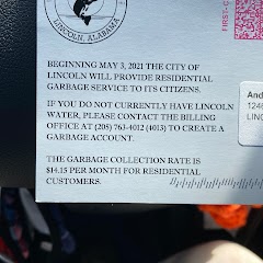
City of Lincoln Water Department
Transit and Meeting Points
Useful pickup, handoff, or rendezvous points close to Talladega.
Anniston
Birmingham
Brent, AL
Flight Path Map
This map shows the direct air route between Auburn and New Hope. Straight-line distance: 143.16 mi (230.4 km).

#1 Auburn
The most populous city in Lee County, Alabama.
| Population | 68,343 |
| Coordinates | 32.6098600, -85.4807800 |
| Altitude | 215 |
| Country | United States |
#2 New Hope
City in Madison County, Alabama
| Population | 2,800 |
| Coordinates | 34.5371200, -86.3942600 |
| Altitude | 177 |
| Country | United States |
End: New Hope (-86.39426, 34.53712)
Estimated Travel Time
Distance: 289 km by road
| Speed | Time |
|---|---|
| 30 mph (48.3 km/h) | 05h 58m |
| 40 mph (64.37 km/h) | 04h 29m |
| 50 mph (80.47 km/h) | 03h 35m |
| 60 mph (96.56 km/h) | 02h 59m |
| 70 mph (112.65 km/h) | 02h 33m |
| 80 mph (129 km/h) | 02h 14m |
Fuel, Round Trip and CO2
Estimated fuel cost and emissions for this route.
| Fuel | $/gal | One way | Round trip |
|---|---|---|---|
| Regular gas | $3.79 | $23.97 | $47.94 |
| Mid-grade | $4.26 | $26.96 | $53.92 |
| Premium | $4.63 | $29.28 | $58.55 |
| Diesel | $5.42 | $34.28 | $68.55 |
Assumes 8.3 L/100 km (about 28.3 MPG). CO2 is an estimate and varies by vehicle, fuel blend, traffic, and terrain.
Prices in Alabama · Jul 17, 2026
Distance to Other Cities
Planning a road trip? See the full trip guide on Trip.ovh — stops, fuel costs, weather, and departure timing.