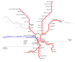
Dallas Blue Line Map (light Rail)

Click on the Dallas Blue Line Map (light Rail) to view it full screen. File Type: png, File size: 65682 bytes (64.14 KB), Map Dimensions: 1000px x 1075px (256 colors)
More Dallas Static Maps

Dallas Blue Line Map (light Rail)
1000 x 1075 - 65,682k - png
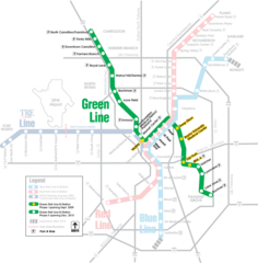
Dallas Green Line Map (light Rail)
1000 x 1018 - 84,632k - png
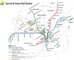
Dallas Metro System Map
1200 x 981 - 106,940k - png
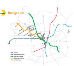
Dallas Orange Light Map (light Rail)
999 x 885 - 59,556k - png
Dallas Transport Map
1647 x 2400 - 753,955k - jpg
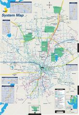
Dallas Metro Map
950 x 788 - 12,654k - png