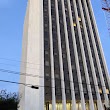
Columbia, South Carolina
Columbia: The most populous city in South Carolina.
About
Columbia is a city located in the county of Richland in the U.S. state of South Carolina. Its population at the 2010 census was 129,272. After 10 years in 2020 city had an estimated population of 132,130 inhabitants.
The city was created 239 years ago in 1786.
Columbia was founded in 1786 as the new state capital. It replaced Charleston and was strategically situated at the confluence of major rivers. Columbia officially incorporated as a city in 1854.
Columbia emerged as a trading hub and distribution point for the cotton-driven economy. Infrastructure like rail lines and textile mills drove expansion into the early 1900s. Fort Jackson was established in 1917, bolstering growth.
Key Facts About Modern Columbia
Here are some key details about Columbia today:
- Population: Around 133,000 residents, though over 300,000 live in the Metro area.
- Economy: Major employers include Fort Jackson, the University of South Carolina, Palmetto Health, and various government/corporate offices. Tourism is also significant.
- Neighborhoods: Popular areas include Downtown, the Vista arts district, Five Points, and Shandon. There is great diversity from historic to modern residential.
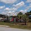
- Parks: Columbia has numerous public parks and gardens, including Finlay Park and Riverfront Park along the Congaree River.
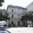
- Attractions: Top sites include the South Carolina State House, EdVenture Children's Museum, Riverbanks Zoo, and the Columbia Museum of Art.
Columbia provides big-city culture and economic energy to the region while retaining its historic southern identity and charm. Education, government, and corporate activity drive continued growth.

Quick Facts about Columbia
| Population | 132,130 (2020) |
| Country | United States of America |
| State | South Carolina (United States) |
| County | Richland County |
| Different from | Colombia |
| Postal code | 29201, 29203-6, 29209-10, 29212, 29223, 29225, 29229 |
| Phone Area Codes | 803 |
| Water as percent of area | 2.05% |
| Land as percent of area | 97.95% |
| Latitude & Longitude | 34.0007,-81.0348 |
| Named for | Christopher Columbus |
| Altitude | 292 feet / 89 meters |
| Capital city | Columbia is capital of Republic of South Carolina, South Carolina |
| Establishment | January 01, 1787 (239 years ago) |
| Time Zone | Eastern Time Zone |
| Local time | 07:18:34 (15th July 2026) |
| Population growth | 2.16% (2010-2020) |
| Weather | 91℉ Patchy Fog then Mostly Sunny 7-days weather |

Geography
Columbia is located at 34°0'3"N 81°2'5"W (34.0007100, -81.0348100).
Columbia map
Weather
Patchy fog before 9am. Mostly sunny, with a high near 91. Heat index values as high as 102. Northeast wind around 2 mph.
7-Day ForecastOfficial website of Columbia
Official Website- Accra
- Chelyabinsk (1995 )
- Cluj-Napoca
- Kaiserslautern (2000 )
- Plovdiv
Demographics
The population of Columbia increased by 2.16% in 10 years.
| Year | Population | % Change | Method |
|---|---|---|---|
| 2010 | 129,272 | - | census |
| 2011 | 131,302 | 1.55% | estimation process |
| 2012 | 131,761 | 0.35% | estimation process |
| 2013 | 131,527 | -0.18% | estimation process |
| 2014 | 131,781 | 0.19% | estimation process |
| 2015 | 133,616 | 1.37% | estimation process |
| 2016 | 134,129 | 0.38% | estimation process |
| 2017 | 134,005 | -0.09% | estimation process |
| 2018 | 132,770 | -0.93% | estimation process |
| 2019 | 131,674 | -0.83% | estimation process |
| 2020 | 132,130 | 0.35% | estimation process |
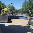
Best Things to Do in Columbia
1Frankie's Fun Park
140 Parkridge Dr, Columbia, SC 29212, United States View details
Phone: +18037812342 | Website available

2South Carolina State Museum
301 Gervais St, Columbia, SC 29201, United States View details
Phone: +18038984921 | Website available

3EdVenture Children's Museum
211 Gervais St, Columbia, SC 29201, United States View details
Phone: +18037793100 | Website available
4Palmetto Falls Water Park
6511 Marion Ave, Columbia, SC 29207, United States View details
Phone: +18037513475
5Fort Jackson Post Flag
4325 Jackson Blvd, Columbia, SC 29207, United States View details
Services and Civic Places in Columbia
1SC Department of Insurance
1201 Main St #1000, Columbia, SC 29201, United States View details
Phone: +18037376160 | Website available
2Labor Licensing & Regulation
110 Centerview Dr, Columbia, SC 29210, United States View details
Phone: +18038964300 | Website available
3Columbia City Hall
1737 Main St, Columbia, SC 29201 View details
Phone: +18035453000 | Website available
4Cosmetology Board
110 Centerview Dr # 109, Columbia, SC 29210, United States View details
Phone: +18038964588 | Website available
5South Carolina Department of Education
1429 Senate St, Columbia, SC 29201, United States View details
Phone: +18037348500 | Website available
6Sc Board of Dentistry
110 Centerview Dr # 101, Columbia, SC 29210, United States View details
Phone: +18038964599 | Website available
7Forest Acres City Hall
5209 N Trenholm Rd, Columbia, SC 29206 View details
Phone: +18037829475 | Website available
8Columbia City Hall
Laurel St, Columbia, SC 29201 View details
9South Carolina Department of Agriculture
1200 Senate St, Columbia, SC 29201, United States View details
Phone: +18037342210 | Website available
10USDA Rural Development
1701 Senate St, Columbia, SC 29201, United States View details
Phone: +18037655163 | Website available
Nearby Schools and Colleges
Schools and campuses linked to Columbia, SC. Select a name to open its map and contact details.
| Code | Name | City | ZIP |
|---|---|---|---|
| 491923 | Southeastern Esthetics Institute | Columbia (SC) | 29201-0000 |
| 218663 | University of South Carolina-Columbia | Columbia (SC) | 29208 |
| 467863 | Paul Mitchell the School-Columbia | Columbia (SC) | 29201-3126 |
| 217624 | Allen University | Columbia (SC) | 29204 |
| 217721 | Benedict College | Columbia (SC) | 29204-1086 |
Nearby Transit Stations (4)
Rail and bus stations connected to Columbia, SC. Select a station to open its map and address details.
| Code | Name | Address | Type |
|---|---|---|---|
| CLB | Columbia | 850 Pulaski Street | RAIL |
| CAM | Camden | 1060 West Dekalb Street | RAIL |
| DNK | Denmark | 200 West Baruch Street | RAIL |
| KTR | Kingstree | 101 East Main St. | RAIL |
Closest post offices linked to Columbia.
| Post Office Name | City | ZIP |
|---|---|---|
| Capitol Post Office | Columbia (SC) | 29201 |
| Columbia Post Office | Columbia (SC) | 29201 |
| Five Poin Post Office | Columbia (SC) | 29205 |
| Eau Clair Post Office | Columbia (SC) | 29203 |
| Edgewood Post Office | Columbia (SC) | 29204 |
Other places with the same name (15)
- Columbia, Missouri The most populous city in the state of Missouri. with a population of 124,769 people.
- Columbia, Tennessee The county seat of Maury County, Tennessee. with a population of 41,826 people.
- Columbia, Illinois city in Illinois, United States with a population of 10,627 people.
- Columbia, Pennsylvania borough in western Lancaster County, Pennsylvania, United States with a population of 10,295 people.
- Columbia, Indiana county seat in Indiana with a population of 9,416 people.
- Columbia, Mississippi city in Mississippi, United States with a population of 5,850 people.
- Columbia, Connecticut town in Tolland County, Connecticut, United States with a population of 5,355 people.
- Columbia, Kentucky city in Adair County, Kentucky, United States with a population of 4,902 people.
- Columbia, Ohio township of Ohio with a population of 1,128 people.
- Columbia, North Carolina human settlement in Tyrrell County, North Carolina, United States of America with a population of 752 people.
- Columbia, New Hampshire town in New Hampshire, United States with a population of 744 people.
- Columbia, Alabama town in Alabama, United States with a population of 743 people.
- Columbia, Maine town in Maine, USA with a population of 469 people.
- Columbia, Louisiana parish seat of Caldwell Parish, Louisiana, United States with a population of 364 people.
- Columbia, South Dakota city in Brown County, South Dakota, United States with a population of 108 people.
Other cities in Richland County
Cities, towns, neighborhoods & other populated places in Richland County , SC.
| City Name | Population | Title |
|---|---|---|
| Dentsville | 14,062 | Census-designated place in Richland County, South Carolina |
| Forest Acres | 10,615 | City in Richland County, South Carolina, United States of America |
| Woodfield | 9,303 | Census-designated place in Richland County, South Carolina |
| Blythewood | 4,531 | Human settlement in South Carolina, United States of America |
| Arcadia Lakes | 874 | Human settlement in Richland County, South Carolina, United States of America |
| Eastover | 850 | Human settlement in Richland County, South Carolina, United States of America |
Distance to Other Cities
Columbia distances to largest South Carolina cities