MapSof
.net
Places
Countries
States
Capital Cities
All Places
Maps
Physical Maps
Political Maps
Historical Maps
All Maps
Tools
Distance Calculator
Address Locator
Geocoder
Street View
Coordinate Finder
Distances
Countries
States
Cities
Maps
Distance Calculator
Geocoder
Distances
Home
/
Asia
/
Cocos Islands
/
Territory of Cocos (Keeling) Islands
/
Maps
/
Historical Map Cocos Island (1889)
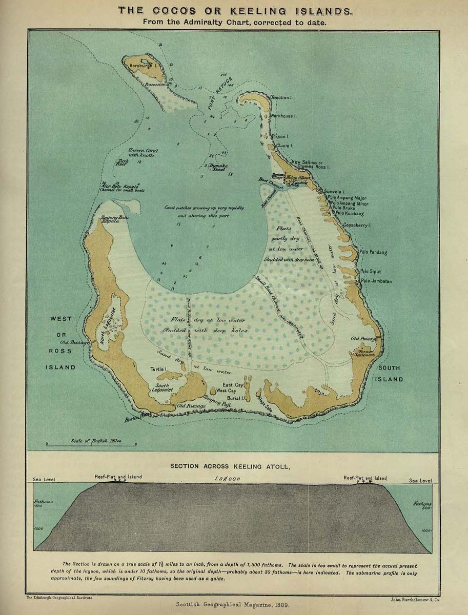
Click on the
Historical Map Cocos Island (1889)
to view it full screen.
File Type:
jpg,
File size:
159181 bytes (155.45 KB),
Map Dimensions:
913px x 1200px (16777216 colors)
More
Territory of Cocos (Keeling) Islands Static Maps
Historical Map Cocos Island (1889)
913 x 1200 - 159,181k - jpg