Chestertown, Maryland
Chestertown: town in Maryland, United States
About
Chestertown is a town located in the county of Kent in the U.S. state of Maryland. Its population at the 2010 census was 5,252 and a population density of 698 people per km². After 10 years in 2020 city had an estimated population of 5,001 inhabitants.
The town was created 320 years ago in 1705.
Chestertown, Maryland is a town in Kent County, Maryland, United States. The population was 5,252 as of the 2010 census. It is the county seat of Kent County.
The town is named after Chester and Thomas Towne, two English brothers who founded the settlement. The name "Chestertown" was derived from the Towne family's ancestral home in England.
The first settlers arrived in 1649 but abandoned Chestertown when they were forced to leave by the plague in 1654. The second settlement was founded in 1690 by William Stone.
Chestertown hosts several historical sites dating back to its founding. Among these are Tudor Hall (ca 1720), the oldest house still standing in Chestertown; St. Paul's Episcopal Church (1739); Christ Episcopal Church (1750); Kent County Courthouse (1806); Kent Manor House (ca 1810); and Chesterville Methodist Church (1828).

Quick Facts about Chestertown
| Population | 5,001 (2020) |
| Country | United States of America |
| State | Maryland (United States) |
| County | Kent County |
| Postal code | 21620 |
| Area | 7.52 km2 |
| Latitude & Longitude | 39.2090,-76.0666 |
| Altitude | 20 feet / 6 meters |
| Capital city | Chestertown is capital of Kent County |
| Establishment | January 01, 1706 (320 years ago) |
| Time Zone | America/New_York |
| Local time | 11:19:33 (19th June 2026) |
| Density | 665 Pop. per km² as of 2020 |
| Population growth | -5.02% (2010-2020) |
| Weather | 81℉ Chance Rain Showers 7-days weather |

Geography
Chestertown is located at 39°12'32"N 76°3'60"W (39.2090000, -76.0666100).
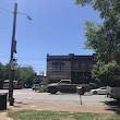
Chestertown map
Weather
A chance of rain showers between 8am and 2pm. Partly sunny, with a high near 81. West wind around 5 mph. Chance of precipitation is 40%. New rainfall...
7-Day ForecastOfficial website of Chestertown
Official WebsiteDemographics
According to census records, the population of Chestertown decreased by 5.02% in 10 years.
| Year | Population | % Change | Method |
|---|---|---|---|
| 2010 | 5,252 | - | census |
| 2011 | 5,415 | 3.01% | estimation process |
| 2012 | 5,234 | -3.46% | estimation process |
| 2013 | 5,191 | -0.83% | estimation process |
| 2014 | 5,156 | -0.68% | estimation process |
| 2015 | 5,127 | -0.57% | estimation process |
| 2016 | 5,118 | -0.18% | estimation process |
| 2017 | 5,071 | -0.93% | estimation process |
| 2018 | 5,063 | -0.16% | estimation process |
| 2019 | 5,051 | -0.24% | estimation process |
| 2020 | 5,001 | -1% | estimation process |
Best Things to Do in Chestertown
1Wilmer Park
413 S Cross St, Chestertown, MD 21620, United States View details
Phone: +14107780500 | Website available

2Historical Society-Kent County
301 High St, Chestertown, MD 21620, United States View details
Phone: +14107783499 | Website available
3John L Stam House
114 Washington Ave, Chestertown, MD 21620, United States View details
Phone: +14107088059

4MassoniArt Gallery
203 High St, Chestertown, MD 21620, United States View details
Phone: +14107787330 | Website available

Services and Civic Places in Chestertown
1US Agricultural Department
122 Speer Rd # 4, Chestertown, MD 21620, United States View details
Phone: +14107785150 | Website available
People born in Chestertown (22)
People born in Chestertown, including politician John W. Crisfield, politician George Vickers, politician James Lloyd, .
More notable people
- Samuel Ringgold (American politician (1770-1829)) he was born in 15/01/1770
- Joseph Hopper Nicholson (American politician) he was born in 15/05/1770
- Lemuel Ely Quigg (American politician) he was born in 12/02/1863
- James Peale (painter from the United States (1749-1831)) he was born in 01/01/1749
- Kennard Winchester (American basketball player) he was born in 03/09/1966
- Alexander Murray (US naval officer (1755–1821)) he was born in 12/07/1755
- Bill Nicholson (American baseball player) he was born in 11/12/1914
- Ezekiel F. Chambers (American politician) he was born in 28/02/1788
- Philip Reed (American politician) he was born in 01/01/1760
- James Houston (American judge) he was born in 10/10/1767
- James Nicholson (US Navy officer) he was born in 01/01/1737
- Samuel Nicholson (officer of the Continental Navy during the American Revolutionary War) he was born in 01/01/1743
- Tom Kibler (American basketball player and coach) he was born in 17/07/1886
- Ron Eglash (American mathematician) he was born in 25/12/1958
- R. Clayton Mitchell, Jr. (American politician) he was born in 16/04/1936
- Mary Adele France she was born in 17/02/1880
- James Alfred Pearce (U.S. lawyer; judge of the Maryland Court of Appeals) he was born in 02/04/1840
- Yvng Swag (recording artist) he was born in 20/02/1999
Nearby Schools and Colleges
Schools and campuses linked to Chestertown, MD. Select a name to open its map and contact details.
| Code | Name | City | ZIP |
|---|---|---|---|
| 164216 | Washington College | Chestertown (MD) | 21620-1438 |
Nearby Transit Stations (35)
Rail and bus stations connected to Chestertown, MD. Select a station to open its map and address details.
| Code | Name | Address | Type |
|---|---|---|---|
| KNT | Kent Island, MD | 3206 Main Street | BUS |
| ABE | Aberdeen | 18 East Bel Air Ave. | RAIL |
| ESN | Easton Airport, Maryland | 29137 Newman Road | BUS |
| DVR | Dover, Delaware | 716 South Governors Ave | BUS |
| BAL | Pennsylvania Station | 1515 North Charles Street | RAIL |
Closest post offices linked to Chestertown.
| Post Office Name | City | ZIP |
|---|---|---|
| Chestertown Post Office | Chestertown (MD) | 21620 |
Other cities in Kent County
Cities, towns, neighborhoods & other populated places in Kent County , MD.
| City Name | Population | Title |
|---|---|---|
| Rock Hall | 1,303 | Town of the United States |
| Millington | 595 | Town in the U. |
| Galena | 574 | Town in Maryland |
| Betterton | 311 | Town of the United States |
Distance to Other Cities
Chestertown distances to largest Maryland cities