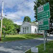
Chesterfield, Massachusetts
Chesterfield: town in Massachusetts, USA
About
Chesterfield is a town located in the county of Hampshire in the U.S. state of Massachusetts. Its population at the 2010 census was 1,222. After 10 years in 2020 city had an estimated population of 1,250 inhabitants.
The town was created 266 years ago in 1759.

Quick Facts about Chesterfield
| Population | 1,250 (2020) |
| Country | United States of America |
| State | Massachusetts (United States) |
| County | Hampshire County |
| Postal code | 01012 |
| Area | 81066627 km2 |
| Latitude & Longitude | 42.3918,-72.8398 |
| Altitude | 1,427 feet / 435 meters |
| Establishment | January 01, 1760 (266 years ago) |
| Time Zone | America/New_York |
| Local time | 20:44:38 (27th June 2026) |
| Population growth | 2.24% (2010-2020) |
| Weather | 62℉ Slight Chance Rain Showers then Mostly Cloudy 7-days weather |

Geography
Chesterfield is located at 42°23'30"N 72°50'23"W (42.3917500, -72.8398200).
Chesterfield map
Weather
A slight chance of rain showers before 11pm. Mostly cloudy, with a low around 62. Northwest wind around 5 mph. Chance of precipitation is 20%.
7-Day ForecastOfficial website of Chesterfield
Official WebsiteDemographics
The population of Chesterfield increased by 2.24% in 10 years.
| Year | Population | % Change | Method |
|---|---|---|---|
| 2010 | 1,222 | - | census |
| 2011 | 1,237 | 1.21% | estimation process |
| 2012 | 1,243 | 0.48% | estimation process |
| 2013 | 1,249 | 0.48% | estimation process |
| 2014 | 1,247 | -0.16% | estimation process |
| 2015 | 1,244 | -0.24% | estimation process |
| 2016 | 1,255 | 0.88% | estimation process |
| 2017 | 1,255 | 0% | estimation process |
| 2018 | 1,254 | -0.08% | estimation process |
| 2019 | 1,249 | -0.4% | estimation process |
| 2020 | 1,250 | 0.08% | estimation process |
Services and Civic Places in Chesterfield
1Chesterfield Town Hall
403 Main Rd, Chesterfield, MA 01012 View details
People born in Chesterfield (4)
People born in Chesterfield, including politician Elijah H. Mills, H. Taylor Edwards, United States Army officer Oliver Edwards (World War I general), .
More notable people
- Dana Kellogg (American luger) he was born in 02/02/2001
Nearby Schools and Colleges
Schools and campuses linked to Chesterfield, MA. Select a name to open its map and contact details.
| Code | Name | City | ZIP |
|---|---|---|---|
| 165495 | Conway School of Landscape Design | Northampton (MA) | 01060 |
Nearby Transit Stations (26)
Rail and bus stations connected to Chesterfield, MA. Select a station to open its map and address details.
| Code | Name | Address | Type |
|---|---|---|---|
| NHT | Union Station | 170 Pleasant Street | RAIL |
| AMM | Amherst, Massachusetts | 13 Railroad St. | RAIL |
| GFD | John W. Olver Transit Center | 12 Olive Street | RAIL |
| PIT | Joseph Scelsi Intermodal Transportation Center | 1 Columbus Avenue | RAIL |
| SPG | Springfield Union Station | 66 Lyman St. | RAIL |
Closest post offices linked to Chesterfield.
| Post Office Name | City | ZIP |
|---|---|---|
| Chesterfield Post Office | Chesterfield (MA) | 01012 |
Other places with the same name (8)
- Chesterfield, Missouri A city in St. with a population of 47,570 people.
- Chesterfield, Michigan township in Macomb County, Michigan with a population of 46,659 people.
- Chesterfield, New Jersey township of New Jersey with a population of 7,584 people.
- Chesterfield, New Hampshire town in New Hampshire with a population of 3,644 people.
- Chesterfield, Indiana city in Indiana, United States of America with a population of 2,467 people.
- Chesterfield, South Carolina town in Chesterfield County, South Carolina, United States with a population of 1,452 people.
- Chesterfield, South Carolina town in Chesterfield County, South Carolina, United States with a population of 1,401 people.
- Chesterfield, Illinois city in Illinois, United States of America with a population of 175 people.
Other cities in Hampshire County
Cities, towns, neighborhoods & other populated places in Hampshire County , MA. (more)
| City Name | Population | Title |
|---|---|---|
| Amherst | 40,643 | Town in Massachusetts |
| Northampton | 28,362 | County seat of Hampshire County, Massachusetts, United States |
| Amherst Center | 19,065 | Census-designated place in Hampshire County, Massachusetts |
| South Hadley | 17,539 | City in Massachusetts |
| Easthampton | 15,750 | City in Massachusetts, United States of America |
| Belchertown | 15,103 | City in Hampshire County, Massachusetts, United States of America |
| Ware | 9,897 | Town in Massachusetts, United States |
| North Amherst | 6,819 | Census-designated place in Hampshire County, Massachusetts |
| Granby | 6,262 | Town in Hampshire County, Massachusetts, United States |
| Southampton | 6,162 | Human settlement in Hampshire County, Massachusetts, United States of America |
| Hadley | 5,327 | Town in Hampshire County, Massachusetts, United States |
| South Amherst | 4,994 | Village in the United States |
| Hatfield | 3,243 | Town in Hampshire County, Massachusetts, United States |
| Williamsburg | 2,462 | Town in Hampshire County, Massachusetts, United States |
| Huntington | 2,159 | Town in Massachusetts |
| Westhampton | 1,630 | Town in Hampshire County, Massachusetts, United States |
Distance to Other Cities
Chesterfield distances to largest Massachusetts cities