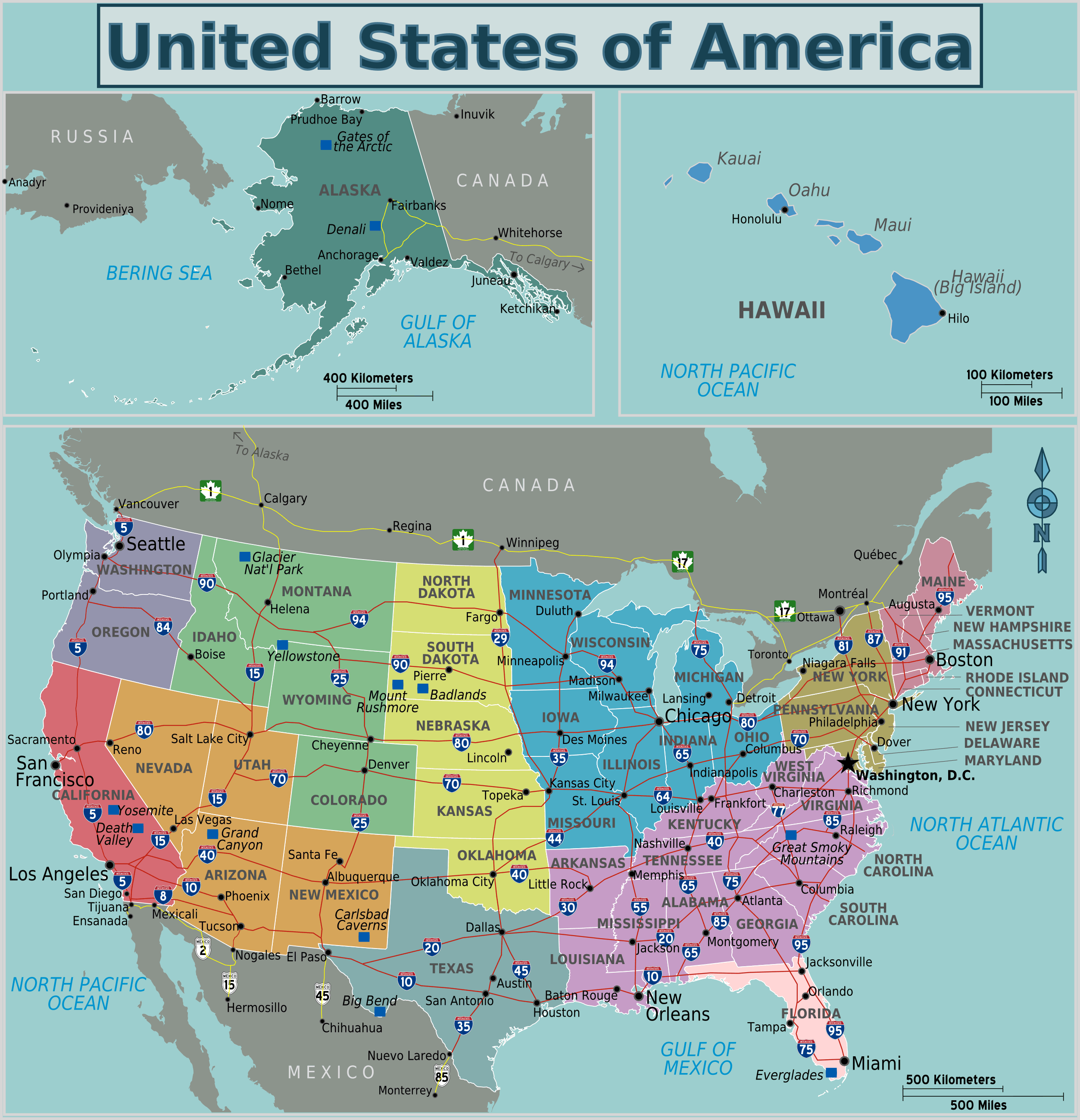
Usa Regions Map
The United States spans a massive and diverse geographical area that can be divided into distinct regions. Looking at a map of these different regions helps illustrate the immensity and variety of the country.
The Northeast Region
The Northeast, along the upper Atlantic coast, contains states like Maine, New York, Pennsylvania, and Massachusetts. This was one of the first areas settled during the colonial era and still includes many major cities like New York City and Philadelphia. The climate is marked by cold winters and humid summers.
The Southeast Region
Stretching from states like Virginia and North Carolina down to Florida, the Southeast has a warm, humid climate and long coastline along the Atlantic Ocean and Gulf of Mexico. The region maintained an agricultural economy longer than other parts of the country.
The Midwest Region
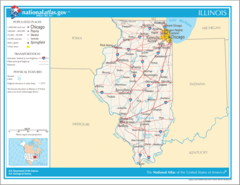
America's heartland, the Midwest contains the country's most productive farmlands within states like Iowa, Illinois, Indiana, and Ohio. The Great Lakes form the northern border. Manufacturing is a key economic driver.
The South Region
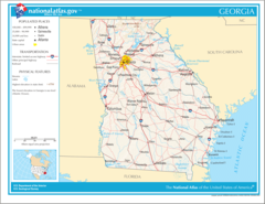
Former Confederate states like Louisiana, Mississippi, Alabama, and Georgia make up the South along with Arkansas and Oklahoma. This region has been defined by its southern culture and hospitality. Much of the area is warm year-round.
The Southwest and West Regions
From the desert Southwest including states like Arizona, New Mexico, Nevada and Colorado to Pacific coastal states like California and Washington, the West makes up America's most arid yet geographically diverse region.
A map allows you to visualize how the regions fit together to form the continental United States. Recognizing regional differences provides insight into American history, culture, economics and identity.
More United States Static Maps
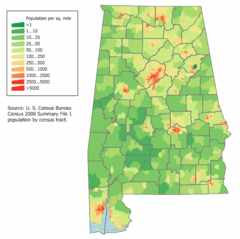
Alabama Population Map
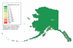
Alaska Population Map
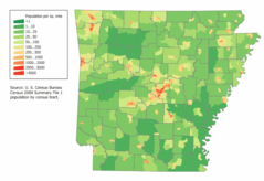
Arkansas Population Map
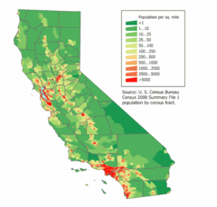
California Population Map
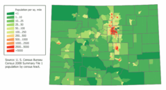
Colorado Population Map
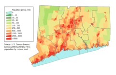
Connecticut Population Map
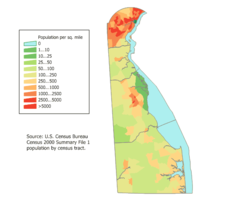
Delaware Population Map
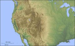
Der Westen Der Vereinigten Staaten
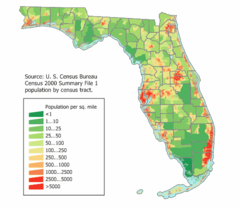
Florida Population Map
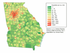
Georgia Population Map
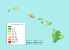
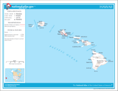
Hawaii Population Map
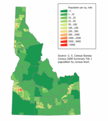
Idaho Population Map
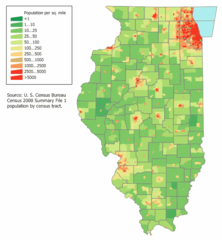
Illinois Population Map
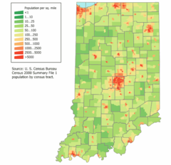
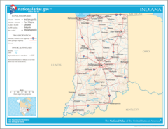
Indiana Population Map
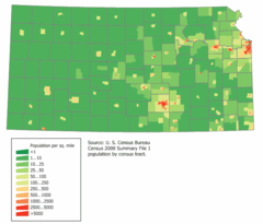
Kansas Population Map
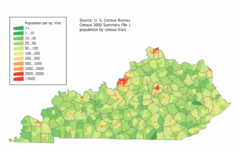
Kentucky Population Map
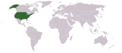
Location Uf Us
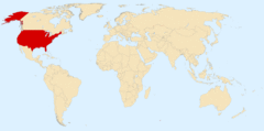
Location Usa
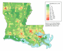
Louisiana Population Map
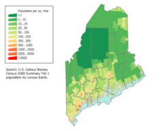
Maine Population Map
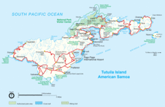
Mapoftutuila American Samoa
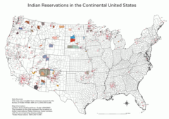
Map Indian Reservations Usa
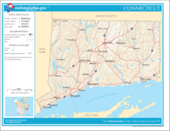
Map of Connecticut Na
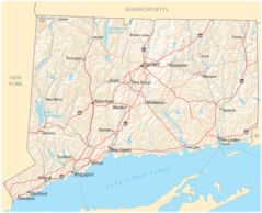
Map of Connecticut Na Cropp
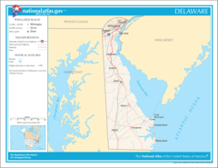
Map of Delaware Na
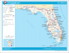
Map of Florida Na
Map of Georgia Na
Map of Hawaii Na
Map of Illinois Na