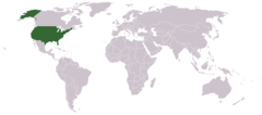
Map of the United States of America
The United States is comprised of 50 states located in North America between the Atlantic and Pacific Oceans.
Regions
The U.S. can be divided into regions like the Northeast, South, Midwest, and West Coast.
50 States
The states include well-known ones like California, Texas, Florida, New York and more obscure ones like Wyoming, Vermont, and North Dakota.
Borders
The U.S. borders include the northern border with Canada and southern border with Mexico. The Atlantic and Pacific Oceans form the east and west coasts.
Capitals
Each state has its own capital city, like Sacramento, California and Atlanta, Georgia. Washington D.C. is the federal capital.
Physical Features
Prominent physical features include the Rocky Mountains, Great Lakes, Mississippi River and desert landscapes like the Mojave.
The United States stretches across a massive, diverse landscape between the Pacific and Atlantic oceans and reaching from Canada to Mexico.
More United States Static Maps
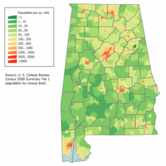
Alabama Population Map
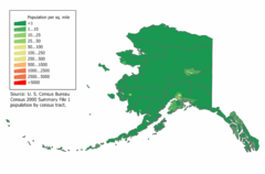
Alaska Population Map
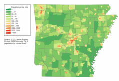
Arkansas Population Map
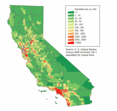
California Population Map
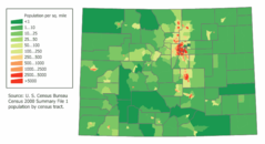
Colorado Population Map
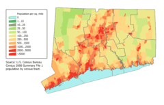
Connecticut Population Map
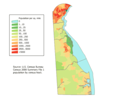
Delaware Population Map
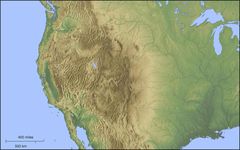
Der Westen Der Vereinigten Staaten
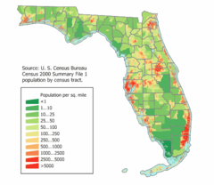
Florida Population Map
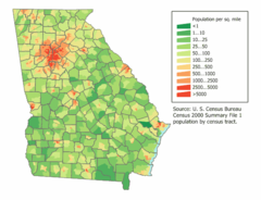
Georgia Population Map
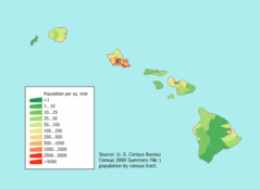
Hawaii Population Map
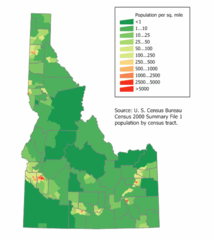
Idaho Population Map
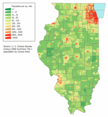
Illinois Population Map
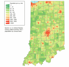
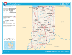
Indiana Population Map
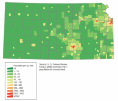
Kansas Population Map
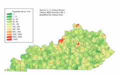
Kentucky Population Map
Location Uf Us
Location Usa
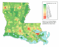
Louisiana Population Map
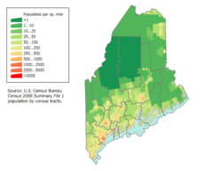
Maine Population Map
Mapoftutuila American Samoa
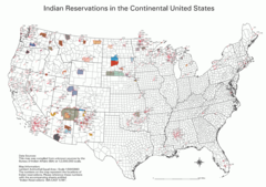
Map Indian Reservations Usa
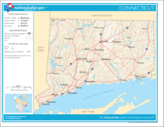
Map of Connecticut Na
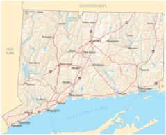
Map of Connecticut Na Cropp
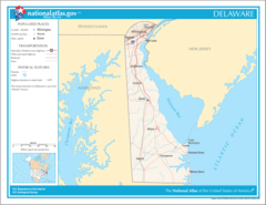
Map of Delaware Na
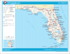
Map of Florida Na
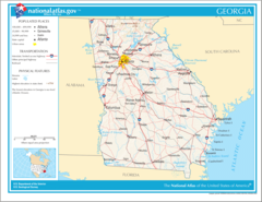
Map of Georgia Na
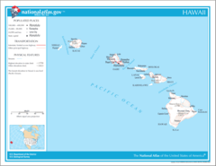
Map of Hawaii Na
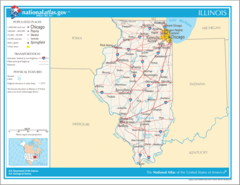
Map of Illinois Na