Thornwood, New York
Thornwood: census-designated place in Westchester County, New York
About
Thornwood is a CDP located in the county of Westchester in the U.S. state of New York.

Quick Facts about Thornwood
| Population | 3,759 |
| Country | United States of America |
| State | New York (United States) |
| County | Westchester County |
| Postal code | 10594 |
| Area | 2.83 km2 |
| Latitude & Longitude | 41.1234,-73.7790 |
| Altitude | 269 feet / 82 meters |
| Time Zone | America/New_York |
| Local time | 04:18:14 (18th July 2026) |
| Weather | 83℉ Areas Of Smoke 7-days weather |
Geography
Thornwood is located at 41°7'24"N 73°46'44"W (41.1234300, -73.7790200).
Thornwood map
Weather
Areas of smoke before 8am, then areas of smoke and a slight chance of rain showers between 8am and 11am, then areas of smoke and showers and thunderst...
7-Day ForecastBest Things to Do in Thornwood
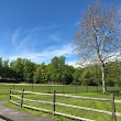
1James M. Carroll Park
202 Kensico Rd, Thornwood, NY 10594, United States View details
People born in Thornwood (1)
American boxer Ann Marie Saccurato was born in Thornwood
Nearby Schools and Colleges
Schools and campuses linked to Thornwood, NY. Select a name to open its map and contact details.
| Code | Name | City | ZIP |
|---|---|---|---|
| 193830 | New York Medical College | Valhalla (NY) | 10595 |
Nearby Transit Stations (19)
Rail and bus stations connected to Thornwood, NY. Select a station to open its map and address details.
| Code | Name | Address | Type |
|---|---|---|---|
| CRT | Croton–Harmon station | 1 Croton Point Avenue | RAIL |
| STM | Stamford Transportation Center | Washington Blvd and South State St. | RAIL |
| YNY | Yonkers station | 5 Buena Vista Ave. | RAIL |
| NRO | New Rochelle station | 1 Railroad Plaza | RAIL |
| NYP | Pennsylvania Station | 8th Ave 31st Street / 8th Ave 33rd Street | RAIL |
Closest post offices linked to Thornwood.
| Post Office Name | City | ZIP |
|---|---|---|
| Thornwood Post Office | Thornwood (NY) | 10594 |
Other cities in Westchester County
Cities, towns, neighborhoods & other populated places in Westchester County , NY. (more)
| City Name | Population | Title |
|---|---|---|
| Yonkers | 200,040 | The second most populous city in Westchester County, New York. |
| Greenburgh | 90,543 | Town |
| New Rochelle | 80,973 | A city in Westchester County, New York. |
| Mount Vernon | 68,628 | The most populous city in Westchester County, New York. |
| White Plains | 58,286 | The most populous city in Westchester County, New York. |
| Rye | 46,100 | A town in Westchester County, New York. |
| Ossining | 37,551 | Town in Westchester County, New York, United States |
| Yorktown | 35,988 | Town in New York |
| Spring Valley | 32,258 | Village in New York, United States |
| Mamaroneck | 29,343 | Town in Westchester County, New York |
| Harrison | 28,959 | Community (coterminous town-village) in Westchester County, New York |
| Port Chester | 28,857 | Village in Westchester County, New York |
| Peekskill | 24,087 | City in Westchester County, New York, United States |
| Somers | 21,476 | Town in New York, US |
| Scarsdale | 17,785 | Town and village in Westchester County, New York, United States |
| Bedford | 17,450 | Town in Westchester County, New York, United States |
Distance to Other Cities
Thornwood distances to largest New York cities