The Hague, South Holland
The Hague: situated on the western coast of the Netherlands, in the province of South Holland.
About

Quick Facts about The Hague
| Population | 537,833 |
| Country | Kingdom of Holland, First French Empire, Batavian Republic, Dutch Republic, County of Holland, Habsburg Netherlands, Spanish Empire, Netherlands |
| State | South Holland (Netherlands) |
| County | Gemeente Den Haag |
| Instagram username | gemeentedenhaag |
| Twitter username | GemeenteDenHaag |
| Postal code | 2491–2599 |
| Phone Area Codes | 015, 070 |
| Area | 98.12 km2 |
| Continent | Europe |
| Latitude & Longitude | 52.0767,4.2986 |
| Altitude | 3 feet / 1 meters |
| Capital city | The Hague is capital of Batavian Commonwealth, Holland, Dutch Republic, Batavian Republic, South Holland, County of Holland, Kingdom of Holland, Holland Department, Maasland Department, Bouches-de-la-Meuse |
| Establishment | January 01, 1201 (825 years ago) |
| Time Zone | Central European Time |
| Local time | 04:15:50 (28th June 2026) |

Het Plein 2012 image
Geography
The Hague is located at 52°4'36"N 4°17'55"E (52.0766700, 4.2986100). It has 7 neighbors: Zoetermeer, Wassenaar, Rijswijk, Delft, Westland, Gemeente Pijnacker Nootdorp and Gemeente Leidschendam Voorburg.
The Hague map
Click "full screen"  icon to open full mode. View satellite images
- Bethlehem
- Juigalpa
- Nazareth
- Palembang
- Warsaw
Demographics
| Year | Population | % Change | Method |
|---|---|---|---|
| 1815 | 42,301 | - | census |
| 1830 | 56,105 | 24.6% | census |
| 1840 | 63,556 | 11.72% | census |
| 1849 | 69,707 | 8.82% | census |
| 1859 | 78,405 | 11.09% | census |
| 1869 | 91,328 | 14.15% | census |
| 1879 | 113,460 | 19.51% | census |
| 1889 | 156,761 | 27.62% | census |
| 1899 | 206,022 | 23.91% | census |
| 1909 | 271,280 | 24.06% | census |
| 1920 | 354,987 | 23.58% | census |
| 1930 | 437,675 | 18.89% | census |
| 1947 | 523,703 | 16.43% | census |
| 1960 | 605,876 | 13.56% | census |
| 1971 | 525,368 | -15.32% | census |
| 1980 | 456,726 | -15.03% | census |
| 1990 | 444,242 | -2.81% | census |
| 2000 | 442,356 | -0.43% | census |
| 2010 | 495,083 | 10.65% | census |
| 2014 | 509,939 | 2.91% | census |
| 2015 | 515,880 | 1.15% | census |
| 2017 | 524,882 | 1.72% | resident registration |
| 2018 | 532,561 | 1.44% | resident registration |
| 2019 | 537,833 | 0.98% | resident registration |
's-Gravenhage, A Haia, An Haig, An Háig, Chage, D'n Haog, De Haach, Den Haag, Gaaga, HAG, Haag, Haga, Hago, Hague, Hága, Hāga, Khag, Khaga, L'Aia, La Haia, La Haya, La Haye, Lahey, den・hagu, haaga, hai ya, heigeu, lahay, lahh, Χάγη, Гаага, Хаг, Хага, האג, لاهاي, لاهه, ჰააგა, デン・ハーグ, 海牙, 헤이그
Map & Images (more maps)
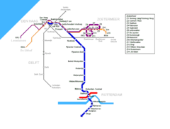
Den Haag Metro Map
900 x 688
- 16,777k -
png