Stearns, Kentucky
Stearns: census designated place in Kentucky, United States
About
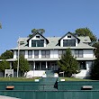
Stearns is a CDP located in the county of McCreary in the U.S. state of Kentucky.

Quick Facts about Stearns
| Population | 1,416 |
| Country | United States of America |
| State | Kentucky (United States) |
| County | McCreary County |
| Postal code | 42647 |
| Area | 10.5 km2 |
| Latitude & Longitude | 36.6990,-84.4774 |
| Altitude | 1,339 feet / 408 meters |
| Time Zone | America/New_York |
| Local time | 17:45:05 (16th July 2026) |
| Weather | 89℉ Mostly Sunny then Slight Chance Showers And Thunderstorms 7-days weather |

Geography
Stearns is located at 36°41'56"N 84°28'39"W (36.6989700, -84.4774400).
Stearns map
Weather
A slight chance of showers and thunderstorms after 2pm. Mostly sunny. High near 89, with temperatures falling to around 87 in the afternoon. Heat inde...
7-Day ForecastBest Things to Do in Stearns
1Princess Falls
Sheltowee, Trace Road, Stearns, KY 42647, United States View details

2Mc Creary County Museum
1 Henderson St, Stearns, KY 42647, United States View details
Phone: +16063765730 | Website available
3Stearns Heritage Hall
27 Bridge St, Stearns, KY 42647, United States View details

Where to Eat in Stearns
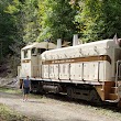
1Big South Fork Scenic Railway
66 Henderson St, Stearns, KY 42647, United States View details
Phone: +16063765330 | Website available
Nearby Schools and Colleges
Schools and campuses linked to Stearns, KY. Select a name to open its map and contact details.
| Code | Name | City | ZIP |
|---|---|---|---|
| 156541 | University of the Cumberlands | Williamsburg (KY) | 40769 |
Closest post offices linked to Stearns.
| Post Office Name | City | ZIP |
|---|---|---|
| Stearn Post Office | Stearns (KY) | 42647 |
Other cities in McCreary County
Cities, towns, neighborhoods & other populated places in McCreary County , KY.
| City Name | Population | Title |
|---|---|---|
| Pine Knot | 1,621 | Census-designated place in McCreary County, Kentucky |
| Whitley City | 1,170 | Census-designated place in McCreary County, Kentucky |
Distance to Other Cities
Stearns distances to largest Kentucky cities