Rosedale, Indiana
Rosedale: town in Indiana, United States.
About
Rosedale is a town located in the county of Parke in the U.S. state of Indiana. Its population at the 2010 census was 725 and a population density of 709 people per km². After 10 years in 2020 city had an estimated population of 704 inhabitants.
Quick Facts about Rosedale
| Population | 704 (2020) |
| Country | United States of America |
| State | Indiana (United States) |
| County | Parke County |
| Postal code | 47874 |
| Phone Area Codes | 765 |
| Area | 1.02 km2 |
| Latitude & Longitude | 39.6228,-87.2834 |
| Altitude | 535 feet / 163 meters |
| Time Zone | America/Indiana/Indianapolis |
| Local time | 20:50:09 (8th November 2026) |
| Density | 689 Pop. per km² as of 2020 |
| Population growth | -2.9% (2010-2020) |
| Weather | 61℉ Sunny 7-days weather |
Geography
Rosedale is located at 39°37'22"N 87°17'0"W (39.6228200, -87.2833500).
Rosedale map
 icon to open full mode. View satellite images
Weather
Sunny. High near 61, with temperatures falling to around 59 in the afternoon. South southwest wind 6 to 13 mph, with gusts as high as 21 mph.
7-Day ForecastDemographics
According to census records, the population of Rosedale decreased by 2.9% in 10 years.
| Year | Population | % Change | Method |
|---|---|---|---|
| 2010 | 725 | - | census |
| 2011 | 712 | -1.79% | estimation process |
| 2012 | 715 | 0.42% | estimation process |
| 2013 | 714 | -0.14% | estimation process |
| 2014 | 714 | 0% | estimation process |
| 2015 | 706 | -1.12% | estimation process |
| 2016 | 711 | 0.71% | estimation process |
| 2017 | 708 | -0.42% | estimation process |
| 2018 | 709 | 0.14% | estimation process |
| 2019 | 706 | -0.42% | estimation process |
| 2020 | 704 | -0.28% | estimation process |
Best Things to Do in Rosedale
1Thorpe Ford Covered Bridge
9000 Rosedale Catlin Rd, Rosedale, IN 47874, United States View details
Website available
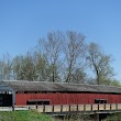
2Harry Evans Covered Bridge
7257 325 W, Rosedale, IN 47874, United States View details

Services and Civic Places in Rosedale
1Rosedale Town Hall
52 Middle St, Rosedale, IN 47874 View details
Phone: +17655482528
Nearby Schools and Colleges
Schools and campuses linked to Rosedale, IN. Select a name to open its map and contact details.
| Code | Name | City | ZIP |
|---|---|---|---|
| 152318 | Rose-Hulman Institute of Technology | Terre Haute (IN) | 47803-3920 |
Nearby Transit Stations (8)
Rail and bus stations connected to Rosedale, IN. Select a station to open its map and address details.
| Code | Name | Address | Type |
|---|---|---|---|
| CRF | Crawfordsville | Spring and Green Streets | RAIL |
| CRB | Crawfordsville (Bus), Indiana | 1000 Smith Ave | BUS |
| DVI | Danville, Illinois | 379 Lynch Road | BUS |
| LAF | Lafayette station | 200 North 2nd St. | RAIL |
| MAT | Mattoon station | 1718 Broadway Ave. | RAIL |
Closest post offices linked to Rosedale.
| Post Office Name | City | ZIP |
|---|---|---|
| Rosedal Post Office | Rosedale (IN) | 47874 |
Other cities in Parke County
Cities, towns, neighborhoods & other populated places in Parke County , IN.
| City Name | Population | Title |
|---|---|---|
| Rockville | 2,449 | Town in Adams Township, Parke County, Indiana, United States |
| Rockport | 2,136 | Located along the Ohio River, Rockport is a city in Indiana's Spencer County in Ohio Township. |