MapSof
.net
Places
Countries
States
Capital Cities
All Places
Maps
Physical Maps
Political Maps
Historical Maps
All Maps
Tools
Distance Calculator
Address Locator
Geocoder
Street View
Coordinate Finder
Distances
Countries
States
Cities
Maps
Distance Calculator
Geocoder
Distances
Home
/
Maps
/
Physical Maps
Physical Maps
Browse our collection of physical maps from around the world.
Physical
Political
Historical
Relief
Climate
Thematic
Elevation
Satellite
Road
Topo
Street
Contour
Election
Showing
45
maps — Page 2 of 2
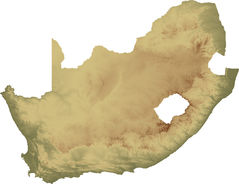
South Africa Topo Island
Republic of South Africa
2600x1999 · 344,843k · jpg
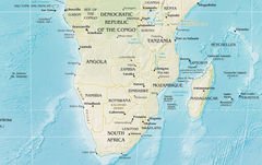
South Africa Regions Map
Republic of South Africa
750x750 · 80,669k · gif
South Africa Physical Map 2
Republic of South Africa
1111x701 · 211,939k · jpg
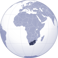
Where Is South Africa Located
Republic of South Africa
1000x1000 · 102,935k · png
South Africa Flag Map
Republic of South Africa
2000x1635 · 113,617k · PNG
«
1
2
»