Wuppertal, Sudurpashchim Pradesh
Wuppertal: Located in western Germany in the state of North Rhine-Westphalia, this city is a significant industrial and economic center.
About
Quick Facts about Wuppertal
| Population | 354,382 |
| Country | West Germany, Germany |
| State | Sudurpashchim Pradesh (Germany) |
| Postal code | 42001–42399 |
| Plate code | W |
| Phone Area Codes | 02058, 02053, 0202 |
| Official name | Wuppertal |
| Latitude & Longitude | 51.2667,7.1833 |
| Patron saint | Lawrence of Rome |
| Named for | Wupper |
| Male population | 173687 |
| Female population | 180695 |
| Altitude | 525 feet / 160, 157 meters |
| Establishment | January 01, 1929 (97 years ago) |
| Time Zone | UTC+01:00 |
| Local time | 00:25:20 (25th July 2026) |
Geography
Wuppertal is located at 51°16'0"N 7°10'60"E (51.2666667, 7.1833333). It has 10 neighbors: Velbert, Sprockhovel, Solingen, Schwelm, Remscheid, Radevormwald, Mettmann, Hattingen, Haan and Ennepetal.
Wuppertal map
Click "full screen"  icon to open full mode. View satellite images
Official website of Wuppertal
Official Website- Beersheba (1977 )
- Dongguan
- Engels
- Košice (1980 )
- Legnica (1993 )
- Matagalpa (1987 )
- Metropolitan Borough of South Tyneside (1951 )
- Qingdao
- Saint-Étienne (1960 )
- Schwerin (1987 )
- Schöneberg (2000 )
- Tabarka
- Yekaterinburg (1993 )
- Elberfeld
- Oberbarmen
- Vohwinkel
- Barmen
- Ronsdorf
- Uellendahl-Katernberg
- Langerfeld-Beyenburg
- Heckinghausen
- Cronenberg
- Elberfeld-West
Demographics
| Year | Population | % Change | Method |
|---|---|---|---|
| 1975 | 405,369 | - | statistical updating |
| 2014 | 345,425 | -17.35% | statistical updating |
| 2015 | 350,046 | 1.32% | project management estimation |
| 2016 | 352,390 | 0.67% | project management estimation |
| 2017 | 353,590 | 0.34% | statistical updating |
| 2019 | 354,382 | 0.22% | statistical updating |
Vupertale, Vupertāle, Vuppertal', Βούπερταλ, Вупперталь, וופרטל, فوبرتال, ヴッパータール, 伍泊塔尔
Map & Images (more maps)
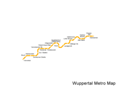
Wuppertal Metro Map
890 x 708
- 5,329k -
png