Surat (Sūrat), Gujarat
Surat:
About
County Snapshot
Sūrat at a glance
Sūrat currently has 9 quality-checked populated place pages linked on MapSof, making it easier to jump from the county overview into local city pages.
Mapped populated places
9
These counts use a stricter populated-place filter so the main lists stay focused on real city and town pages.
Gujarat counties
10
Open related pagesLargest city
SuratPopulation 5,935,000
Top linked places
Quick Facts about Sūrat
| State | Gujarat (India) |
| Latitude & Longitude | 21.1780,72.8119 |
| Time Zone | Asia/Kolkata |
| Local time | 03:10:41 (10th June 2026) |
Geography
Sūrat is located at 21°10'41"N 72°48'43"E (21.1780100, 72.8118900).
Surat map
Click "full screen"  icon to open full mode. View satellite images
The largest city of Sūrat is Surat with a population of 5,935,000. . See all Sūrat cities & populated places.
SRT, Surat District
Map & Images (more maps)
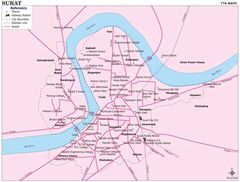
City Center Map of Surat
1151 x 872
- 122,964k -
jpg
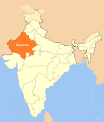
Location Map of Rajasthan
1714 x 2000
- 101,731k -
png
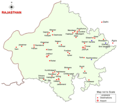
Map of Rajasthan
930 x 804
- 31,148k -
png
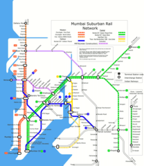
Subway Map of Mumbai
1042 x 1200
- 166,513k -
png