MapSof
.net
Places
Countries
States
Capital Cities
All Places
Maps
Physical Maps
Political Maps
Historical Maps
All Maps
Tools
Distance Calculator
Address Locator
Geocoder
Street View
Coordinate Finder
Distances
Countries
States
Cities
Maps
Distance Calculator
Geocoder
Distances
Home
/
North America
/
United States
/
New York
/
Richmond County
/
Staten Island
/
Maps
/
Staten Island Bus Map
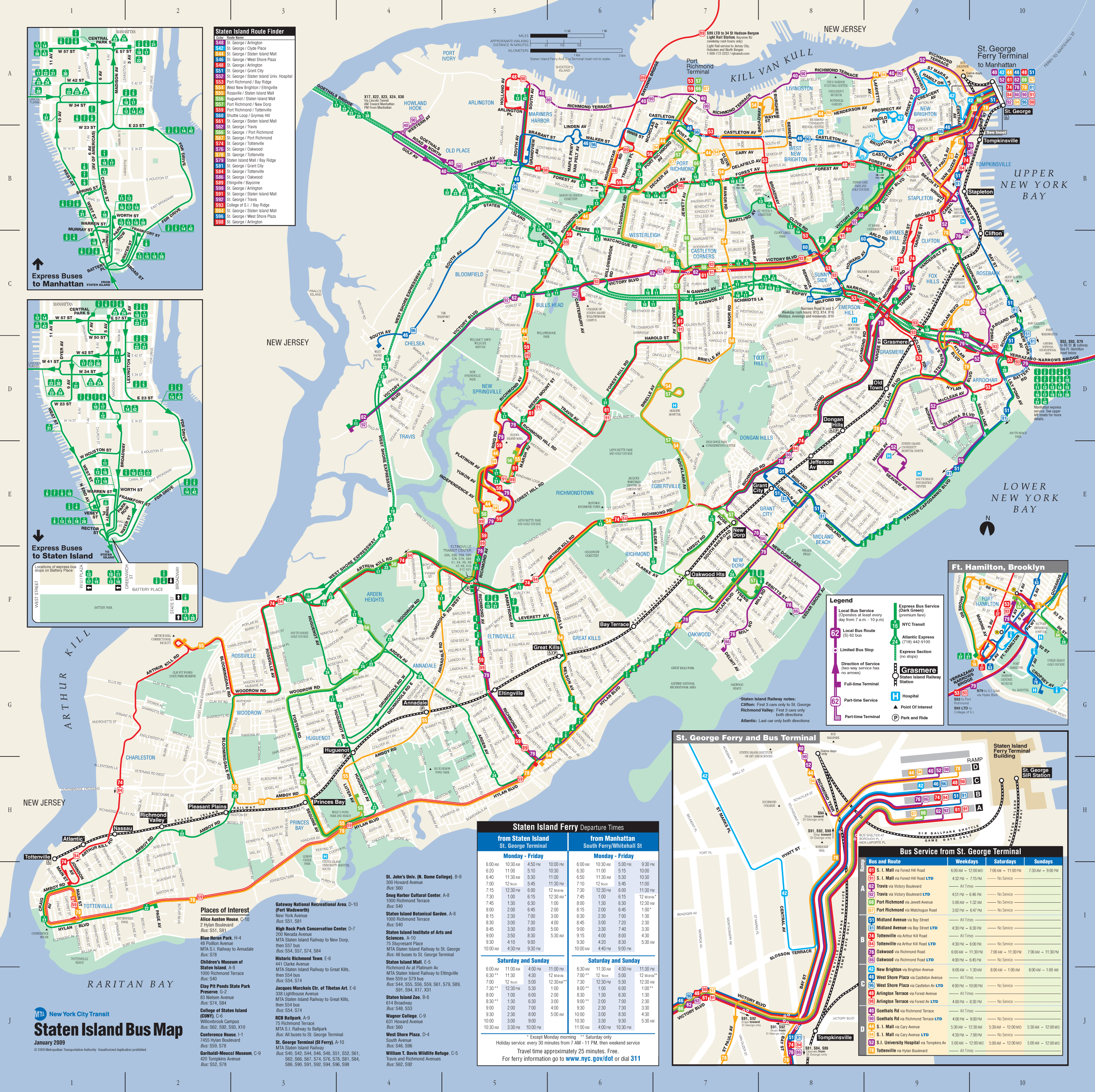
Click on the
Staten Island Bus Map
to view it full screen.
File Type:
png,
File size:
1337571 bytes (1306.22 KB),
Map Dimensions:
2800px x 2792px (256 colors)
More
Staten Island Static Maps
Staten Island Bus Map
2800 x 2792 - 1,337,571k - png
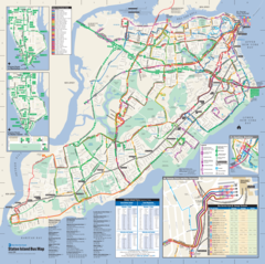
Staten Island Railway Map
1803 x 1453 - 109,659k - png
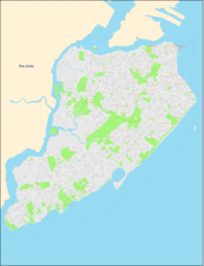
Staten Island Streets Map
2500 x 3259 - 780,825k - png