Rouen, Normandy
Rouen: commune in Seine-Maritime, France
About
Quick Facts about Rouen
| Population | 110,145 |
| Country | France |
| State | Normandy (France) |
| County | Seine-Maritime |
| Different from | Ruan |
| Twitter username | Rouen |
| Postal code | 76000, 76100 |
| Plate code | 76 |
| Area | 21.38 km2 |
| Official name | Rouen |
| Latitude & Longitude | 49.4431,1.0993 |
| Male population | 52673 |
| Female population | 57472 |
| Altitude | 33 feet / 10 meters |
| Capital city | Rouen is capital of arrondissement of Rouen, canton of Rouen-1, canton of Rouen-2, canton of Rouen-3, Normandy, canton of Rouen-6, Upper Normandy, canton of Rouen-7, Seine-Maritime, canton of Rouen-5, Duchy of Normandy, Normandy, canton of Rouen-4 |
| Time Zone | UTC+01:00, UTC+02:00 |
| Local time | 20:48:57 (24th July 2026) |
Geography
Rouen is located at 49°26'35"N 1°5'58"E (49.4431300, 1.0993200). It has 11 neighbors: Sotteville les Rouen, Saint Martin du Vivier, Saint Leger du Bourg Denis, Mont Saint Aignan, Le Petit Quevilly, Le Grand Quevilly, Deville les Rouen, Darnetal, Canteleu, Bois Guillaume and Bihorel.
Rouen map
Click "full screen"  icon to open full mode. View satellite images
- Carmignano
- Gdańsk (1992 )
- Hanover (1966 )
- Jeju
- Koblenz
- Ningbo
- Norwich
- Salerno
- Wejherowo
Demographics
| Year | Population | % Change | Method |
|---|---|---|---|
| 2013 | 110,755 | - | census |
| 2015 | 110,169 | -0.53% | census |
| 2016 | 112,596 | 2.16% | census |
| 2017 | 110,145 | -2.23% | census |
Erruan, Roan, Rodem, Roeaan, Rothomagus, Rouan, Rovan, Roðem, Ruan, Ruana, Ruanas, Ruao, Ruduborg, Rueno, Ruán, Ruão, Ruāna, Rúðuborg, URO, lu ang, luang, ro'am, ru x xng, ru'am, ruani, rwan, rwn, Ρουέν, Руан, Ռուան, רואן, رؤن, روان, रुआं, रोआँ, รูอ็อง, რუანი, ሩዋን, ルーアン, 盧昂, 鲁昂, 루앙
Map & Images (more maps)
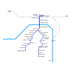
Rouen Metro Map
750 x 750
- 7,517k -
png