Pusan (Busan), Busan
Pusan: Located on the southeastern coast of the Korean Peninsula, this major port city is South Korea's second-most populous with a population of over 3.
About
Quick Facts about Busan
| Population | 3,453,198 |
| Country | South Korea, Korea |
| State | Busan (South Korea) |
| Twitter username | BusanCityGovt |
| Postal code | 600-010, 619-963, 46000, 49599 |
| Phone Area Codes | 051 |
| Area | 769.83 km2 |
| Latitude & Longitude | 35.1017,129.0300 |
| Legislative body | Busan municipal council |
| Altitude | 98 feet / 30 meters |
| Time Zone | UTC+09:00 |
| Local time | 11:58:35 (10th June 2026) |
Geography
Busan is located at 35°6'6"N 129°1'48"E (35.1016800, 129.0300400).
Pusan map
Click "full screen"  icon to open full mode. View satellite images
- Auckland
- Bangkok (2011 )
- Barcelona
- Casablanca
- Chicago
- Dubai (2006 )
- Emirate of Dubai
- Fukuoka
- Istanbul
- Jiulongpo District
- Kaohsiung
- Los Angeles
- Manila
- Montreal
- Nagasaki Prefecture (2014 )
- Penza (2006 )
- Rio de Janeiro
- Saint Petersburg
- Shanghai (1993 )
- Shimonoseki
- Surabaya (1994 )
- Thessaloniki
- Tijuana
- Valparaíso
- Vladivostok
- Buk District
- Yeongdo District
- Sasang District
- Haeundae District
- Gijang County
- Jung District
- Seo District
- Geumjeong District
- Busanjin District
- Nam District
- Yeonje District
- Suyeong District
- Saha District
- Dong District
- Gangseo District
- Dongnae District
Demographics
| Year | Population | % Change | Method |
|---|---|---|---|
| 2010 | 3,414,950 | - | census |
| 2015 | 3,448,737 | 0.98% | census |
| 2016 | 3,440,484 | -0.24% | census |
| 2018 | 3,453,198 | 0.37% | census |
Bousan, Busan-si, Busán, Fousan, Fusan, Fuzan, PUS, Phu San, Phủ San, Pusana, Pusano, Tsau-liang-hai, busangwang-yeogsi, busansi, fu shan, fu shan guang yu shi, fu shan shi, pu san, Μπούσαν, Пусан, ปูซาน, 釜山, 釜山市, 釜山广域市, 釜山広域市, 부산, 부산광역시, 부산시
Map & Images (more maps)
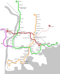
Busan Metro Map
950 x 1176
- 20,467k -
png