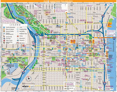
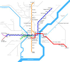
Philadelphia Downtown Transport Map
Click on the Philadelphia Downtown Transport Map to view it full screen. File Type: png, File size: 451003 bytes (440.43 KB), Map Dimensions: 1600px x 1047px (256 colors)
More Philadelphia Static Maps
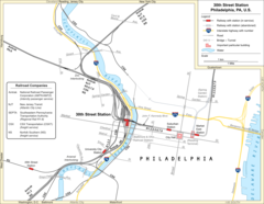
30th Street Station Overview
1603 x 1242 - 183,001k - png
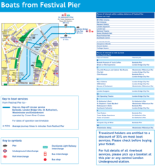
Festival Pier Route Map
984 x 1049 - 92,946k - png
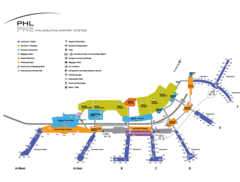
Philadelphia Airport Map
1200 x 910 - 59,849k - png
Philadelphia Downtown Map (city Center)
1400 x 1100 - 615,548k - jpg
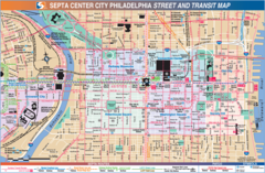
Philadelphia Downtown Transport Map
1600 x 1047 - 451,003k - png
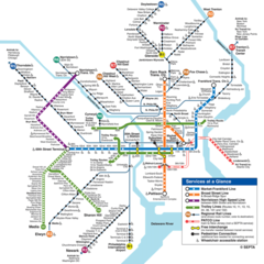
Philadelphia Subway Map (metro)
900 x 900 - 166,791k - png
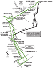
Philadelphia Trolley Map
1000 x 1307 - 81,136k - png
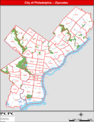
Philadelphia Zip Code Map
1200 x 1568 - 172,665k - png
Philadelphia Metro Map
866 x 768 - 17,682k - png