Metro Manila (National Capital Region), PH
Metro Manila: capital region of the Philippines.
Quick Facts about National Capital Region
| Population | 3,966,695 |
| Country | Philippines |
| County | Bous |
| Phone Area Codes | 2 |
| Area | 611.39 km2 |
| Latitude & Longitude | 14.5833,121.0000 |
| Altitude | 10 feet / 3 meters |
| Capital | Manila |
| Establishment | November 07, 1975 (50 years ago) |
| Time Zone | Asia/Manila |
| Local time | 22:04:03 (23rd September 2026) |
Geography
National Capital Region is located at 14°34'60"N 121°0'0"E (14.5833000, 121.0000000). It has 4 neighbors: Rizal, Cavite, Bulacan and Laguna.
Metro Manila map
Click "full screen"  icon to open full mode. View satellite images
icon to open full mode. View satellite images
Official website of National Capital Region
Official Website- Muntinlupa
- Valenzuela
- Pasay
- Pasig
- Marikina
- Las Piñas
- Navotas
- Malabon
- Makati
- San Juan
- Pateros
- Taguig
- Parañaque
- Mandaluyong
- Caloocan
- Quezon City
- Manila
Demographics
| Year | Population | % Change | Method |
|---|---|---|---|
| 1903 | 328,939 | - | census |
| 1918 | 461,166 | 40.2% | census |
| 1939 | 993,889 | 115.52% | census |
| 1948 | 1,569,128 | 57.88% | census |
| 1960 | 2,462,488 | 56.93% | census |
| 1975 | 4,970,006 | 101.83% | census |
| 1980 | 5,925,884 | 19.23% | census |
| 1990 | 7,948,392 | 34.13% | census |
| 1995 | 9,454,040 | 18.94% | census |
| 2000 | 9,932,560 | 5.06% | census |
| 2007 | 11,566,325 | 16.45% | census |
| 2010 | 11,855,975 | 2.5% | census |
| 2015 | 3,966,695 | -66.54% | 1970-05-06T00:00:00Z |
Metropolitan Manila, NCR
Map & Images (more maps)
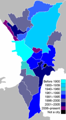
Metro Manila By Cityhood
700 x 1260
- 17 KB -
png
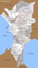
Metro Manila Map
750 x 1350
- 222 KB -
jpg
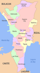
Metro Manila Political Map
500 x 900
- 30 KB -
png
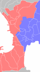
Metro Manila Water Zones
700 x 1260
- 17 KB -
png