Lower Manhattan Transport Map
Click on the Lower Manhattan Transport Map to view it full screen. File Type: png, File size: 870960 bytes (850.55 KB), Map Dimensions: 1696px x 2200px (256 colors)
More Manhattan Static Maps
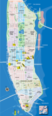
Manhattan Tourist Map
720 x 1600 - 320,664k - png
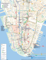
Lower Manhattan Transport Map
1696 x 2200 - 870,960k - png
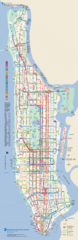
Manhattan Bus Map
1299 x 4000 - 856,820k - png
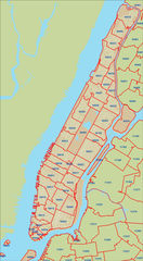
Manhattan Zip Code Map
658 x 1200 - 201,028k - jpg