Kobe, Hyōgo
Kobe: This major port city is located on the southern side of Honshu, the largest island in Japan.
About
Quick Facts about Kobe
| Population | 1,522,944 |
| Country | Japan |
| State | Hyōgo (Japan) |
| County | Kōbe Shi |
| Instagram username | kobecity |
| Postal code | 650-8570 |
| Area | 552230000 km2 |
| Latitude & Longitude | 34.6913,135.1830 |
| Legislative body | Kobe City Council |
| Capital city | Kobe is capital of Hyōgo Prefecture |
| Establishment | April 01, 1889 (137 years ago) |
| Time Zone | UTC+09:00 |
| Local time | 00:41:39 (25th July 2026) |
Geography
Kobe is located at 34°41'29"N 135°10'59"E (34.6913000, 135.1830000). It has 6 neighbors: Akashi, Takarazuka, Sanda, Nishinomiya, Miki and Ashiya.
Kobe map
Click "full screen"  icon to open full mode. View satellite images
- Barcelona (1993 )
- Brisbane (1985 )
- Cádiz
- Faisalabad (2000 )
- Haifa (2004 )
- Incheon (2010 )
- Marseille (1961 )
- Philadelphia
- Riga (1974 )
- Rio de Janeiro (1969 )
- Seattle (1957 )
- Terni
- Tianjin (1973 )
- Tarumi-ku
- Nada-ku
- Nagata-ku
- Chūō-ku
- Suma-ku
- Kita-ku
- Nishi-ku
- Higashinada-ku
- Hyōgo-ku
Demographics
| Year | Population | % Change | Method |
|---|---|---|---|
| 2010 | 1,544,200 | - | census |
| 2015 | 1,537,272 | -0.45% | census |
| 2019 | 1,522,944 | -0.94% | census |
Kobe-chhi, Kobe-shi, Kobeh, Kobė, Kompe, Kóbe, Kôbe-chhī, Kōbe, Kōbe-shi, Lungsod ng Kobe, gobe si, kaube, kho bea, kope, koubeshi, kwbh, qwbh, shen hu, shen hu shi, Κόμπε, Кобе, Кобэ, Կոբե, קובה, كوبه, کوبه, کوبے, कोबे, কৌবে, கோபே, โคเบะ, კობე, こうべし, 神戶, 神户市, 神戸, 神戸市, 고베 시
Map & Images (more maps)
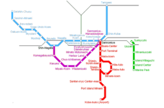
Kobe Metro Map
750 x 495
- 13,777k -
png