Gibbstown, New Jersey
Gibbstown: census designated place
About
Gibbstown is a CDP located in the county of Gloucester in the U.S. state of New Jersey.

Quick Facts about Gibbstown
| Population | 3,739 |
| Country | United States of America |
| State | New Jersey (United States) |
| County | Gloucester County |
| Area | 4.25 km2 |
| Latitude & Longitude | 39.8251,-75.2835 |
| Altitude | 13 feet / 4 meters |
| Time Zone | Eastern Time Zone |
| Local time | 10:55:29 (24th July 2026) |
| Postal code | 08027 |
| Weather | 83℉ Mostly Sunny 7-days weather |

Geography
Gibbstown is located at 39°49'30"N 75°17'1"W (39.8251100, -75.2835200).
Gibbstown map
Weather
Mostly sunny, with a high near 83. East wind 0 to 5 mph.
7-Day ForecastBest Things to Do in Gibbstown
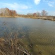
1Greenwich Lake Park
U Lough Ln, Gibbstown, NJ 08027, United States View details
2Nehaunsey Park
198 S Democrat Rd, Gibbstown, NJ 08027, United States View details

People born in Gibbstown (3)
People born in Gibbstown, including oceanographer Sylvia Earle, football player Alex Silvestro, politician Lewis Earle, .
More notable people
Nearby Schools and Colleges
Schools and campuses linked to Gibbstown, NJ. Select a name to open its map and contact details.
| Code | Name | City | ZIP |
|---|---|---|---|
| 210599 | All-State Career School | Essington (PA) | 19029 |
Nearby Transit Stations (28)
Rail and bus stations connected to Gibbstown, NJ. Select a station to open its map and address details.
| Code | Name | Address | Type |
|---|---|---|---|
| PHL | 30th Street Station | 2955 Market St. | RAIL |
| ARD | Ardmore | Station Road and Lancaster Ave. | RAIL |
| PHN | North Philadelphia station | 2900 North Broad St. | RAIL |
| CRH | Cherry Hill, New Jersey | Cornell Ave. & West Marlton Pike | OTHER |
| LDW | Lindenwold | Station Ave & White Horse Rd West | OTHER |
Closest post offices linked to Gibbstown.
| Post Office Name | City | ZIP |
|---|---|---|
| Gibbstown Post Office | Gibbstown (NJ) | 08027 |
Other cities in Gloucester County
Cities, towns, neighborhoods & other populated places in Gloucester County , NJ. (more)
| City Name | Population | Title |
|---|---|---|
| Jefferson | 20,611 | Township in Morris County, New Jersey |
| Glassboro | 20,386 | Borough in New Jersey, United States |
| Williamstown | 15,567 | Town in Massachusetts |
| Mantua | 14,877 | Township in Gloucester County, New Jersey |
| Red Bank | 11,979 | Borough in Monmouth County, New Jersey, United States |
| Woodbury | 9,813 | City in New Jersey |
| Clayton | 8,759 | Borough in Gloucester County, New Jersey |
| Pitman | 8,753 | Borough in Gloucester County, New Jersey, United States |
| Paulsboro | 5,866 | Borough in Gloucester County, New Jersey, United States |
| Beckett | 4,847 | Unincorporated community and census-designated place in Gloucester County, New Jersey, United States |
| Westville | 4,154 | Borough of New Jersey |
| Mullica Hill | 3,982 | Census designated place |
| Harding | 3,752 | Township of New Jersey |
| Turnersville | 3,742 | Census designated place |
| Oak Valley | 3,483 | Census designated place |
| Woodbury Heights | 2,970 | Borough of New Jersey, United States |
Distance to Other Cities
Gibbstown distances to largest New Jersey cities