Gera, Thuringia
Gera: town in Thuringia, Germany
About
Quick Facts about Gera
| Population | 94,152 |
| Country | Germany |
| State | Thuringia (Germany) |
| County | Bous |
| Postal code | 07557, 07545 |
| Plate code | G |
| Phone Area Codes | 0365 |
| Area | 152.19 km2 |
| Official name | Gera |
| Latitude & Longitude | 50.8803,12.0819 |
| Altitude | 673 feet / 205, 194 meters |
| Capital city | Gera is capital of Principality of Reuss-Gera, Kreis Gera-Land, Republic of Reuss, Gera District |
| Establishment | January 01, 0995 (1031 years ago) |
| Time Zone | UTC+01:00, UTC+02:00 |
| Local time | 00:24:26 (25th July 2026) |
Geography
Gera is located at 50°52'49"N 12°4'55"E (50.8802900, 12.0818700).
Gera map
Click "full screen"  icon to open full mode. View satellite images
Official website of Gera
Official Website- Arnhem (1987 )
- Fort Wayne (1992 )
- Goražde (2002 )
- Kuopio (1972 )
- Nuremberg (1988 )
- Plzeň (1970 )
- Pskov (1996 )
- Rostov-on-Don (1997 )
- Saint-Denis (1950 )
- Skierniewice (1965 )
- Sliven (1997 )
- Timișoara (1998 )
- Thränitz (Gera)
- Aga
- Q1804991
- Röpsen
- Untermhaus
- Q1313531
- Q2450919
- Liebschwitz
- Naulitz (Gera)
- Zwötzen
- Q1613652
- Roben (Gera)
- Q2557234
- Q1274352
Demographics
| Year | Population | % Change | Method |
|---|---|---|---|
| 1971 | 111,535 | - | census |
| 1981 | 126,792 | 12.03% | census |
| 1990 | 129,037 | 1.74% | census |
| 2000 | 112,835 | -14.36% | census |
| 2010 | 99,262 | -13.67% | census |
| 2014 | 94,492 | -5.05% | census |
| 2015 | 96,011 | 1.58% | census |
| 2017 | 94,859 | -1.21% | census |
| 2019 | 94,152 | -0.75% | statistical updating |
Gerapolis, Gėra, ZGA, ge la, gela, gra, gyra, Гера, گرا, گیرا, ゲーラ, 格拉, 게라
Map & Images (more maps)
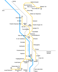
Gera Metro Map
500 x 620
- 7,812k -
png