Hartsdale, New York
Hartsdale: census-designated place in Westchester County, New York
About
Hartsdale is a CDP located in the county of Westchester in the U.S. state of New York.

Quick Facts about Hartsdale
| Population | 5,293 |
| Country | United States of America |
| State | New York (United States) |
| County | Westchester County |
| Postal code | 10530 |
| Area | 2.32 km2 |
| Latitude & Longitude | 41.0190,-73.7982 |
| Altitude | 184 feet / 56 meters |
| Time Zone | America/New_York |
| Local time | 05:29:20 (18th July 2026) |
| Weather | 83℉ Areas Of Smoke 7-days weather |

Geography
Hartsdale is located at 41°1'8"N 73°47'53"W (41.0189900, -73.7981900).
Hartsdale map
Weather
Areas of smoke before 11am, then areas of smoke and showers and thunderstorms between 11am and 3pm, then patchy smoke and showers and thunderstorms. M...
7-Day ForecastBest Things to Do in Hartsdale
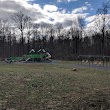
1Ridge Road Park
287 Ridge Rd, Hartsdale, NY 10530, United States View details
Phone: +19149468133 | Website available
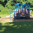
2Secor Woods Park
Secor Rd, Hartsdale, NY 10530, United States View details
Phone: +19146938985 | Website available
People born in Hartsdale (7)
People born in Hartsdale, including actress Shera Danese, actor Mark Burg, Grammy Award-winning record producer, composer, musician, orchestrator and conductor Albhy Galuten, .
More notable people
- George Townsend (American baseball player) he was born in 04/06/1867
- Kathy McCord (singer) she was born in 18/02/1952
- Morris E. Lasker (United States federal judge) he was born in 17/07/1917
- David M. Solomon (American banker) he was born in 01/01/1962
Nearby Schools and Colleges
Schools and campuses linked to Hartsdale, NY. Select a name to open its map and contact details.
| Code | Name | City | ZIP |
|---|---|---|---|
| 197285 | The College of Westchester | White Plains (NY) | 10606-1200 |
Nearby Transit Stations (17)
Rail and bus stations connected to Hartsdale, NY. Select a station to open its map and address details.
| Code | Name | Address | Type |
|---|---|---|---|
| NRO | New Rochelle station | 1 Railroad Plaza | RAIL |
| YNY | Yonkers station | 5 Buena Vista Ave. | RAIL |
| CRT | Croton–Harmon station | 1 Croton Point Avenue | RAIL |
| STM | Stamford Transportation Center | Washington Blvd and South State St. | RAIL |
| NYP | Pennsylvania Station | 8th Ave 31st Street / 8th Ave 33rd Street | RAIL |
Closest post offices linked to Hartsdale.
| Post Office Name | City | ZIP |
|---|---|---|
| Hartsdal Post Office | Scarsdale (NY) | 10583 |
Other cities in Westchester County
Cities, towns, neighborhoods & other populated places in Westchester County , NY. (more)
| City Name | Population | Title |
|---|---|---|
| Yonkers | 200,040 | The second most populous city in Westchester County, New York. |
| Greenburgh | 90,543 | Town |
| New Rochelle | 80,973 | A city in Westchester County, New York. |
| Mount Vernon | 68,628 | The most populous city in Westchester County, New York. |
| White Plains | 58,286 | The most populous city in Westchester County, New York. |
| Rye | 46,100 | A town in Westchester County, New York. |
| Ossining | 37,551 | Town in Westchester County, New York, United States |
| Yorktown | 35,988 | Town in New York |
| Spring Valley | 32,258 | Village in New York, United States |
| Mamaroneck | 29,343 | Town in Westchester County, New York |
| Harrison | 28,959 | Community (coterminous town-village) in Westchester County, New York |
| Port Chester | 28,857 | Village in Westchester County, New York |
| Peekskill | 24,087 | City in Westchester County, New York, United States |
| Somers | 21,476 | Town in New York, US |
| Scarsdale | 17,785 | Town and village in Westchester County, New York, United States |
| Bedford | 17,450 | Town in Westchester County, New York, United States |
Distance to Other Cities
Hartsdale distances to largest New York cities